- Clos du Doubs
-
Clos du Doubs Country Switzerland 
Canton Jura District Porrentruy 47°21′N 07°09′E / 47.35°N 7.15°ECoordinates: 47°21′N 07°09′E / 47.35°N 7.15°E Population 1,312 (Dec 2009)[1] - Density 21 /km2 (55 /sq mi) Area 61.86 km2 (23.88 sq mi) Elevation 440 m (1,444 ft) Postal code 2882 SFOS number 6808 Localities Epauvillers, Epiquerez, Montenol, Montmelon, Ocourt, Saint-Ursanne and Seleute Surrounded by Montfaucon, Soubey, Saint-Brais, La Baroche, Glovelier, Boécourt, Cornol, Courgenay, Fontenais, Bressaucourt, Montancy (F), Burnevillers (F) Website du Doubs.ch Clos du Doubs.ch
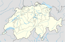
SFSO statisticsView map of Clos du Doubs Clos du Doubs is a municipality in the district of Porrentruy in the canton of Jura in Switzerland. It was founded at January 1, 2009 by the former municipalities of Epauvillers, Epiquerez, Montenol, Montmelon, Ocourt, Saint-Ursanne and Seleute. Soubey voted not to join the merger.
Clos du Doubs is also the name of the region (including Soubey). It includes the section of the Doubs valley near Saint-Ursanne, about 15 km west of Delémont. Center of the region of about 80 km² is Saint-Ursanne.
Clos du Doubs is also the name of a range of the Jura folds south-west of Saint-Ursanne.
References
- ^ Swiss Federal Statistical Office, MS Excel document – Bilanz der ständigen Wohnbevölkerung nach Kantonen, Bezirken und Gemeinden (German) accessed 25 August 2010
Alle · Basse-Allaine · Beurnevésin · Boncourt · Bonfol · Bressaucourt · Bure · Clos du Doubs · Coeuve · Cornol · Courchavon · Courgenay · Courtedoux · Damphreux · Fahy · Fontenais · Grandfontaine · Haute-Ajoie · La Baroche · Lugnez · Porrentruy · Rocourt · Vendlincourt
 Categories:
- Municipalities of the canton of Jura
- Municipalities of Switzerland
- Clos-du-Doubs
- Canton of Jura geography stubs
Wikimedia Foundation. 2010.

