Lake Leake, Tasmania

Lake Leake, Tasmania

Infobox Australian Place | type = town
name = Lake Leake
state = tas


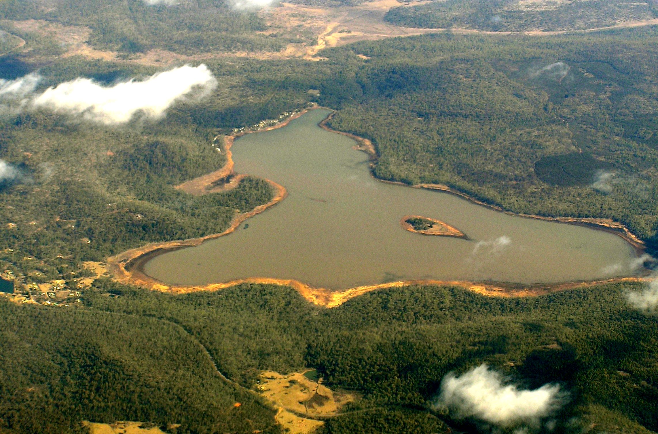
caption = Aerial photo from the east. Rawlinna Village is at the left of the lake.
lga = North Midlands Council
postcode = 7210
coordinates = coord|42|0|40|S|147|48|0|E|type:city_region:AU|display=inline,title
est =
pop =
elevation=
maxtemp =
mintemp =
rainfall =
stategov = Lyons
fedgov = Lyons
dist1 =
dir1 = S
location1= Hobart
dist2 =
dir2 = N
location2= Launceston
dist3 =
dir3 =
location3=

Lake Leake is the name of both a lake and a small township (Australian Postcode 7210) in the eastern midlands of Tasmania. The lake can hold 22.076 gigaliters of water. [http://www.northmidlands.tas.gov.au/lakes/lake.asp?lake=1&styled=y] The lake was named after Charles Henry Leake a member of the Tasmanian Legislative Council. [http://www.parliament.tas.gov.au/history/tasparl/leakec189.htm]

The lake is used for recreational fishing, for brook trout, brown trout and rainbow trout. [http://www.ifs.tas.gov.au/ifs/IFSDatabaseManager/WatersDatabase/lake-leake]

Water flowing out from the lake has an electrical conductivity of 56 μS/cm.

Rawlinna is a locality located between the south side of the lake and Lake Yaleena, another water impoundment.

Infobox lake
align = left
lake_name = Lake Leake
image_lake = Lake Leake Map.png caption_lake =
image_bathymetry =
caption_bathymetry =
location = Tasmania
coords = coord|42|0|30|S|147|49|30|E|type:waterbody_region:AU
type = reservoir
inflow =
outflow =
catchment =
basin_countries = Australia
length =
width =
area =
depth =
max-depth =
volume = 22.076 gigaliters
residence_time =
shore =
elevation =
islands =
cities =
frozen =

History

The lake was constructed after a long debate. A five meter high dam was finished in 1884. The initial capacity was 19.9 Mm3 and an area of 6 km2. In 1971 the spillway highest point was raised by 18 cm to increase storage capacity. Water is released for irrigation and also stored to maintain a fishing facility. Lake Leake has always been at least half full. [http://www.dpiw.tas.gov.au/inter.nsf/attachments/wweb-64p8a8/$file/sth%20esk%20basin%207%20macquarie%201.pdf]

References


Wikimedia Foundation. 2010.

Игры ⚽ Поможем решить контрольную работу

Look at other dictionaries:

  • Tooms Lake, Tasmania — Infobox Australian Place | type = town name = Tooms Lake state = tas caption = Aerial photo from the east. Village is at the top of the lake. lga = North Midlands Council postcode = 7209 est = pop = 271 elevation= 464 maxtemp = mintemp = rainfall …   Wikipedia

  • List of highways in Tasmania — The Highways in Tasmania generally expand from Hobart and other major cities with secondary roads interconnecting the highways to each other. Functions of these highways include freight, personal travel and tourism. The AusLink Network currently… …   Wikipedia

  • Macquarie River (Tasmania) — The Macquarie River in Tasmania rises near Lake Leake, flowing south and then north west and through the town of Ross before flowing into the South Esk River near Longford. The Elizabeth, Isis and Lake rivers are tributaries. [… …   Wikipedia

  • Маккуори (река, Тасмания) — У этого термина существуют и другие значения, см. Маккуори. Маккуори Macquarie River Мост Рос …   Википедия

  • Highways in Australia — This is a list of highways in Australia, listed alphabetically along with its route number and location. Note that some highways service more than one state or territory.Route numbering systemsAustralia is a vast and sparsely populated country.… …   Wikipedia

  • Highways in Australien — Australiens National Highways Die Highways in Australien sind hier in alphabetischer Reihenfolge aufgelistet, zusammen mit ihrer Nummer und dem Bundesstaat in dem sie sich befinden. Einige der Highways erstrecken sich dabei auch über mehrere… …   Deutsch Wikipedia

  • Суонси (Тасмания) — Город Суонси Swansea Страна АвстралияАвстралия …   Википедия

  • Northern Midlands Municipality — Lage der Northern Midlands in Tasmanien Gliederung …   Deutsch Wikipedia

  • History of Western Australia — The human history of Western Australia spans between the first inhabitants arriving on the northwest coast about 55,000 years ago to events in the twentieth century.Aboriginal settlement: For early human settlement in Australia see Prehistory of… …   Wikipedia

Share the article and excerpts

Direct link
Do a right-click on the link above
and select “Copy Link”