- Nagarjun, Nepal
-
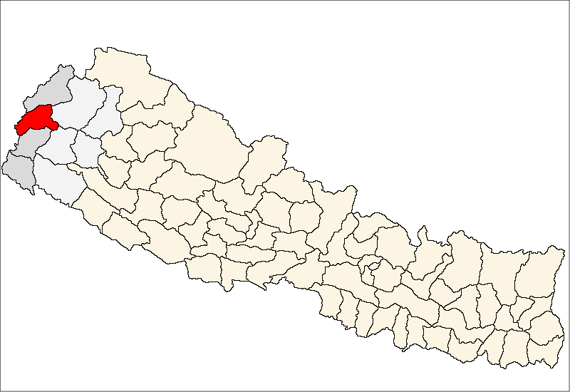
Nagarjun, Nepal — Village development committee — Location in Nepal
 Nagarjun, Nepal
Coordinates: 27°45′N 85°16′E / 27.75°N 85.267°ECoordinates: 27°45′N 85°16′E / 27.75°N 85.267°E Country  Nepal
NepalZone Mahakali Zone District Baitadi District Population (1991) - Total 1,835 - Religions Hindu Time zone Nepal Time (UTC+5:45) Nagarjun, Nepal is a village development committee in Baitadi District in the Mahakali Zone of western Nepal. At the time of the 1991 Nepal census it had a population of 1,835 and had 360 houses in the village.[1]
References
- ^ "Nepal Census 2001". Nepal's Village Development Committees. Digital Himalaya. http://www.digitalhimalaya.com/collections/nepalcensus/form.php?selection=1. Retrieved 2008-08-26.
Amchaur · Barakot · Basantapur · Basuling · Bhatana · Bhumeswor · Bijayapur · Bilaspur · Bumiraj · Chadeu · Chaukham · Dasharathchanda · Dehimandau · Deulek · Dhikarim · Dhikasintad · Dhungad · Dilasaini · Durga Bhabani · Durgasthan · Gajari · Giregada · Gokuleswor · Gujar · Gurukhola · Gwallek · Hat, Nepal · Hatraj · Jogannath · Kaipal · Kataujpani · Kotila · Kotpetara · Kulau · Kuwakot · Mahadevsthan · Mahakali · Maharudra · Malladehi · Mathraj · Maunali · Melauli · Nagarjun · Nwadeu · Nwali · Pancheswor · Patan · Raudidewal · Rauleswor · Rudreswor · Sakar · Salena · Sankar · Sarmali · Shibanath · Shikharpur · Shivaling · Shree Kedar · Siddhapur · Siddheswor · Sikash · Silanga · Sreekot · Talladehi · Thalakanda · Thalegada · Tripurasundari · Udayadeb
 Categories:
- Populated places in Baitadi District
- Mahakali Zone geography stubs

Wikimedia Foundation. 2010.