- Mount Friesland
-
Mount Friesland 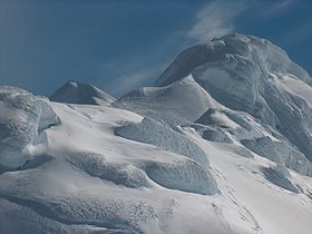
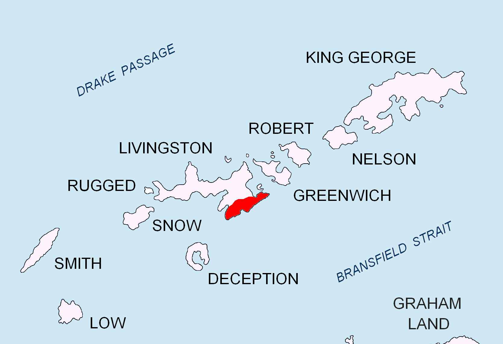
Elevation 1,700 m (5,577 ft) Prominence 1,700 m (5,577 ft) Listing Ultra Location Location Livingston Island, South Shetland Islands, Antarctica Range Tangra Mountains  Location of Tangra Mountains on Livingston Island in the South Shetland Islands.
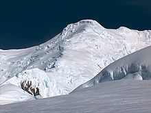
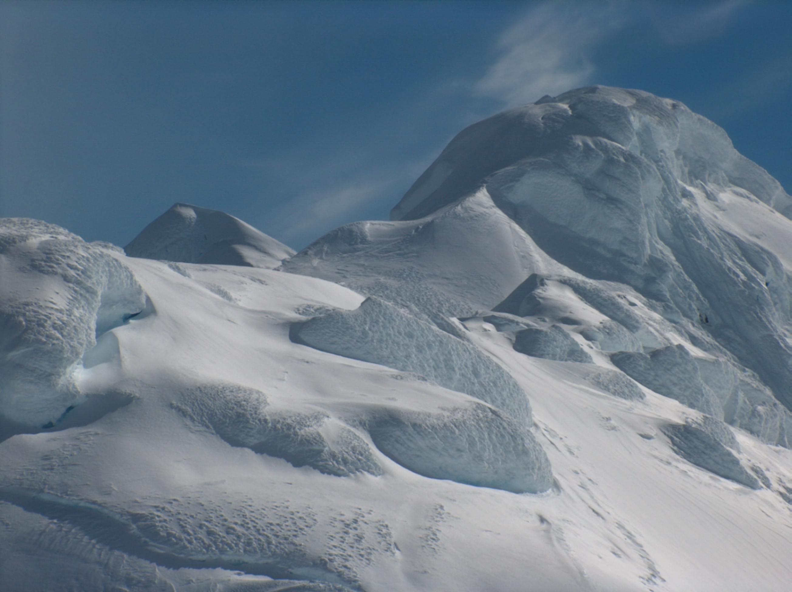
Mount Friesland (62°40′14.9″S 60°11′10.7″W / 62.670806°S 60.186306°W) is the summit of Tangra Mountains on Livingston Island, in the South Shetland Islands, Antarctica. The peak is rising to 1700 m sharp, and is heavily glaciated and crevassed. Situated 12.5 km northeast of Barnard Point, 9.7 km east-southeast of St. Kliment Ohridski Base, 3.6 km southeast of the summit of Pliska Ridge, 6.1 km south by east of Mount Bowles, 2.9 km south-southwest of Camp Academia, 7 km west of Great Needle Peak, and 6.85 km north by west of Samuel Point.
The first ascent of Mount Friesland was made by the Catalans Francesc Sàbat (q.v. Sàbat Hill) and Jorge Enrique (q.v. Enrique Hill) from Juan Carlos I Base on 30 December 1991. The peak was climbed and GPS surveyed by the Australians Damien Gildea and John Bath and the Chilean Rodrigo Fica on 20 December 2003, who produced a new map of the island in 2004, based on Spanish satellite imagery and their GPS data. The third ascent was made by the Bulgarians Lyubomir Ivanov and Doychin Vasilev from Camp Academia on 15 December 2004. All these used the eastern route to the peak, by way of Catalunyan Saddle and Presian Ridge.
The feature was known to American and British sealers as early as 1820-21, and has been variously known as ‘Peak of Frezeland’, ‘Friezland Peak’, and ‘Friesland Peak’. In the early 1900s the name ‘Barnard’, applied by James Weddell in 1825 to nearby Needle Peak, was transferred to this mountain. The original name has now been restored; the spelling ‘Friesland’ appears to have been more frequently used than any of the other versions. The name Barnard Point has since been approved for the nearby point at the southeast side of False Bay.
Maps
- S. Soccol, D. Gildea and J. Bath. Livingston Island, Antarctica. Scale 1:100000 satellite map. The Omega Foundation, USA, 2004.
- L.L. Ivanov et al., Antarctica: Livingston Island and Greenwich Island, South Shetland Islands (from English Strait to Morton Strait, with illustrations and ice-cover distribution), 1:100000 scale topographic map, Antarctic Place-names Commission of Bulgaria, Sofia, 2005
- L.L. Ivanov. Antarctica: Livingston Island and Greenwich, Robert, Snow and Smith Islands. Scale 1:120000 topographic map. Troyan: Manfred Wörner Foundation, 2009. ISBN 978-954-92032-6-4
External links
Reference
 This article incorporates public domain material from the United States Geological Survey document "Mount Friesland" (content from the Geographic Names Information System).
This Livingston Island location article is a stub. You can help Wikipedia by expanding it.
