- Mokulele Highway
-
Route 311
Mokulele Highway Route information Maintained by HDOT Length: 7 mi (11 km) Major junctions From: Kahului Piilani Highway To: North Kihei Road Highway system ← x20px Route 310 Route 320  →
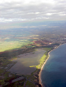
→Mokulele Highway (designated as Route 311) is a highway on Maui that connects Kahului with Kihei, covering the distance of approximately 7 miles (11 km). Most of the highway cuts through the valley-like isthmus of Maui surrounded by sugarcane fields on both sides of the road.
Mokulele begins as a continuation of Puunene Road South, leaving Kahului. It then passes through what is known as the "Puunene" area of Maui, and continues as Mokulele, designated as Route 311 and 350 combined.
The Highway continues South from agricultural land and as it nears the Kealia Pond area, it intersects the Piilani Highway, ending shortly after at its junction with South Kehei Road, just to the north side of Kihei.
 Categories:
- Roads in Hawaii
- Transportation in Maui County, Hawaii
- Western United States road stubs


Wikimedia Foundation. 2010.