Tikorangi

Tikorangi
Tikorangi
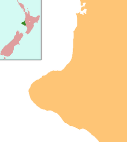
Tikorangi is located in Taranaki Region
Tikorangi
Coordinates: 39°2′2″S 174°16′47″E / 39.03389°S 174.27972°E / -39.03389; 174.27972Coordinates: 39°2′2″S 174°16′47″E / 39.03389°S 174.27972°E / -39.03389; 174.27972
Country New Zealand
Region Taranaki
District New Plymouth District

Tikorangi is a settlement in Taranaki, New Zealand. Waitara lies about 6 kilometres to the north-west. The Waitara River flows to the west of the settlement, with the Bertrand Road suspension bridge providing access to the other side.[1][2]

Tikorangi's Jury Garden has been awarded the highest rating by the New Zealand Gardens Trust: Garden of National Significance. It is open to the public for part of the year.[3]

Education

Tikorangi School is a coeducational contributing primary (years 1-6) school with a decile rating of 4 and a roll of 136.[4] Most of the students come from Waitara and travel by school bus each day.[5]

Notes

  1. ^ Peter Dowling (editor) (2004). Reed New Zealand Atlas. Reed Books. pp. map 34. ISBN 0-7900-0952-8. 
  2. ^ Roger Smith, GeographX (2005). The Geographic Atlas of New Zealand. Robbie Burton. pp. map 85. ISBN 1-877333-20-4. 
  3. ^ "Tikorangi The Jury Garden". http://www.jury.co.nz/. Retrieved 2008-07-08. 
  4. ^ "Te Kete Ipurangi - Tikorangi School". Ministry of Education. http://www.tki.org.nz/e/schools/display_school_info.php?school_id=2251. 
  5. ^ "Education Review Report: Tikorangi School". Education Review Office. June 2006. http://www.ero.govt.nz/ERO\reppub.nsf/Institution/C0FD72433887DC0DCC2571B6000167E2/$File/2251.htm. 

Wikimedia Foundation. 2010.

Игры ⚽ Нужно сделать НИР?

Look at other dictionaries:

  • Urenui — Infobox Settlement name = Urenui population total = 429 population as of = 2006 subdivision type = Country subdivision name = New Zealand subdivision type1= Region subdivision name1= Taranaki subdivision type2= District subdivision name2= New… …   Wikipedia

  • Bertrand Road suspension bridge — The Bertrand Road suspension bridge crosses the Waitara River, linking Huirangi, near Lepperton and Tikorangi in north Taranaki, New Zealand. The original bridge was built in 1897, and rebuilt in 1927 (using an adapted form of the original… …   Wikipedia

  • Otaika — This article is about the location in New Zealand. For the Polynesian dish, see Ota ika. Otaika …   Wikipedia

  • Portland, New Zealand — Infobox Settlement name = Portland population total = 993 population as of = 2006 subdivision type = Country subdivision name = New Zealand subdivision type1= Region subdivision name1= Northland Region subdivision type2= District subdivision… …   Wikipedia

  • First Taranaki War — Infobox Military Conflict conflict = First Taranaki War partof = New Zealand land wars caption = date = March 17, 1860 to March 18, 1861 place = Taranaki, New Zealand territory = result = Indecisive status = combatant1 =flagicon|New Zealand New… …   Wikipedia

  • List of towns in New Zealand — This is a list of towns in New Zealand. The term town has no current statutory meaning in New Zealand, the few Town Districts having been abolished in 1989 or earlier. No particular size minimum has been adopted. Many would be called villages in… …   Wikipedia

  • Taranaki Rugby Football Union — Rugby team teamname = Taranaki Rugby Football Union nickname = Amber and Blacks founded = 1885 region = Taranaki ground = Yarrow Stadium capacity = 25,000 coach = flagicon|New Zealand Adrian Kennedy captain = flagicon|New Zealand Tony Penn chief… …   Wikipedia

  • Onaero — Onaero …   Wikipedia

  • McKee field — is an oil and gas producing field in Taranaki, New Zealand. It is located 20 km south east of New Plymouth. The field is now owned and operated by subsidiaries of Todd Energy.[1] The field is named for Tasman Joseph McKee, a New Zealand… …   Wikipedia

Share the article and excerpts

Direct link
Do a right-click on the link above
and select “Copy Link”