- Nazlat 'Isa
-
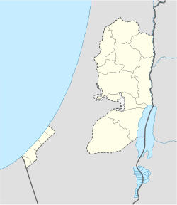
Nazlat 'Isa Other transcription(s) – Arabic نزلة عيسى Location of Nazlat 'Isa within the Palestinian territories Coordinates: 32°24′57.41″N 35°03′19.59″E / 32.4159472°N 35.0554417°ECoordinates: 32°24′57.41″N 35°03′19.59″E / 32.4159472°N 35.0554417°E Governorate Tulkarm Government – Type Village Council Population (2006) – Jurisdiction 2,502 Nazlat 'Isa (Arabic: نزلة عيسى) is a Palestinian village in the Tulkarm Governorate in the eastern West Bank, located 17 kilometers North of Tulkarm. According to the Palestinian Central Bureau of Statistics, Nazlat 'Isa had a population of approximately 2,502 inhabitants in mid-year 2006.[1] 8.7% of the population of Nazlat 'Isa were refugees in 1997.[2] The healthcare facilities for Nazlat 'Isa are designated as MOH level 2.[3]
Footnotes
Cities 

Municipalities Anabta · Attil · Bal'a · Baqa ash-Sharqiyya · Beit Lid · Deir al-Ghusun · Dhinnaba · 'Illar · Kafr al-Labad · Qaffin · ZeitaVillages Far'un · Iktaba · Izbat Shufa · Al Jarushiya · Kafr Abbush · Kafr Jammal · Kafr Rumman · Kafr Sur · Kafr Zibad · Khureish · Kur · an-Nazla al-Gharbiya · an-Nazla ash-Sharqiya · an-Nazla al-Wusta · Nazlat Abu Nar · Nazlat 'Isa · Raml Zeita · Ramin · al-Ras · Saffarin · Seida · ShufaRefugee camps Categories:- Tulkarm Governorate
- Palestine geography stubs
- Villages in the West Bank
Wikimedia Foundation. 2010.

