Megler, Washington

Megler, Washington

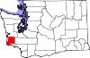
Megler is a small community located in Pacific County in the U.S. state of Washington. Named for legislator Joseph G. Megler,[1] the community is located at the mouth of the Columbia River on the north shore (Washington side) of the river. It is the northern end of the Astoria-Megler Bridge, which connects Megler to Astoria, Oregon, a nearby city on the south shore (Oregon side) of the river. U.S. Route 101 and State Route 401 intersect in the community and connect Megler to Aberdeen, Olympia, and Vancouver.

History

From 1921 to 1966, a ferry route across the Columbia River connected with docks at and near Megler.

References

  1. ^ Majors, Harry M. (1975). Exploring Washington. Van Winkle Publishing Co. p. 114. ISBN 9780918664006. http://books.google.com/books?id=CoWrPQAACAAJ. 

Coordinates: 46°15′03″N 123°51′28″W / 46.25083°N 123.85778°W / 46.25083; -123.85778


Wikimedia Foundation. 2010.

Игры ⚽ Нужно сделать НИР?

Look at other dictionaries:

  • Washington State Route 401 — Infobox WA State Route|type=State|route=401|parent type=State|parent=4|sec=580 length mi=12.13 length ref= length round=2 dir1=South dir2=North from= to= previous type=WA previous route=397 next type=Interstate next route=405State Route 401… …   Wikipedia

  • Washington State Route 4 — Infobox WA State Route type=State route=4 sec=010 length mi=62.27 length ref= length round=2 formed=1964 dir1=West dir2=East from= junction= to= next type=Interstate|previous type=State|next route=5|previous route=3State Route 4, also known as… …   Wikipedia

  • Astoria-Megler Bridge — Infobox Bridge bridge name= Astoria Megler Bridge caption= official name= also known as= carries= 2 lanes of US 101 crosses= Columbia River locale= Astoria, Oregon maint= Oregon DOT id= design= cantilever through truss mainspan= 1,232 ft length=… …   Wikipedia

  • Pont Astoria-Megler — Pont Astoria–Megler Pays États Unis Région Oregon / Washing …   Wikipédia en Français

  • McGowan, Washington — was a stop on the Ilwaco Railway and Navigation Company s narrow gauge line that ran on the Long Beach Peninsula in Pacific County, Washington, USA from 1889 to 1930.[1] In the late 19th century, P.J. McGowan bought land in the area for $1,200,… …   Wikipedia

  • Primary State Highway 12 (Washington) — Infobox road state=WA type=PSH route=12 alternate name= Ocean Beach Highway maint= section= length mi= length round= length ref= length notes= established=1937 decommissioned=1964 direction a=North terminus a= junction= direction b=South terminus …   Wikipedia

  • U.S. Route 101 in Washington — Infobox road state=WA type=US route=101 maint=WSDOT length mi=365.55 length ref=Washington State Department of Transportation, [http://www.wsdot.wa.gov/mapsdata/TDO/PDF and ZIP Files/HwyLog2006.pdf State Highway Log] , 2006] length round=2 year… …   Wikipedia

  • Chinook, Washington —   CDP   Location of …   Wikipedia

  • List of unincorporated communities in Washington — This is a list of unincorporated communities in the U.S. state of Washington which are not incorporated municipalities. Incorporated municipalities in the state are listed separately in a list of cities and list of towns. Contents 1 Census… …   Wikipedia

  • Oysterville, Washington — Oysterville   Unincorporated community   View of Willapa Bay from Oysterville …   Wikipedia

Share the article and excerpts

Direct link
Do a right-click on the link above
and select “Copy Link”