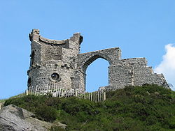
Mow Cop Castle

Mow Cop Castle
Mow Cop Castle
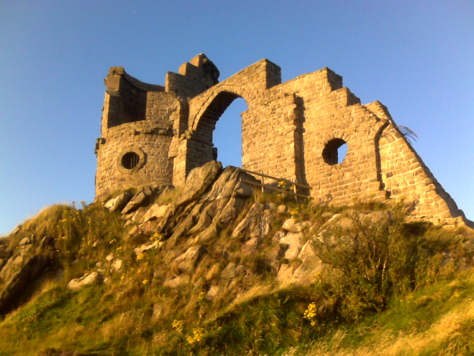
Mow Cop Castle at sunset

Mow Cop Castle is a folly at Mow Cop, near Harriseahead in the county of Staffordshire, England.

Traces of a prehistoric camp have been found here, but in 1754, Randle Wilbraham of nearby Rode Hall built an elaborate summerhouse looking like a medieval fortress and round tower.

The Castle was given to the National Trust in 1937. The same year over ten thousand Methodists met on the hill to commemorate the first Primitive Methodist Camp Meeting there.

The area around the castle was nationally famous for the quarrying of high-quality millstones ('querns') for use in water mills. Excavations at Mow Cop have found querns dating back to the Iron Age.

Though visitors were originally allowed inside the folly the area surrounding it has been fenced off due to an instance of suicide off the cliff edge.

On the turn of the millennium in the year 2000 a large fire was lit beside the folly as part of a network of communicating fires across the country.

Mow Cop and its folly are central images in Alan Garner's novel, Red Shift.

External links

Coordinates: 53°06′47″N 2°12′51″W / 53.1130°N 2.2143°W / 53.1130; -2.2143


Wikimedia Foundation. 2010.

Игры ⚽ Нужно сделать НИР?

Look at other dictionaries:

  • Mow Cop — Coordinates: 53°06′47″N 2°13′03″W / 53.112973°N 2.217582°W / 53.112973; 2.217582 …   Wikipedia

  • Mow Cop and Scholar Green railway station — was a station on the North Staffordshire Railway between Stoke on Trent and Congleton. It served the village of Mow Cop. The station was opened by the North Staffordshire Railway on 9 October 1848.[1] The station closed in 1964 and was… …   Wikipedia

  • Staffordshire — Geography Status Ceremonial (smaller) Non metropolitan county …   Wikipedia

  • List of National Trust properties in England — This is a list of National Trust Properties in England, including any stately home, historic house, castle, abbey, museum or other property in the care of the National Trust in England. Contents 1 Bedfordshire …   Wikipedia

  • Folly — In architecture, a folly is a building constructed strictly as a decoration, having none of the usual purposes of housing or sheltering associated with a conventional structure. They originated as decorative accents in parks and estates. Folly is …   Wikipedia

  • Wistaston Church Lane Primary School — Infobox UK school latitude = longitude = dms = name = Wistaston Church Lane Primary School size = 350px motto = Growing, learning and succeeding together motto pl = established = 2007 approx = closed = c approx = type = Primary School religion =… …   Wikipedia

  • Harriseahead — infobox UK place country = England official name= Harriseahead latitude= 53.1003 longitude= 2.2093population = shire district= Newcastle under Lyme shire county= Staffordshire region= West Midlands constituency westminster= Staffordshire… …   Wikipedia

  • Bignall Hill, Staffordshire — is a prominent local landmark, and forms part of an escarpment ridge four miles north west of Newcastle under Lyme. There is a large stone monument on the summit which is dedicated to John Wedgwood (1760 1839), a former local employer and coal… …   Wikipedia

  • Staffordshire Way — The Staffordshire Way is a long distance walk in Staffordshire, England. The path links with the Heart of England Way The Route The route runs for 147km/92 miles from Mow Cop Castle to Kinver traversing Staffordshire from north to south, setting… …   Wikipedia

  • Red Shift (novel) — infobox Book | name = Red Shift title orig = translator = image caption = First edition cover, showing the folly tower on Mow Cop. author = Alan Garner cover artist = country = United Kingdom language = English series = genre = Fantasy Novel… …   Wikipedia

Share the article and excerpts

Direct link
Do a right-click on the link above
and select “Copy Link”