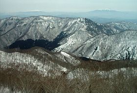
Mount Shiomi — 塩見岳 Mount Shiomi seen from Mount Aino Elevatio … Wikipedia
Mount Aso — For the city in Kumamoto Prefecture, please see Aso, Kumamoto. Mount Aso 阿蘇山 Central cone group of Aso caldera … Wikipedia
Mount Yari — For other uses, see Yari (disambiguation). Mount Yari 槍ヶ岳 Mount Yari in the centre of the image (A view from Enzansō) … Wikipedia
Daisetsuzan Volcanic Group — (大雪山系 Daisetsuzan kei) Nutapukaushipe or Nutaku Kamushupe volcanic group … Wikipedia
Ōmachi, Nagano — Ōmachi 大町市 City … Wikipedia
Shō River — Infobox River river name = Shō River 庄川 image size = 300px caption = Shō River in Tonami, Toyama Prefecture origin = Mount Eboshi mouth = Toyama Bay basin countries = Japan length km = 115 elevation m = 1625 mouth elevation m = discharge m3/s =… … Wikipedia
Umaji, Kōchi — Infobox City Japan Name= Umaji JapaneseName= 馬路村 Map Region= Shikoku region Prefecture= Kōchi Prefecture District= Aki District Area km2= 165.52 PopDate= February 29, 2008 Population= 1109 Density km2= 6.7 Coords= Tree= Cryptomeria Flower= Yuzu… … Wikipedia
Central Hotel Sasebo — (Сасебо,Япония) Категория отеля: 3 звездочный отель Адрес: 857 0872 Нагасаки, Сасебо, Kam … Каталог отелей
List of aerial lifts in Japan — The list of aerial lifts in Japan lists aerial lifts in the nation.In Japan, aerial lift, or nihongo| ropeway |索道|sakudō, includes means of transport such as aerial tramway, funitel, gondola lift, funifor, as well as chairlift. All of them are… … Wikipedia
Bandai-Asahi National Park — Infobox protected area | name = Bandai Asahi National Park 磐梯朝日国立公園 iucn category = II caption = locator x = locator y = location = Honshū, Japan nearest city = lat degrees = lat minutes = lat seconds = lat direction = long degrees = long minutes … Wikipedia

