- Nerkin Sasunashen
-
Coordinates: 40°21′43″N 43°58′58″E / 40.36194°N 43.98278°E
Nerkin Sasunashen
Ներքին Սասունաշեն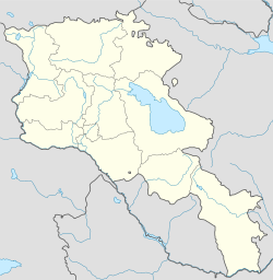
 Nerkin Sasunashen
Coordinates: 40°21′43″N 43°58′58″E / 40.36194°N 43.98278°E Country Armenia Marz (Province) Aragatsotn Population (2001) – Total 999 Time zone (UTC+4) – Summer (DST) (UTC+5) Nerkin Sasunashen (Armenian: Ներքին Սասունաշեն, also Romanized as Nerk’in Sasunashen, Nerqin Sasunashen and Nerkin Sasnashen; formerly, Nizhniy Karakoymaz, Nerkin Karakoymaz, Karakoymaz, and Gharagonmaz) is a town in the Aragatsotn Province of Armenia. The town has the foundations of a 7th century monastery. The town also contains a granite stele marking the crash site of a United States Air Force C-130 shot down by Soviet MiGs on September 2, 1958, in which 17 US personnel were lost.
References
- Nerkin Sasunashen at GEOnet Names Server
- Report of the results of the 2001 Armenian Census
- Kiesling, Rediscoving Armenia, p. 18, available online at the US embassy to Armenia's website
Capital: AshtarakAshtarak Agarak · Aghtsk · Antarut · Aragatsotn · Artashavan · Aruch · Ashtarak · Avan · Bazmaghbyur · Byurakan · Dprevank · Ghazaravan · Karbi · Kosh · Lernarot · Nor Amanos · Nor Yedesia · Ohanavan · Orgov · Oshakan · Parpi · Saghmosavan · Sasunik · Shamiram · Tegher · Ujan · Ushi · Verin Sasunik · Voskehat · Voskevaz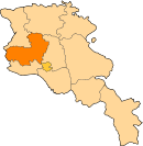
Aparan Aragats Talin Agarak · Akunk · Aragats · Areg · Arteni · Ashnak · Barozh · Baysz · Dashtadem · Davtashen · Dian · Garnahovit · Getap · Ghabaghtapa · Gyalto · Hakko · Hatsashen · Irind · Kakavadzor · Karmrashen · Katnaghbyur · Lusakn · Mastara · Metsadsor · Nerkin Bazmaberd · Nerkin Sasunashen · Nor Artik · Partizak · Shgharshik · Sorik · Suser · Talin · Tlik · Tsaghkasar · Tsamakasar · Verin Bazmaberd · Verin Sasunashen · Vosketas · Yeghnik · Zarinja · ZovasarCategories:- Populated places in Aragatsotn
- Aragatsotn geography stubs


Wikimedia Foundation. 2010.