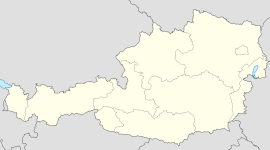
- Oberndorf in Tirol
-
Oberndorf in Tirol Country Austria State Tyrol District Kitzbühel Mayor Johann Schweigkofler Area 17.7 km2 (7 sq mi) Elevation 687 m (2254 ft) Population 2,015 (1 January 2011)[1] - Density 114 /km² (295 /sq mi) Time zone CET/CEST (UTC+1/+2) Licence plate KB Postal code 6372 Area code 05352 Website www.oberndorf-tirol.at Coordinates: 47°29′55″N 12°23′05″E / 47.49861°N 12.38472°E
Oberndorf is a municipality in Kitzbühel District, Tyrol, Austria. It is located in the Leukental valley, on the Kitzbühler Ache stream, halfway between St. Johann in Tirol and Kitzbühel, at an altitude of 687 m above sea level.
It has area of 17.7 square kilometres (6.8 sq mi) and a population of 2,009. The municipality consists of a main village and several hamlets, reaching up to the Kitzbühler Horn mountain. Its neighbouring municipalities are Going am Wilden Kaiser, Kitzbühel, Reith bei Kitzbühel, and St. Johann in Tirol.
Until the 18th century copper was mined at the Rerobichl.
Today, economy is focused on tourism, and a quarry. Oberndorf has a railway halt on the Salzburg-Tyrol Railway.
Panorama
References
External links
- http://www.gpix.at/Gpix.at-Gigapixel_gpath,oberndorfwinter,pid,9112,type,gpix.html Oberndorf Gigapixel Panorama (7.000 Megapixel)]
Aurach bei Kitzbühel · Brixen im Thale · Fieberbrunn · Going am Wilden Kaiser · Hochfilzen · Hopfgarten im Brixental · Itter · Jochberg · Kirchberg in Tirol · Kirchdorf in Tirol · Kitzbühel · Kössen · Oberndorf in Tirol · Reith bei Kitzbühel · Sankt Jakob in Haus · Sankt Johann in Tirol · Sankt Ulrich am Pillersee · Schwendt · Waidring · Westendorf
Categories:- Cities and towns in Tyrol
- Tyrol geography stubs
- Kitzbühel Alps
Wikimedia Foundation. 2010.


