- Ntete
-
Ntete Location in Mozambique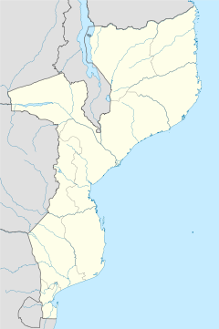
 Ntete
NteteCoordinates: 12°59′13″S 39°50′15″E / 12.98694°S 39.8375°ECoordinates: 12°59′13″S 39°50′15″E / 12.98694°S 39.8375°E Country  Mozambique
Province Cabo Delgado Province District Ancuabe District Time zone Central Africa Time (UTC+2) Ntete is a village in Ancuabe District in Cabo Delgado Province in northeastern Mozambique.[1]
It is located 1.2 miles (1.9 km) away from the district capital of Ancuabe on the southwestern outskirts of the town.
Transport
The nearest airport is 40 miles (64 km) away at Pemba Airport.
References
- ^ "NGA GeoName Database". National Geospatial Intelligence Agency. Archived from the original on 2008-06-08. http://web.archive.org/web/20080608190852/http://geonames.nga.mil/ggmagaz/geonames4.asp. Retrieved 2008-06-26.
External links
Capital: AncuabeAdamo · Alenane · Alimo · Aliti · Alumar · Amade · Amade · Ametina · Aneli · Anli · Apura · Arufo · Assane · Assane · Assane · Atoto · Bacar · Bacar Antigo · Banjira · Biaque · Bidjolo · Borolia · Camope · Cantalia · Cantia · Cauo · Cavano · Chefe Afonso · Chefe Ahonamoro · Chefe Antonio · Chefe Aquimo · Chefe Cahura · Chefe Caire · Chefe Calialia · Chefe Cantato · Chefe Caroa · Chefe Chinande · Chefe Cobre · Chefe Colete · Chefe Coze · Chefe Cunliala · Chefe Giquina · Chefe Iacuelane · Chefe Ingori · Chefe Inhatia · Chefe Inripa · Chefe Inteia · Chefe Jalipa · Chefe Julai · Chefe Lave · Chefe Lile · Chefe Lopa · Chefe Madondo · Chefe Malepela · Chefe Marraca · Chefe Misere · Chefe Muanenele · Chefe Muansava · Chefe Muatuca · Chefe Muisse · Chefe Muituva · Chefe Nacibo · Chefe Naioto · Chefe Namione · Chefe Nampuara · Chefe Nancuto · Chefe Nanhoma · Chefe N Cumabai · Chefe Necule · Chefe Neparula · Chefe Nicuto · Chefe Nigoeleua · Chefe Nivero · Chefe Pilote · Chefe Puelia · Chefe Purremuere · Chefe Purulia · Chefe Quilevele · Chefe Quimao · Chefe Quitarubo · Chefe Raide · Chefe Sabao · Chefe Sararia · Chefe Sehane · Chefe Selemane · Chefe Sucuma · Chefe Taiar · Chefe Tico · Chitima · Chiure · Colue · Comala · Costa · Covaninha · Cuvave · Daxe · Dhalman · Giole · Givarro · Iamorra · Incole · Ingaua · Inraba · Insania · Iupuro · Jipala · João · Joio · Juma · Langima · Limia · Maaje · Macaia · Macaiamo · Macassar · Machepe · Macota · Magengo · Maite · Malapua · Manocha · Maon-o · Mapia · Marraparre · Mataiolava · Mauala · Mbonge · Mecete · Mecueracuera · Megama · Megege · Meia · Mejacara · Menhula · Mepamei · Mepengula · Mepipo · Mepoto · Mequitaculo · Merrapia · Mesa · Messalo · Messiloca · Metania · Metito · Metoma · Metoro · Metorro · Metuaquene · Meurra · Mexilo · Minhoene · Mocoloje · Mogido · Moguia · Moja · Moloco · Monunene · Moquina · Morruma · Mpingo · Mpita · Muada · Muaja · Muaja · Mualania · Muania · Muaria · Mue · Muepurra · Mueraerie · Muero · Muerria · Mugara · Muguia · Muguia · Muicava · Muigima · Muipace · Muiquite · Muita · Mussa · Nacacane · Nacololo · Nacopa · Nacote · Nacuale · Nacuale · Nacuanha · Nacuchupa · Nacussa · Nagimbue · Naia · Nalapia · Nalile · Namaaquitica · Namachatua · Namaica · Namangoma · Namarraco · Namarro · Namatubile · Namatuca · Namauco · Namuela · Namuela · Namecala · Nameta · Nampacala · Nampita · Namuine · Nancoi · Nancuto · Nanduli · Nangana · Nanjua · Nanlia · Nanoa · Nanripo · Nantoa · Nantucia · Nanzarro · Naoia · Naputa · Narenga · Narreva · Ncole · Ndala · Nero · Ngeue · Ngura · Niare · Nicocoro · Nicorombe · Nicuata · Niico · Nimone · Nina · Nipatacua · Niqueque · Niquita · Nita · Nivico · Nomapa · Nonia · Ntete · Nucuncile · Nuico · Nuto · Olocota · Omar · Regulo Mariri · Regulo Medoma · Regulo Mepima · Regulo Mogabo · Regulo Momola · Regulo Namaluma · Regulo Polubo · Regulo Polupo · Reia · Retima · Reva · Rimo · Roja · Rupe · Sabai · Saide · Sicoto · Simbo · Sirico · Sitaa · Sunate · Talibo · Talique · Taparara · Tarade · Tarato · Tecua · Terruma · Teucha · Titimare · Tonhinto · Tucule · Uadjire · Uapila · Uarrussa · Uatuncorra · ZambeziaCategories:- Mozambique geography stubs
- Populated places in Ancuabe District

Wikimedia Foundation. 2010.