- Arufo
-
Arufo Location in Mozambique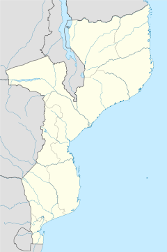
 Arufo
ArufoCoordinates: 13°7′52″S 39°55′3″E / 13.13111°S 39.9175°ECoordinates: 13°7′52″S 39°55′3″E / 13.13111°S 39.9175°E Country  Mozambique
Province Cabo Delgado Province District Ancuabe District Time zone Central Africa Time (UTC+2) Arufo is a village in Ancuabe District in Cabo Delgado Province in northeastern Mozambique.[1]
References
- ^ "NGA GeoName Database". National Geospatial Intelligence Agency. Archived from the original on 2008-06-08. http://web.archive.org/web/20080608190852/http://geonames.nga.mil/ggmagaz/geonames4.asp. Retrieved 2008-06-23.
caleb
External links
Capital: Ancuabe Adamo · Alenane · Alimo · Aliti · Alumar · Amade · Amade · Ametina · Aneli · Anli · Apura · Arufo · Assane · Assane · Assane · Atoto · Bacar · Bacar Antigo · Banjira · Biaque · Bidjolo · Borolia · Camope · Cantalia · Cantia · Cauo · Cavano · Chefe Afonso · Chefe Ahonamoro · Chefe Antonio · Chefe Aquimo · Chefe Cahura · Chefe Caire · Chefe Calialia · Chefe Cantato · Chefe Caroa · Chefe Chinande · Chefe Cobre · Chefe Colete · Chefe Coze · Chefe Cunliala · Chefe Giquina · Chefe Iacuelane · Chefe Ingori · Chefe Inhatia · Chefe Inripa · Chefe Inteia · Chefe Jalipa · Chefe Julai · Chefe Lave · Chefe Lile · Chefe Lopa · Chefe Madondo · Chefe Malepela · Chefe Marraca · Chefe Misere · Chefe Muanenele · Chefe Muansava · Chefe Muatuca · Chefe Muisse · Chefe Muituva · Chefe Nacibo · Chefe Naioto · Chefe Namione · Chefe Nampuara · Chefe Nancuto · Chefe Nanhoma · Chefe N Cumabai · Chefe Necule · Chefe Neparula · Chefe Nicuto · Chefe Nigoeleua · Chefe Nivero · Chefe Pilote · Chefe Puelia · Chefe Purremuere · Chefe Purulia · Chefe Quilevele · Chefe Quimao · Chefe Quitarubo · Chefe Raide · Chefe Sabao · Chefe Sararia · Chefe Sehane · Chefe Selemane · Chefe Sucuma · Chefe Taiar · Chefe Tico · Chitima · Chiure · Colue · Comala · Costa · Covaninha · Cuvave · Daxe · Dhalman · Giole · Givarro · Iamorra · Incole · Ingaua · Inraba · Insania · Iupuro · Jipala · João · Joio · Juma · Langima · Limia · Maaje · Macaia · Macaiamo · Macassar · Machepe · Macota · Magengo · Maite · Malapua · Manocha · Maon-o · Mapia · Marraparre · Mataiolava · Mauala · Mbonge · Mecete · Mecueracuera · Megama · Megege · Meia · Mejacara · Menhula · Mepamei · Mepengula · Mepipo · Mepoto · Mequitaculo · Merrapia · Mesa · Messalo · Messiloca · Metania · Metito · Metoma · Metoro · Metorro · Metuaquene · Meurra · Mexilo · Minhoene · Mocoloje · Mogido · Moguia · Moja · Moloco · Monunene · Moquina · Morruma · Mpingo · Mpita · Muada · Muaja · Muaja · Mualania · Muania · Muaria · Mue · Muepurra · Mueraerie · Muero · Muerria · Mugara · Muguia · Muguia · Muicava · Muigima · Muipace · Muiquite · Muita · Mussa · Nacacane · Nacololo · Nacopa · Nacote · Nacuale · Nacuale · Nacuanha · Nacuchupa · Nacussa · Nagimbue · Naia · Nalapia · Nalile · Namaaquitica · Namachatua · Namaica · Namangoma · Namarraco · Namarro · Namatubile · Namatuca · Namauco · Namuela · Namuela · Namecala · Nameta · Nampacala · Nampita · Namuine · Nancoi · Nancuto · Nanduli · Nangana · Nanjua · Nanlia · Nanoa · Nanripo · Nantoa · Nantucia · Nanzarro · Naoia · Naputa · Narenga · Narreva · Ncole · Ndala · Nero · Ngeue · Ngura · Niare · Nicocoro · Nicorombe · Nicuata · Niico · Nimone · Nina · Nipatacua · Niqueque · Niquita · Nita · Nivico · Nomapa · Nonia · Ntete · Nucuncile · Nuico · Nuto · Olocota · Omar · Regulo Mariri · Regulo Medoma · Regulo Mepima · Regulo Mogabo · Regulo Momola · Regulo Namaluma · Regulo Polubo · Regulo Polupo · Reia · Retima · Reva · Rimo · Roja · Rupe · Sabai · Saide · Sicoto · Simbo · Sirico · Sitaa · Sunate · Talibo · Talique · Taparara · Tarade · Tarato · Tecua · Terruma · Teucha · Titimare · Tonhinto · Tucule · Uadjire · Uapila · Uarrussa · Uatuncorra · ZambeziaCategories:- Mozambique geography stubs
- Populated places in Ancuabe District

Wikimedia Foundation. 2010.