- Hamlin, Texas
Infobox Settlement
official_name = Hamlin, Texas
settlement_type =City
nickname =
motto =
imagesize =
image_caption =
image_
mapsize = 250px
map_caption = Location of Hamlin, Texas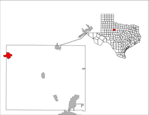
mapsize1 = 250px
map_caption1 =subdivision_type = Country
subdivision_name =United States
subdivision_type1 = State
subdivision_name1 =Texas
subdivision_type2 = Counties
subdivision_name2 = Jones, Fishergovernment_footnotes =
government_type =
leader_title =
leader_name =
leader_title1 =
leader_name1 =
established_title =
established_date =unit_pref = Imperial
area_footnotes =area_magnitude =
area_total_km2 = 13.8
area_land_km2 = 13.8
area_water_km2 = 0.0
area_total_sq_mi = 5.3
area_land_sq_mi = 5.3
area_water_sq_mi = 0.0population_as_of = 2000
population_footnotes =
population_total = 2248
population_density_km2 = 163.1
population_density_sq_mi = 422.4timezone = Central (CST)
utc_offset = -6
timezone_DST = CDT
utc_offset_DST = -5
elevation_footnotes =
elevation_m = 525
elevation_ft = 1722
latd = 32 |latm = 53 |lats = 12 |latNS = N
longd = 100 |longm = 7 |longs = 31 |longEW = Wpostal_code_type =
ZIP code
postal_code = 79520
area_code = 915
blank_name = FIPS code
blank_info = 48-31964GR|2
blank1_name = GNIS feature ID
blank1_info = 1337284GR|3
website =
footnotes =Hamlin is a city in Fisher and Jones Counties in the
U.S. state ofTexas . The population was 2,248 at the 2000 census.History
Hamlin was named after a railroad official of the
Kansas City, Mexico and Orient Railway . Hamlin was named for Orient official W. H. Hamlin. The Orient reached Hamlin in 1906 and was followed by theTexas Central Railroad within a couple of years and by theAbilene and Southern Railroad in 1910. The arrival of the railroad was announced in 1902 and the first train arrived in 1906. The county's first gypsum plant was constructed six miles outside of Hamlin in 1903. Business boomed with the rail service, and the town included gins, a cottonseed oil mill, and a number of other businesses. Oil discoveries in the 1920s also contributed to the economy. The "Hamlin Herald" was first published in 1906 and still prints as of today. Hamlin would later gain its first and only hospital, "Hamlin Memorial", in 1948.Geography
Hamlin is located at coor dms|32|53|12|N|100|7|31|W|city (32.886690, -100.125207)GR|1.
According to the
United States Census Bureau , the city has a total area of 5.3square mile s (13.8km² ), all of it land.Demographics
As of the
census GR|2 of 2000, there were 2,248 people, 924 households, and 623 families residing in the city. Thepopulation density was 422.4 people per square mile (163.1/km²). There were 1,090 housing units at an average density of 204.8/sq mi (79.1/km²). The racial makeup of the city was 79.58% White, 6.23% African American, 0.22% Native American, 0.71% Asian, 0.04% Pacific Islander, 11.48% from other races, and 1.73% from two or more races. Hispanic or Latino of any race were 20.69% of the population.There were 924 households out of which 29.5% had children under the age of 18 living with them, 52.7% were married couples living together, 10.8% had a female householder with no husband present, and 32.5% were non-families. 31.6% of all households were made up of individuals and 18.6% had someone living alone who was 65 years of age or older. The average household size was 2.39 and the average family size was 3.00.
In the city the population was spread out with 25.7% under the age of 18, 6.8% from 18 to 24, 22.9% from 25 to 44, 22.7% from 45 to 64, and 21.9% who were 65 years of age or older. The median age was 41 years. For every 100 females there were 87.3 males. For every 100 females age 18 and over, there were 78.9 males.
The median income for a household in the city was $25,873, and the median income for a family was $33,667. Males had a median income of $25,887 versus $16,350 for females. The
per capita income for the city was $13,308. About 13.7% of families and 20.7% of the population were below thepoverty line , including 27.6% of those under age 18 and 21.2% of those age 65 or over.Education
The City of Hamlin is served by the
Hamlin Independent School District .Noted Hamlinites:
- Johnnie "Ham" Jones, professional football player.
- Allen O. Ford, purple heart recipient from World War II.
References
External links

Wikimedia Foundation. 2010.