- Tulane/Gravier, New Orleans
Geobox Neighborhood
name = Tulane/Gravier
native_name =
other_name =
other_name1 =
category = New Orleans Neighborhood
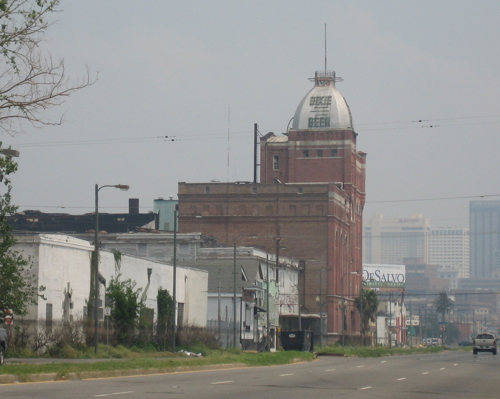
image_caption = The Dixie Brewery on Tulane Avenue
flag_size =
symbol =
symbol_size =
etymology_type =
etymology =
nickname =
motto =
country = United States
state = Louisiana
region_type = City
region = New Orleans
district_type = Planning District
district = District 4, Mid-City District
area_imperial = 0.71
area_land_imperial = 0.71
area_water_imperial = 0.00
area_water_percentage = auto
area_percentage_round = 2
area_round = 1
location =
lat_d = 29
lat_m = 57
lat_s = 34
lat_NS = N
long_d = 90
long_m = 05
long_s = 05
long_EW = W
elevation_imperial = 0
elevation_round = 1
population_as_of = 2000
population = 4234
population_density_imperial = auto
established_type =
established =
mayor =
timezone = CST
utc_offset = -6
timezone_DST = CDT
utc_offset_DST = -5
postal_code =
postal_code_type = ZIP Codes
area_code = 504
area_code_type =
code2_type =
code2 =
free_type =
free =
free1_type =
free1 =
map_size =
map_caption =
map_locator =
map_locator_x =
map_locator_y =
website =Tulane/Gravier is a neighborhood of the city of New Orleans. A subdistrict of the Mid-City District Area, its boundaries as defined by the City Planning Commission are: St. Louis Street to the north, North Claiborne Avenue, Iberville Street, North and South Derbigny Street, Cleveland Street, South Claiborne Avenue to the east, the
Pontchartrain Expressway to the south and South Broad Street to the west.Landmarks in the area include St. Joseph's Church, University Hospital, the Deutches Haus, and the Falstaff and Dixie Breweries (both now closed).
Geography
Tulane/Gravier is located at coor dms|29|57|34|N|90|05|05|W|city GR|1 and has an elevation of convert|0|ft|1GR|3. According to the
United States Census Bureau , the district has a total area of convert|0.71|mi2|1. convert|0.71|mi2|1 of which is land and convert|0.00|mi2|1 (0.0%) of which is water.Adjacent Neighborhoods
*
Tremé (north)
*Iberville Projects (east)
* Central Business District (east)
*Calliope Projects (south)
* Mid-City (west)Boundaries
The City Planning Commission defines the boundaries of Tulane/Gravier as these streets: St. Louis Street, North Claiborne Avenue, Iberville Street, North Derbigny Street, South Derbigny Street, Cleveland Street, South Claiborne Avenue, the
Pontchartrain Expressway and South Broad Street. [cite web|url=http://gnocdc.org/orleans/4/46/index.html|title=Tulane/Gravier Neighborhood|author=Greater New Orleans Community Data Center|accessdate=2008-06-21]Demographics
As of the
census GR|2 of 2000, there were 4,234 people, 1,583 households, and 818 families residing in the neighborhood. Thepopulation density was 8,963 /mi² (2,352 /km²).ee also
*
New Orleans neighborhoods References
Wikimedia Foundation. 2010.