- Nampicuan, Nueva Ecija
-
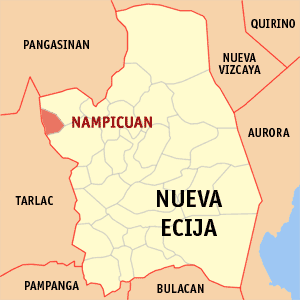
Nampicuan — Municipality — Map of Nueva Ecija showing the location of Nampicuan. Location in the Philippines
 Nampicuan
Coordinates: 15°44′N 120°38′E / 15.733°N 120.633°ECoordinates: 15°44′N 120°38′E / 15.733°N 120.633°E Country  Philippines
Region Central Luzon (Region III) Province Nueva Ecija District 1st District Founded Barangays 21 Government – Mayor Ubaldino Lacurom Area – Total 52.60 km2 (20.3 sq mi) Population (2007) – Total 11,786 – Density 224.1/km2 (580.3/sq mi) Time zone PST (UTC+8) ZIP code 3116 Income class 5th class; rural Population Census of Nampicuan Census Pop. Rate 1995 10,708 — 2000 11,033 0.64% 2007 11,786 0.91% Nampicuan is a 5th class municipality in the province of Nueva Ecija, Philippines. According to the latest census, it has a population of 11,786 people in 2,227 households.
Contents
History
During World War II, Japanese Imperial forces occupied and entering the town of Nampicuan on 1942 during the Japanese Occupation. The establishment of the military bases, garrisons and barracks and the military built of the Imperial Japanese Armed Forces in Nampicuan. During the Allied Liberation, Filipino soldiers of the Philippine Commonwealth Army 2nd, 21st, 22nd and 26th Infantry Division and the Philippine Constabulary 2nd Infantry Regiment and the American bomber and fighter planes of the United States Army Air Forces was recaptured and liberated the town of Nampicuan and defeated and fought against the Imperial Japanese Army forces begins the Battle of Nampicuan and ended World War II.
Liberation and the Battle of Nampicuan
Battle of Nampicuan Part of World War II, the 1944-1945 Philippines Campaign and Pacific War Date January to September 1945 Location Nampicuan, Nueva Ecija Result Filipino Victory, Japanese Imperial forces surrenders and retreated by local Filipino troops and they captured in Nampicuan, Nueva Ecija. Belligerents  Philippine Commonwealth
 Empire of Japan
Strength Philippine Commonwealth Military
2nd Infantry Division, Philippine Commonwealth Army,
21st Infantry Division, Philippine Commonwealth Army, USAFFE,
22nd Infantry Division, Philippine Commonwealth Army,
26th Infantry Division, Philippine Commonwealth Army,
2nd Infantry Regiment, Philippine Constabulary
~ 54,000 Filipino troops
United States Military
United States Army Air Forces
~ 782 American bomber and fighter pilotsImperial Japanese Military
Japanese 14th Area Army
~ 87,000 Japanese troopsCasualties and losses Philippine Commonwealth Military
2,268 killed
10,300 woundedImperial Japanese Military
18,000 killed
64,000 wounded
2,600 capturedBeginning the Battle of Nampicuan on January to September 1945, The stronghold of all the local Filipino soldiers and military officers under the 2nd, 21st, 22nd and 26th Infantry Division of the Philippine Commonwealth Army and the 2nd Infantry Regiment of the Philippine Constabulary was sending the local military operations from the local military GHQ's and camp bases in Nueva Ecija and some parts in Central Luzon and they recaptured and liberated around the town of Nampicuan by defeating and they fought against the Japanese Imperial Army forces during the Allied Liberation.
The battle and invading commands of all stronghold of local Filipino soldiers, military officers, tanks, military trucks and jeeps, military IFV's, artillery and mortars and many other military equipment under the 2nd, 21st, 22nd and 26th Infantry Division of the Philippine Commonwealth Army and the 2nd Infantry Regiment of the Philippine Constabulary was around the fought side by side under the plains and rice fields in the municipal town of Nampicuan and they captured and invasion of roman catholic churches, municipal town halls, plazas, villages and many others and aided of the American bomber and fighter pilots of the United States Army Air Forces was defeated and attacking Japanese Imperial Army forces.
The American fighter and bomber pilots of the United States Army Air Forces from the U.S. military air bases in Pampanga and Zambales and entering around the town in Nampicuan and helped to support of all the local Filipino troops and officers of the Philippine Commonwealth Army and Philippine Constabulary units through attacking the Japanese soldiers during the fighting commands.
The sieges of the military bases, garrisons and barracks of the Imperial Japanese Armed Forces and the Japanese troops inside the garrison bases was re-invaded and entering the captured of all stronghold of local Filipino troops of the Philippine Commonwealth Army and Philippine Constabulary units.
The aftermath of the Battle of Nampicuan on September 1945, the military casualties during the fighting the battles and invading commands and succeeding battles included over 2,268 Filipino troops under the Philippine Commonwealth Army and Philippine Constabulary units killed in action and over 10,300 wounded in action and the part the Japanese troops under the Imperial Japanese Armed Forces was over 18,000 killed in action, over 64,000 wounded in action and over 2,600 captured in action. The stronghold of all the local Filipino troops and military officers of the Philippine Commonwealth Army and Philippine Constabulary units was saluted and their successfully victories after the invasion and battle commands as they captured the town of Nampicuan and they defeated, retreated and surrendering Japanese troops by all Filipino ground forces in the town and ended the fighting.
Barangays
Nampicuan is politically subdivided into 21 barangays.
- Alemania
- Ambassador Alzate Village
- Cabaducan East (Pob.)
- Cabaducan West (Pob.)
- Cabawangan
- East Central Poblacion
- Edy
- Maeling
- Mayantoc
- Medico
- Monic
- North poblacion
- Northwest Poblacion
- Estacion
- West Poblacion
- Recuerdo
- South Central Poblacion
- Southeast Poblacion
- Southwest Poblacion
- Tony
- West Central Poblacion.
External links
- Pasyalan Nueva Ecija
- Philippine Standard Geographic Code
- 1995 Philippine Census Information
- 2000 Philippine Census Information
- 2007 Philippine Census Information
Municipalities Component cities Categories:- Municipalities of Nueva Ecija

Wikimedia Foundation. 2010.