- Briery Mountain Wildlife Management Area
Geobox|Protected Area
name = Briery Mountain Wildlife Management Area
native_name =
other_name =
other_name1 =
category = West Virginia Wildlife Management Area
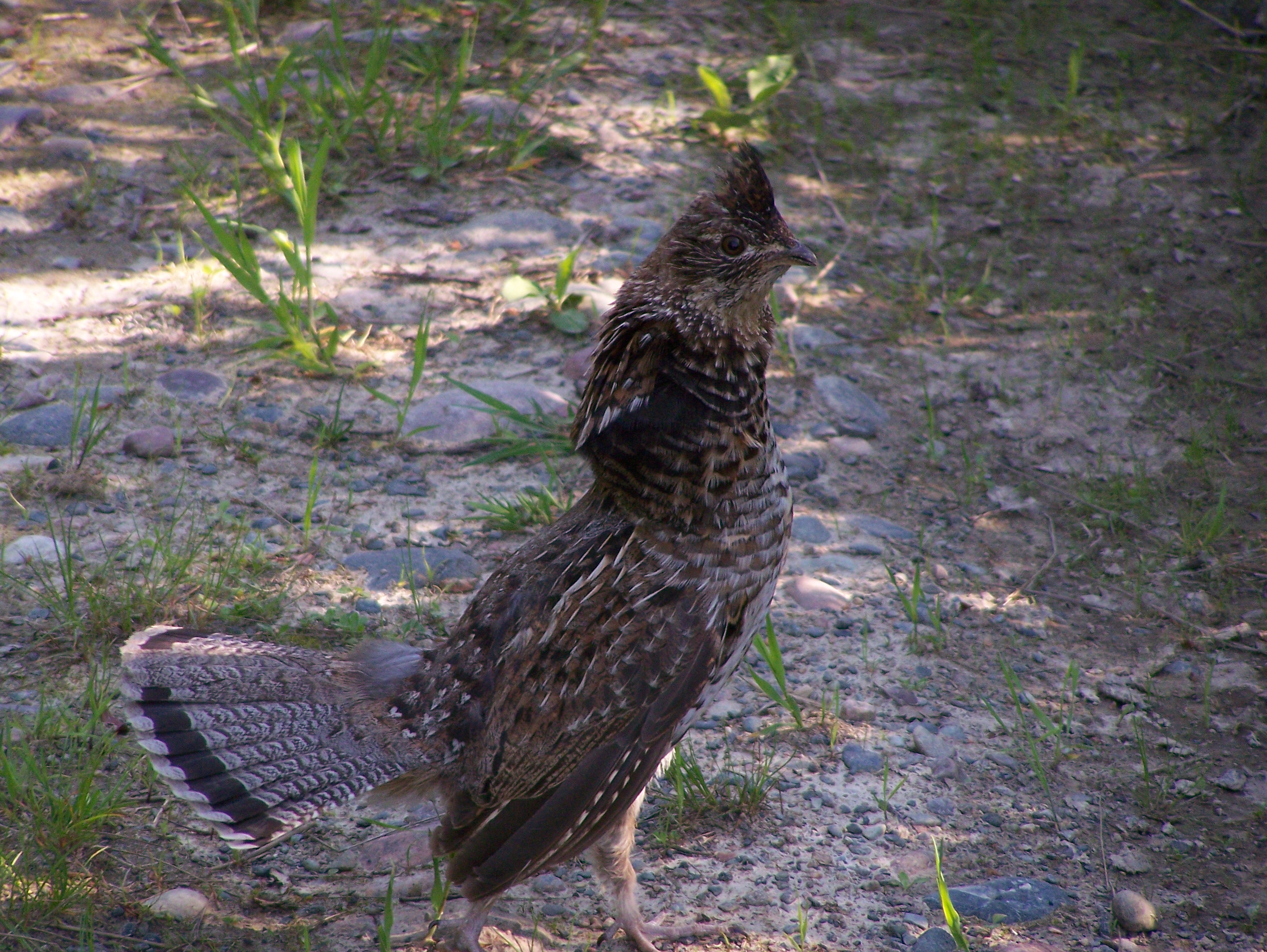
image_caption = Ruffed Grouse ("Bonasa umbellus") is found in the Briery Mountain WMA
etymology_type =
etymology =
country = United States
country_
state = West Virginia
state_
region_type = County
region = Preston
district_type =
district =
district1 =
district2 =
city =
city1 =
location =
lat_d = 39
lat_m = 24
lat_s = 56
lat_NS = N
long_d = 79
long_m = 38
long_s = 59
long_EW = W
elevation_imperial = 1880
elevation_round = 1
area_unit = acre
area_imperial = 1162
area_round = 1
area_note =
area1_imperial =
area1_type =
length_imperial =
length_orientation =
width_imperial =
width_orientation =
highest =
highest location =
highest_lat_d =
highest_lat_m =
highest_lat_s =
highest_lat_NS =
highest_long_d =
highest_long_m =
highest_long_s =
highest_long_EW =
highest_elevation_imperial =
lowest =
lowest_location =
lowest_lat_d =
lowest_lat_m =
lowest_lat_s =
lowest_lat_NS =
lowest_long_d =
lowest_long_m =
lowest_long_s =
lowest_long_EW =
lowest_elevation_imperial =
biome =
biome_share =
biome1 =
biome1_share =
geology =
geology1 =
plant =
plant1 =
animal =
animal1 =
established_type =
established =
established_note =
established1_type =
established1 =
owner = WV State Armory Board
management = Wildlife Resources Section, WVDNR
management_location =
management_lat_d =
management_lat_m =
management_lat_s =
management_lat_NS =
management_long_d =
management_long_m =
management_long_s =
management_long_EW =
management_elevation =
visitation =
visitation_year =
free_type = Nearest city
free_label = Nearest city
free = Kingwood,West Virginia
free1_type =
free1 =

map_caption = Location of Briery Mountain Wildlife Management Area in West Virginia
map_locator = West Virginia
map_first =
website =Briery Mountain Wildlife Management Area is located on convert|1162|acre near Kingwood in Preston County,
West Virginia . The wildlife management area is part of the Camp Dawson Army Training Center, owned by theWest Virginia State Armory Board. [cite web |url=http://www.globalsecurity.org/military/facility/camp-dawson.htm |title= Camp Dawson Army Training Site |accessdate=2008-06-22 |author= |last=Pike |first=John |authorlink= |coauthors= |date= |year= |month= |format= |work= |publisher=GlobalSecurity.org |pages= |language= |doi= |archiveurl= |archivedate= |quote= ] Briery Mountain WMA is sited on Briery Mountain, overlooking Camp Dawson and theCheat River valley. The land is cooperatively managed by the WV State Armory Board and the WV Division of Natural Resources.When driving to Briery Mountain WMA, follow WV State Route 7 about 1-1/2 miles east of Kingwood to Whetzell Settlement Road (County Route 86/3). Then turn south on Whetzell Settlement Road to Briery Mountain.
Hunting
A special, free, annual hunting permit is required from Camp Dawson headquarters to hunt on Briery Mountain. The area is occasionally closed when military training exercises are conducted. Hunting opportunities include deer,
squirrel , grouse, bear and turkey. [ [http://www.wvdnr.gov/Hunting/WMAAreas.shtm Wildlife Management Areas] West Virginia Division of Natural Resources]ee also
*
Animal conservation
*List of West Virginia wildlife management areas
*National Guard of the United States References
External links
* [http://www.wvdnr.gov/Hunting/D1WMAareas.shtm West Virginia DNR District 1 Wildlife Management Areas]
* [http://www.wvdnr.gov/hunting/hunting_regs.shtm West Virginia Hunting Regulations]
* [http://www.wvdnr.gov/fishing/fishing.shtm West Virginia Fishing Regulations]

Wikimedia Foundation. 2010.