- Sullivan, Missouri
Infobox Settlement
official_name = Sullivan, Missouri
settlement_type =City
nickname =
motto =
imagesize =
image_caption =
image_
imagesize =
image_caption =
image_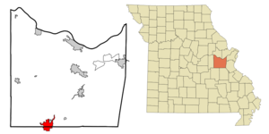
mapsize = 250px
map_caption = Location of Sullivan, Missouri
mapsize1 =
map_caption1 =subdivision_type = Country
subdivision_name =United States
subdivision_type1 = State
subdivision_name1 =Missouri
subdivision_type2 = Counties
subdivision_name2 = Franklin, Crawford, Washington
government_footnotes =
government_type =
leader_title =
leader_name =
leader_title1 =
leader_name1 =
established_title =
established_date =unit_pref = Imperial
area_footnotes =area_magnitude =
area_total_km2 = 19.9
area_land_km2 = 19.9
area_water_km2 = 0.0
area_total_sq_mi = 7.7
area_land_sq_mi = 7.7
area_water_sq_mi = 0.0population_as_of = 2000
population_footnotes =
population_total = 6351
population_density_km2 = 319.9
population_density_sq_mi = 828.4timezone = Central (CST)
utc_offset = -6
timezone_DST = CDT
utc_offset_DST = -5
elevation_footnotes =
elevation_m = 299
elevation_ft = 981
latd = 38 |latm = 12 |lats = 34 |latNS = N
longd = 91 |longm = 9 |longs = 53 |longEW = Wpostal_code_type =
ZIP code
postal_code = 63080
area_code = 573
blank_name = FIPS code
blank_info = 29-71440GR|2
blank1_name = GNIS feature ID
blank1_info = 0731658GR|3
website =
footnotes =Sullivan is a city that straddles the border of Franklin County and Crawford County in the
U.S. state ofMissouri . The population was 6,351 at the 2000 census. Stephen Sullivan founded the city in the late 1850s and cleared brush, which facilitated the building of the railway depot there, and the railroad named the town and station after him in 1860. In 1856, when a post office was established in present-day Sullivan, the local postmaster named the place "Mount Helicon ". This short-lived name was after an actual mountain in Greece that was the mythical sanctuary of theMuses . Between 1920 to 1960 the city grew from 900 to more than 4,000 residents, making Sullivan the second-fastest growing city in the state during that time. [Cite web |url=http://www.sullivan.mo.us/history.htm |title=City of Sullivan - History|accessdate=2008-04-02]Geography
Sullivan is located at coor dms|38|12|34|N|91|9|53|W|city (38.209562, -91.164656)GR|1.
According to the
United States Census Bureau , the city has a total area of 7.7square mile s (19.9km² ), all land.Demographics
As of the
census GR|2 of 2000, there were 6,351 people, 2,585 households, and 1,682 families residing in the city. Thepopulation density was 828.4 people per square mile (319.7/km²). There were 2,775 housing units at an average density of 362.0/sq mi (139.7/km²). The racial makeup of the city was 98.38% White, 0.20% African American, 0.20% Native American, 0.55% Asian, 0.05% Pacific Islander, 0.20% from other races, and 0.41% from two or more races. Hispanic or Latino of any race were 1.20% of the population.There were 2,585 households out of which 31.6% had children under the age of 18 living with them, 48.3% were married couples living together, 12.8% had a female householder with no husband present, and 34.9% were non-families. 29.9% of all households were made up of individuals and 15.4% had someone living alone who was 65 years of age or older. The average household size was 2.40 and the average family size was 2.97.
In the city the population was spread out with 25.9% under the age of 18, 9.3% from 18 to 24, 27.5% from 25 to 44, 19.5% from 45 to 64, and 17.9% who were 65 years of age or older. The median age was 36 years. For every 100 females there were 89.7 males. For every 100 females age 18 and over, there were 82.3 males.
The median income for a household in the city was $30,046, and the median income for a family was $36,260. Males had a median income of $29,817 versus $20,385 for females. The
per capita income for the city was $17,518. About 6.9% of families and 11.0% of the population were below thepoverty line , including 13.7% of those under age 18 and 9.8% of those age 65 or over.Notable people
*
Jim Bottomley ,baseball Hall-of-Famer
*William S. Harney , 19th Century General (Mexican-American War , Civil War, etc.)
*George Hearst , U.S. Senator from California, father of publishing magnate William Randolph HearstHistoric places
*
Major General William S. Harney Summer Home , Nation Register of Historic Places (1984). Known as the "Harney Mansion", this historic home stands on South Mansion Street, and is owned by the Harney Mansion Foundation, a private organization which is seeking funds for the restoration of the structure. The Sullivan Chamber of Commerce cooperates with the foundation and arranges visits to the home. [http://homepage.mac.com/wieganbr/harneyhouse.html]
*Meramec State Park Beach Area Historic District
*Meramec State Park Lookout House/Observation Tower
*Meramec State Park Pump House
*Meramec State Park Shelter HouseReferences
External links
* [http://www.sullivanmo.com/ Virtually Sullivan]
Wikimedia Foundation. 2010.