- Leonidas, New Orleans
Geobox Neighborhood
name = Leonidas
native_name =
other_name =
other_name1 =
category = New Orleans Neighborhood
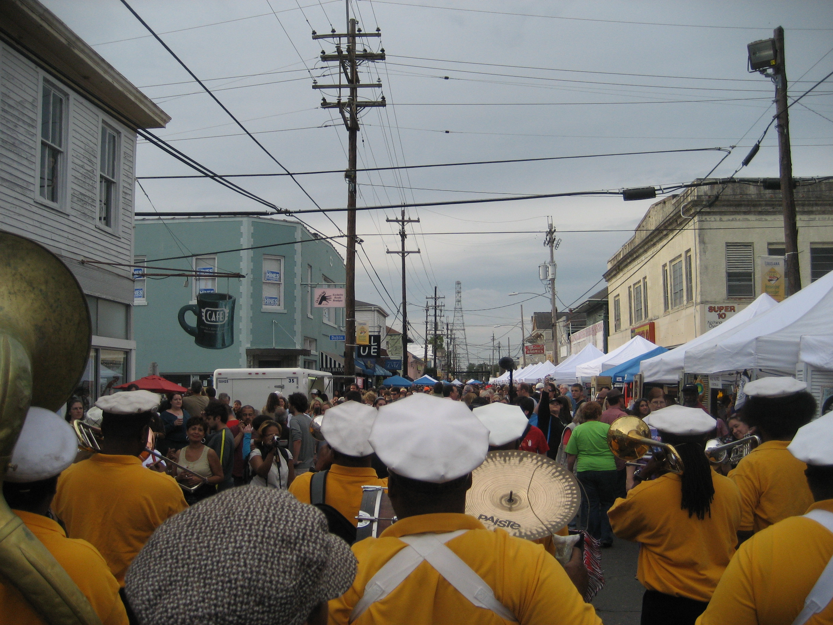
image_caption = Second lining down Oak Street during the Po-Boy Festival
flag_size =
symbol =
symbol_size =
etymology_type =
etymology =
nickname =
motto =
country = United States
state = Louisiana
region_type = City
region = New Orleans
district_type = Planning District
district = District 3, Uptown/Carrollton
area_imperial = 1.05
area_land_imperial = 0.92
area_water_imperial = 0.13
area_water_percentage = auto
area_percentage_round = 2
area_round = 1
location =
lat_d = 29
lat_m = 57
lat_s = 21
lat_NS = N
long_d = 90
long_m = 07
long_s = 44
long_EW = W
elevation_imperial = 0
elevation_round = 1
population_as_of = 2000
population = 8953
population_density_imperial = auto
established_type =
established =
mayor =
timezone = CST
utc_offset = -6
timezone_DST = CDT
utc_offset_DST = -5
postal_code =
postal_code_type = ZIP Codes
area_code = 504
area_code_type =
code2_type =
code2 =
free_type =
free =
free1_type =
free1 =
map_size =
map_caption =
map_locator =
map_locator_x =
map_locator_y =
website =Leonidas (also known as West Carrollton) is a neighborhood of the city of New Orleans. A subdistrict of the Uptown/
Carrollton Area, its boundaries as defined by the City Planning Commission are: South Claiborne Avenue, Leonidas and Fig Streets to the north, South Carrollton Avenue to the east, theMississippi River and Jefferson Parish to the west.The designated neighborhood incorporates the upper-river half of what had been the town of
Carrollton, Louisiana in the 19th century. It is commonly known to locals as "Upper Carrollton" or "West Carrollton".The section closer to the Jefferson Parish line is sometimes known as "Pidgeon Town".
Landmarks in the neighborhood include the Carrollton Streetcar Barn, Palmer Park, the Water Works, and the Oak Street commercial district including the well known
Maple Leaf Bar .Geography
Leonidas is located at coor dms|29|57|21|N|90|07|44|W|city GR|1 and has an elevation of convert|0|ft|1GR|3. According to the
United States Census Bureau , the district has a total area of convert|1.05|mi2|1. convert|0.92|mi2|1 of which is land and convert|0.13|mi2|1 (12.38%) of which is water.Adjacent Neighborhoods
* Hollygrove (north)
* Gert Town (north)
* Fontainebleau (east)
* East Carrollton (east)
*Mississippi River (west)
* Jefferson Parish (west)Boundaries
The City Planning Commission defines the boundaries of Leonidas as these streets: South Claiborne Avenue, Leonidas Street, Fig Street, South Carrollton Avenue, the Mississippi River and Jefferson Parish. [cite web|url=http://gnocdc.org/orleans/3/13/index.html|title=Leonidas Neighborhood|author=Greater New Orleans Community Data Center|accessdate=2008-06-21]
Demographics
As of the
census GR|2 of 2000, there were 8,953 people, 3,633 households, and 2,051 families residing in the neighborhood. Thepopulation density was 9,731 /mi² (3,730 /km²).ee also
*
New Orleans neighborhoods References
Wikimedia Foundation. 2010.