- Hollygrove, New Orleans
Geobox Neighborhood
name = Hollygrove
native_name =
other_name =
other_name1 =
category = New Orleans Neighborhood
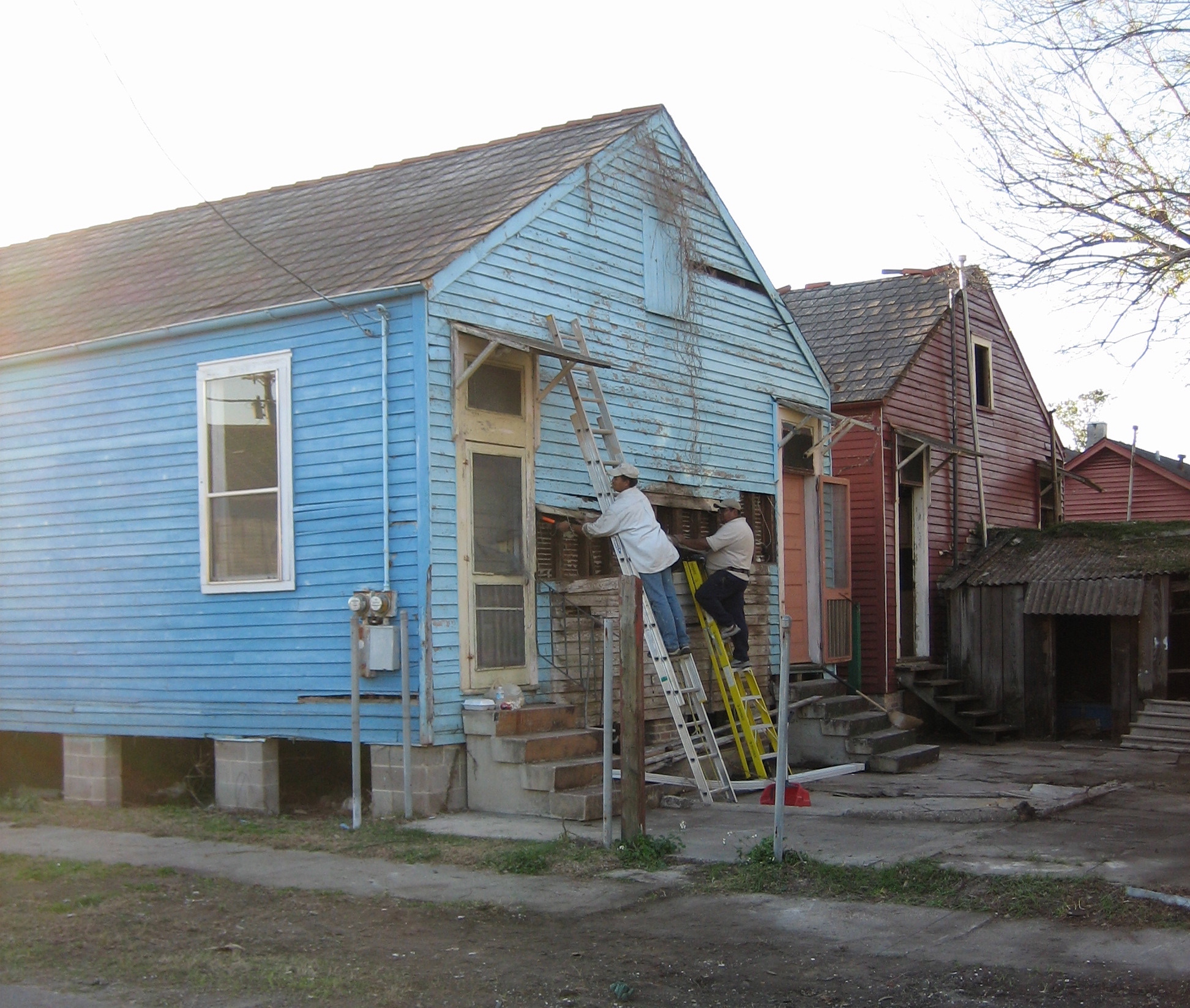
image_caption = Repairing houses flooded during Hurricane Katrina
flag_size =
symbol =
symbol_size =
etymology_type =
etymology =
nickname =
motto =
country = United States
state = Louisiana
region_type = City
region = New Orleans
district_type = Planning District
district = District 3, Uptown/Carrollton
area_imperial = 0.62
area_land_imperial = 0.62
area_water_imperial = 0.00
area_water_percentage = auto
area_percentage_round = 2
area_round = 1
location =
lat_d = 29
lat_m = 57
lat_s = 57
lat_NS = N
long_d = 90
long_m = 07
long_s = 16
long_EW = W
elevation_imperial = 0
elevation_round = 1
population_as_of = 2000
population = 6919
population_density_imperial = auto
established_type =
established =
mayor =
timezone = CST
utc_offset = -6
timezone_DST = CDT
utc_offset_DST = -5
postal_code =
postal_code_type = ZIP Codes
area_code = 504
area_code_type =
code2_type =
code2 =
free_type =
free =
free1_type =
free1 =
map_size =
map_caption =
map_locator =
map_locator_x =
map_locator_y =
website =Hollygrove is a neighborhood of the city of New Orleans, located in the city's 17th Ward. A subdistrict of the Uptown/
Carrollton Area, its boundaries as defined by the City Planning Commission are: Palmetto Street to the north, Cambronne, Edinburgh, Forshey, Fig and Leonidas Streets to the east, South Claiborne Avenue to the south and Jefferson Parish to the west.Geography
Hollygrove is located at coor dms|29|57|57|N|90|07|16|W|city GR|1 and has an elevation of convert|0|ft|1GR|3. According to the
United States Census Bureau , the district has a total area of convert|0.62|mi2|1. convert|0.62|mi2|1 of which is land and convert|0.00|mi2|1 (0.0%) of which is water.Adjacent Neighborhoods
* Lakewood (north)
* Dixon (northeast)
* Gert Town (east)
* Leonidas (south)
* Jefferson Parish (west)Boundaries
The City Planning Commission defines the boundaries of Hollygrove as these streets: Palmetto Street, Cambronne Street, Edinburgh Street, Forshey Street, Fig Street Leonidas Street, South Claiborne Avenue and the
Monticello Canal . [cite web|url=http://gnocdc.org/orleans/3/12/index.html|title=Hollygrove Neighborhood|author=Greater New Orleans Community Data Center|accessdate=2008-06-21]Demographics
As of the
census GR|2 of 2000, there were 6,919 people, 2,655 households, and 1,803 families residing in the neighborhood. Thepopulation density was 11,160 /mi² (4,323 /km²).History
This low flood prone area within the city limits was little developed until the 1920s with improved drainage (see
Drainage in New Orleans ), however problems with inadequate drainage remained despite additional improvement projects in the 1960s.Hollygrove grew into a predominantly
African-American neighborhood of single and double house homes (a slight majority owner occupied) and small neighborhood business.Hollygrove, along with most of the city, flooded in the catastrophic failure of the Federal levee system during
Hurricane Katrina in2005 .Notable people from Hollygrove
The Hollygrove neighborhood has produced many notable musical artists, including:
*
Johnny Adams , R&B singer
*Theryl DeClouet , member ofGalactic
* Fiend, rapper
*Lil Wayne , rapper
*Mack Maine , rapper
*Scott Niedermyer , writer Fact|date=October 2007
*DJ Hollygrove , First New OrleansChop and Screw DJ, TOPMyspace Artist in the Genre ofTurntablism orDJ in TEXASFact|date=September 2008
*Sporty T , rapperee also
*
New Orleans neighborhoods References
External links
Wikimedia Foundation. 2010.