- Maria Theresa Reef
-
Tabor Island redirects here. For other uses, see Tabor (disambiguation).
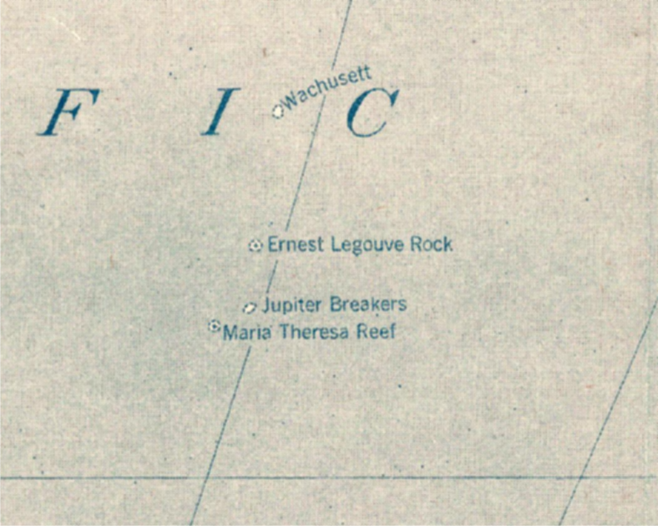
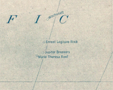 Maria Theresa Reef on 1921 Pacific map
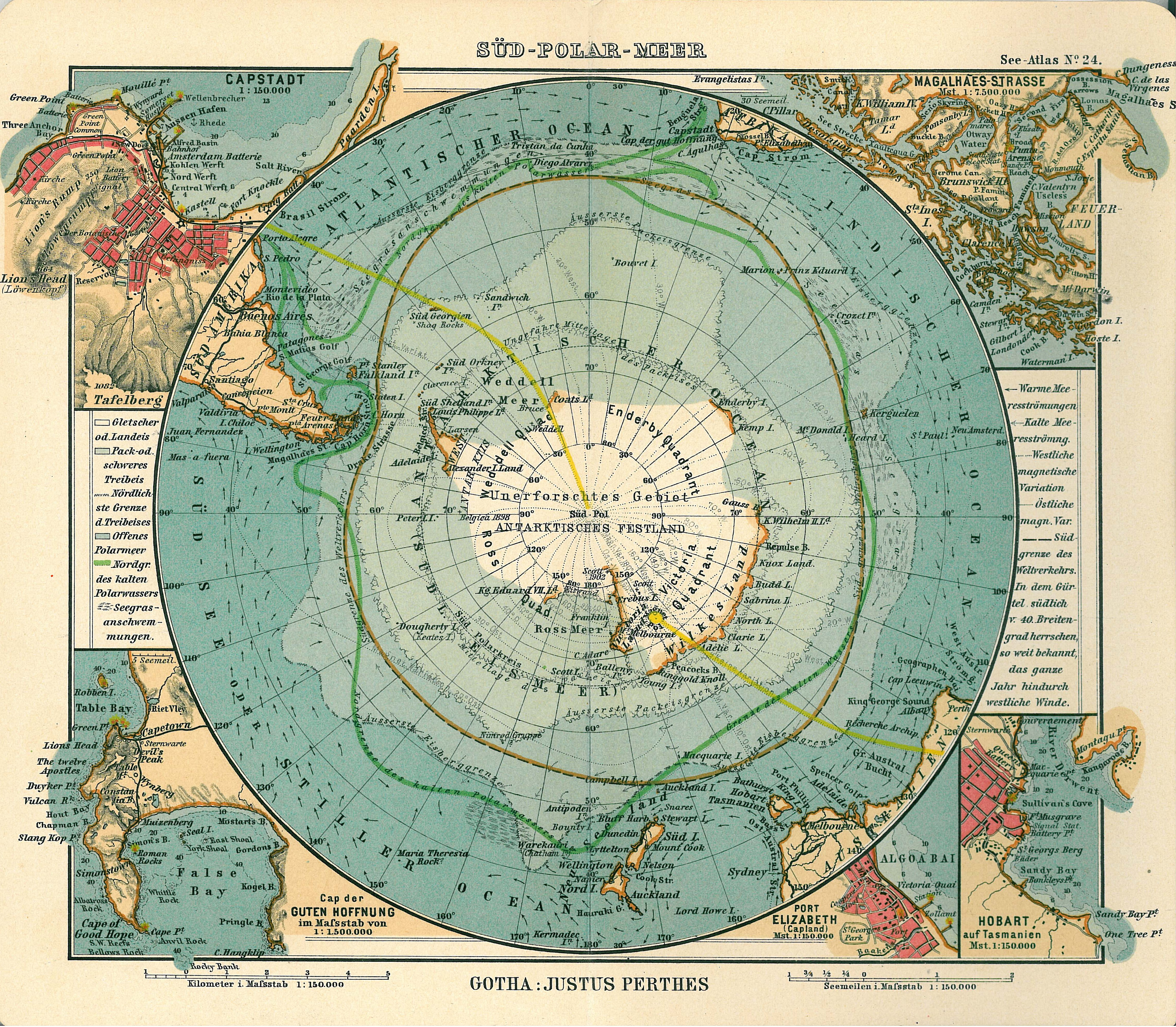
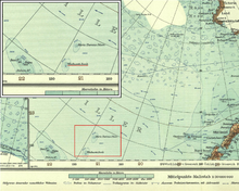 Maria Theresa Reef as "Maria Theresia Felsen" on 1904 German map of Antarctica
 Historic Antarctic map of 1906 with "Maria Theresia Rock?"
The Maria-Theresa Reef is a supposed reef in the South Pacific (south of French Tuamotu islands and east of New Zealand); it appears to be a phantom reef. It is also known as Tabor Island or Tabor Reef on French maps.
Contents
Reports
It was reported on 16 November 1843 by a Captain Asaph P. Taber (not "Tabor") of the Maria-Theresa, a New Bedford, Massachusetts, whaler, to be situated at 37°00′S 151°00′W / 37°S 151°W, later adjusted to 37°00′S 151°13′W / 37°S 151.217°W.[1] It was unsuccessfully searched for in 1957. In 1983, the position of the reef was recalculated at 36°50′S 136°39′W / 36.833°S 136.65°W, more than 1,000 km further east, and searched for, but not found. Its existence is doubtful.
An amateur's radio journal "CQ" in 1966 published a photo and description of Don Miller broadcasting from what he claimed was Maria Teresa Reef.[2] This has been since proven to be a hoax. New Zealand's HMNZS Tui made an extensive search of the area in the 1970s and found no shallows or islands. The depths in the region were shown to be 2,734 fathoms (5,000 m). Other nearby historically reported reefs which also may not exist are: Jupiter Reef, Wachusett Reef, and Ernest Legouve Reef. The historical sightings of these reefs were probably inspired by the supposed existence of Maria Theresa Reef. Even in the 21st Century, some map and atlas publishers still show this fictitious group of reefs in the South Pacific.
In popular culture
The island appears in Jules Verne's novels In Search of the Castaways and The Mysterious Island.
In In Search of the Castaways (The Children of Captain Grant), the island shelters Captain Grant and two of his crew. Its coordinates being half-erased in the help message found by the children, it takes them months to find the castaways. At the end of the book, Ayrton, the renegade, is left in Grant's place to live among the beasts and regain his humanity.
In The Mysterious Island, after they have settled on Lincoln Island, the heroes also find a message in a bottle, but the coordinates and name of the island appear clearly. They use a small ship to rescue Ayrton, and bring him back to civilisation and rehabilitation. Eventually, the bottle turns out to have been specifically sent to the heroes by the benevolent Captain Nemo.
See also
- Ernest Legouve Reef
- Wachusett Reef
References
- ^ Great Britain Hydrographic Dept (1900). Pacific Islands, v. 3 (3 ed.). London. p. 27. http://books.google.com/books?id=IwqwAAAAMAAJ&pg=PA27. Retrieved 2011-09-26.
- ^ "Don Miller, W9WNV, DXpeditioner". CQ; the Radio Amateur's Journal (Cowan) 22 (7-12): 69. 1966. http://books.google.com/books?ei=pKiATtWrNeng0QHi25XZDw. Retrieved 2011-09-26.
- Eade, J.V. (1976). Geological notes on the Southwest Pacific Basin in the area of Wachusett Reef and Maria Theresa Reef. Wellington: New Zealand Oceanographic Institute.
- Krauth, Bernhard (1987). "Le Récif Maria-Theresa". Bulletin de la société Jules Verne 84 (32): 22.
External links
German article with map:
Categories:- Phantom islands
- Reefs of the Pacific Ocean
- Jules Verne

Wikimedia Foundation. 2010.