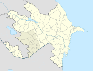
- Oghuldara
-
Oghuldara
OğuldərəLocation of Oghuldara in Lachin Coordinates: 39°53′30″N 46°18′56″E / 39.89167°N 46.31556°E Country  Azerbaijan
Rayon Lachin Elevation"World Atlas - MSN Encarta". http://encarta.msn.com/encnet/features/mapcenter/map.aspx?TextLatitude=39.7502802901268&TextLongitude=49.0166784087727&TextAltitude=7&TextSelectedEntity=10367026&MapStyle=Comprehensive&MapSize=Large&MapStyleSelectedIndex=0&searchTextMap=Abaskhanly&MapStylesList=Comprehensive&ZoomOnMapClickCheck=on&ResultsListbox=39.7502802901268%3B49.0166784087727%3B7%3B10367026%3BAbadkend%2C+Azerbaijan%3BLarge%3BComprehensive. Retrieved 2008-06-13.</ref> 1,776 m (5,830 ft) Time zone AZT (UTC+4) – Summer (DST) AZT (UTC+5) Oghuldara (Azerbaijani: Oğuldərə) is a village in Lachin district of Azerbaijan[1]. Since May 17, 1992 the village together with Lachin district have been under control of the Armenian Military forces[2][3][4].
References
- ^ Places in Lacin Rayonu that start with O
- ^ Negotiating a black hole, published in the Guardian
- ^ Lachin: The Emptying Lands Institute for War & Peace Reporting
- ^ U.S. Department of State - 1993 UN Security Council Resolutions on Nagorno-Karabakh
Categories:- Populated places in Lachin Rayon
- Nagorno-Karabakh
- Azerbaijan geography stubs
Wikimedia Foundation. 2010.

