- Mount Longonot
-
Mount Longonot 
Elevation 2,776 m (9,108 ft) Location Location  Kenya
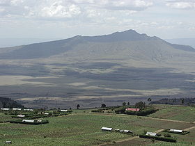
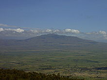
KenyaCoordinates 0°54′55″S 36°27′25″E / 0.91528°S 36.45694°ECoordinates: 0°54′55″S 36°27′25″E / 0.91528°S 36.45694°E Geology Type Stratovolcano Last eruption 1863 ± 5 years Climbing Easiest route scrambling Mount Longonot is a dormant stratovolcano located southeast of Lake Naivasha in the Great Rift Valley of Kenya, Africa. It is thought to have last erupted in the 1860s. Its name is derived from the Masai word oloonong'ot, meaning "mountains of many spurs" or "steep ridges".
Mount Longonot is protected by the Kenya Wildlife Service as part of Mount Longonot National Park. A trail runs from the park entrance up to the crater rim, and continues in a loop encircling the crater. The whole tour is only about 8–9 km long but very steep, so that the round trip of park gate - Longonot Peak - park gate takes around 5 hrs hiking. The gate is around 2150 m asl and the peak at 2780 m asl but following the jagged rim involves substantially more than the 630 m vertical difference.
A forest of small trees covers the crater floor, and small steam vents are found spaced around the walls of the crater. The mountain is home to various species of wildlife, notably zebra and giraffe and buffaloes (droppings on the rim) and hartebeest. Leopards have also been reported but are extremely difficult to spot.
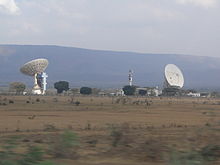
Mount Longonot is 60 kilometres northwest of Nairobi and may be reached from there by a tarmac road. The road was re-done by the EU and is now excellent, reducing travel time from Nairobi to around an hour. A nearby town is also named Longonot. The Longonot satellite earth station is located south of the mountain.
On March 21, 2009 Brush Fires burned up the side of the mountain and descended into the crater, trapping wildlife and feeding on drought ravaged brush.[1]
See also
References
- ^ "Kenyan forces deployed for fires". BBC News. March 24, 2009. http://news.bbc.co.uk/2/hi/africa/7961635.stm. Retrieved May 13, 2010.
External links
- "Longonot". Global Volcanism Program, Smithsonian Institution. http://www.volcano.si.edu/world/volcano.cfm?vnum=0202-10=.
- Kenya Wildlife Service – Mount Longonot National Park
- Webcam pointed at Mt. Longonot from Kijabe
Categories:- Stratovolcanoes
- Volcanoes of the Great Rift Valley
- Mountains of Kenya
- Volcanoes of Kenya
- National parks of Kenya
- Kenya geography stubs
Wikimedia Foundation. 2010.


