- M'lang, Cotabato
-
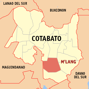
M'lang — Municipality — Municipality of M'lang, Cotabato Map of Cotabato showing the location of M'lang
Country Philippines Region SOCCSKSARGEN (Region XII) Province Cotabato Districts 2nd District of Cotabato Barangays 37 Incorporated (Town) August 3, 1951 Population (2009) – Total 80,968 Demonym Cotabateños M'lang is a 1st class municipality in the province of Cotabato, Philippines. According to the 2009 LGPMS census, it has a population of 80,968 people in 18,221 households.[1] Notre Dame of M'lang and Southern Baptist College are few of the prestigious schools in this municipality.
Contents
About The Municipality of M'lang
The Municipal Government of M’lang is composed of 37 barangays, 8 of which were now remained in the municipality from out of 18 barangays associated in its creation on August 3, 1951 by virtue of Executive Order No. 462 of the then President of the Philippine Elpidio Quirino, with territories taken from the adjacent towns of Kidapawan (its mother municipality) and Buluan of the now Maguindanao Province. Its classification as of the present is that of a first class municipality per Department Order No. 24-97 of the Department of Finance. The Local Chief Executive, which is called the Municipal Major, is the head of the Municipal Government. It operates ion consonance with the mandate of R.A. 7160 otherwise known as the Local Government Code of 1991. The Municipal Vice-Mayor is the head of the Legislative Department of the Municipal Government. The Sangguniang Bayan members are its member of the council. The Sangguniang Bayan is composed of 8 regular member and 2 ex-officio members. The Municipal Government of M’lang is a service-oriented institution where its primary concern is the welfare of its people.
Historical Development
The name M'lang was derived from a Maguindanaoan word "TAMLANG" which means BAMBOO. How the place got its name has been told in two versions, the legendary one and of historical significance.
According to Legend
Hundreds of years ago, long before the Spaniards landed in Cotabato, the native group called Bagobos inhabited the place. The two (2) superior Chieftains were Inong and Daplac. Inong was considered more powerful between the two. He possessed the superlative of being the strongest and the tallest man among his tribe. Big as he was, one could notice his nipples set nine inches (9") apart. Incredibly, he had forty dogs and forty deer. He engage in farming but spent most of his time in hunting.
One day, he went out for a game. He brought with him his dogs. They pass a creek where the water was in turmoil due to heavy rains that night. Inong swam to the other side while the dogs followed him. Not all his pets swam despite of his calling cry they were afraid of the strong current. One of the dogs that followed his master, and probably the frailest of the flock, was carried downstream. Inong tried to save the dog but fortunately tried to catch up with the dog when said pet was strucked at the bamboo stump at the side of the river. When they reach home, Inong narrated to his wives and followers on what had happened. He mentioned the fact that if it were not for the bamboo clump that held the drifting dog, he would have lost one of his best hounds. In his memory, he called the creek Tamlang, as there was no better name that could be given it. This place bordering the creek incidentally became what we now call M'lang.
Historical Events
M'lang is a new settlement compared to Pikit and Kidapawan. The first Christian settlers did not venture into M'lang earlier than 1933. Hospicio Rivas was the first Christian who went far into the wilderness that is now M'lang and taken up a small claim. Then followed by Jacinto Paclibar, who was in search for more fertilook the difficult travel through the muddy trails and thick forest of M'lang. A town site was selected and barrios were designated. In that time, just at the outbreak of the last war, schools begun to spring up through the aid of the Parents Teachers Association. Chapels were constructed for the spiritual needs of the people and small entrepreneurship opened up for the trade. Unhampered settlements can be also attributed to Datu Sambutuan Piang, Datu Mamalangcop, Datu Macatubas and others.
When the war came, it was a productive town and also chosen as the bulwark of guerrillas of Cotabato because of its inaccessibility. It became an evacuation site of the people who did not want to surrender to the enemy. Its patriotic people contributed much to maintain guerrillas, especially in the production of food supplies.
Liberation found the people prostrate with the ravages of war. Lack of working animals and implements prevented the immediate rehabilitation of farms and lessened the chances of increase production. Lack of transportation facilities found the people isolated from the rest of the civilized world. But a determined people want to work as one community to provide basic food supply and to put back school into operation and to return the semblance of the good and harmonious way of life. Despite of the lack of good roads, liberation opened up the incoming waves of new immigrants from the Island of Panay, that for years and until M'lang was formally provided a good roads, settlers could be seen with their heavy packs on their backs hiking day and night on the trail towards a place they could call their own.
M'lang is composed of thirty seven (37) barangays. It became a regular Municipality on August 3, 1951, by virtue of Executive Order No. 462 of the President of the Philippines by the then President Elpidio Quirino, with territories taken from the adjacent towns of Kidapawan (its mother municipality) and Buluan of the now Maguindanao Province. Its classification as of the present is that of First class municipality per Department Order No. 24-97 of the Department of Finance. The M'lang Pilot Elementary School is one of the biggest in Cotabato province and the Notre Dame High School having been the pioneer in secondary education, and the Southern Baptist College leads the collegiate level of education.
The first town officials that ushered the establishment of an independent local government were Domingo Lim (Mayor), Leandro Sorilla (Vice Mayor), Juan Salva, Macario Celestial, Clemente Rendon and Lucas Pueblo (Councilors). The people expressed their suffrage for the first time on November 13, 1952 and elected able bodied, hardworking officials challenged to develop the infant municipality.
Various challenges were experienced by the municipality of M'lang from its birth to the present stage. There were land conflicts, religious demonstration and armed struggle after the declaration of Martial Law. Presently, the municipality has gain its momentum from those experiences that made its inhabitants matured enough to face the future challenges. M'lang today is not the same as M’lang before. Evident to this, its name today, can be found in the "Hall of Fame" as the Cleanest and the Greenest Municipality for five (5) consecutive years, since 1994
Barangays
M'lang is politically subdivided into 37 barangays.
- Bagontapay
- Bialong
- Buayan
- Calunasan
- Dalipe
- Dugong
- Dungo-an
- Gaunan
- Inas
- Katipunan
- La Fortuna
- La Suerte
- Langkong
- Lepaga
- Liboo
- Lika
- Luz Village
- Magallon
- Malayan
- New Antique
- New Barbaza
- New Kalibo
- New Consolacion
- New Esperanza
- New Janiuay
- New Lawa-an
- New Rizal
- Nueva Vida
- Pag-asa
- Poblacion A
- Poblacion B
- Pulang-lupa
- Sangat
- Tawantawan
- Tibao
- Ugpay
- Palma-Perez
Reference
External links
Municipalities Component city - Kidapawan
Coordinates: 6°56′48″N 124°52′42″E / 6.94667°N 124.87833°E
Categories:- Municipalities of Cotabato
Wikimedia Foundation. 2010.