Nantmawr

Nantmawr

Coordinates: 52°48′43″N 3°07′02″W / 52.81188°N 3.11713°W / 52.81188; -3.11713

Nantmawr
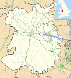
Nantmawr is located in Shropshire
Nantmawr

 Nantmawr shown within Shropshire
OS grid reference SJ248244
Unitary authority Shropshire
Ceremonial county Shropshire
Region West Midlands
Country England
Sovereign state United Kingdom
EU Parliament West Midlands
List of places: UK • England • Shropshire

Nantmawr is a village in Shropshire, England. It is located about 8 km south west of Oswestry and close to the Welsh border. The Offa's Dyke Path runs through the village.

Like many of the towns in the Welsh Marches, the area was formerly Welsh speaking, and its name means "big stream".

The village also forms the terminus of the surviving stub of the former Potteries, Shrewsbury & North Wales Railway, better known as the 'Potts Line', which is currently being re-opened as a heritage railway by the TVLR

Nantmawr has a nature reserve known as "Jones' Rough" managed by Shropshire Wildlife Trust. It is a breeding place for the pearl-bordered fritillary butterfly.

External links


Wikimedia Foundation. 2010.

Игры ⚽ Нужно решить контрольную?

Look at other dictionaries:

  • Potteries, Shrewsbury and North Wales Railway — Potteries, Shrewsbury North Wales Railway Legend …   Wikipedia

  • Trefonen — is a small village located approximately 3 miles southwest of Oswestry, and 3 miles east of the England Wales border, in Shropshire, England. It was founded by farmers who wanted to live near to each other. In 2001, the total population was 1,798 …   Wikipedia

  • Cambrian Railway Society — For recent progress as part of the heritage railways project, see Cambrian Railways Trust. Coordinates: 52°51′37″N 3°03′05″W / 52.8604°N 3.0515°W …   Wikipedia

  • Railways of Shropshire — The English county of Shropshire has a fairly large railway network, with 19 National Rail stations on various national lines, as well as a small number of heritage and freight lines, including the famous heritage Severn Valley Railway running… …   Wikipedia

  • Llanyblodwel and Pant — is an electoral ward in the borough of Oswestry in the county of Shropshire.The ward covers the villages of Pant, Llynclys, Porth y waen and Llanyblodwel, as well as half of Nantmawr and the English half of Llanymynech, and contains the two… …   Wikipedia

  • Four Crosses railway station — was a station on the former Cambrian Railway between Oswestry and Welshpool.It opened in 1860 as part of the Oswestry and Newtown Railway and served the village of Four Crosses in Powys, Wales until closure in 1965. The station was immortalised… …   Wikipedia

  • Treflach — is a small village near Oswestry in Shropshire. It is in the Oswestry rural parish and lies between two other villages Trefonen and Nantmawr. Together these three villages have a Village Design Statement …   Wikipedia

Share the article and excerpts

Direct link
Do a right-click on the link above
and select “Copy Link”