Victoria Viaduct

Victoria Viaduct

Infobox Bridge


bridge_name = Victoria Viaduct
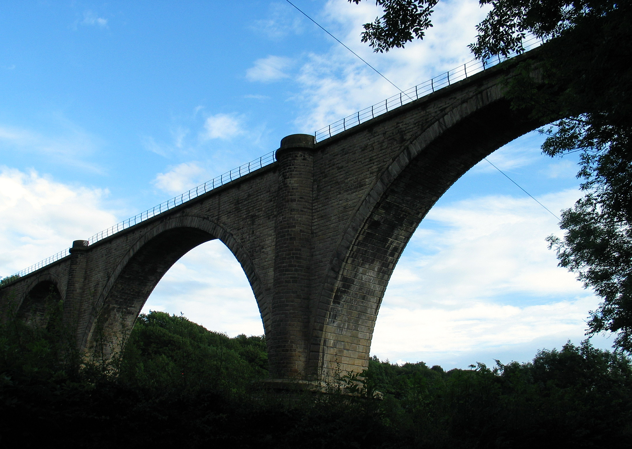
caption = Victoria Viaduct, 2007.
official_name =
locale = Washington, England
carries = Rail (mothballed)
crosses = River Wear
open = 28 June 1838

The Victoria Viaduct is a rail bridge spanning the River Wear in North East England, carrying the mothballed Leamside Line. The bridge was commissioned by the Durham Junction Railway and designed by Thomas Elliot Harrison. It was based upon the Roman bridge at Alcántara, Spain. Built from 1836-8, the viaduct was named after the-then new monarch, Queen Victoria and was officially opened on 28 June 1838 (the queen's coronation day), although it did not open to traffic until 1839.

The bridge formed part of the main line linking Newcastle upon Tyne and London until the line was routed through Durham in 1872. The line was closed to passenger trains following the Beeching Axe. The bridge continued to carry freight until the closure of the freight terminal at nearby Follingsby in 1991, following which the bridge was mothballed.

Crossings navbox
structure = Crossings
place = River Wear
bridge = Victoria Viaduct
upstream = Fatfield Bridge
downstream = Coxgreen Footbridge

Further reading

* [http://books.google.co.uk/books?id=lPkgAAAAMAAJ&pg=PA73&lpg=PA73&dq=%22victoria+viaduct%22&source=web&ots=WKoUKUxDc8&sig=v2-UR6of9wLNKcY_zvOd6cE_QI4&hl=en#PPP1,M1 Francis Whishaw, "The Railways of Great Britain and Ireland" (1842, page 73)]


Wikimedia Foundation. 2010.

Игры ⚽ Нужен реферат?

Look at other dictionaries:

  • Victoria Bridge — may be a reference to:* the Grosvenor Bridge, a rail bridge across the River Thames in London, England, that is sometimes called the Victoria Rail Bridge * the Victoria Bridge, Montreal, a road and rail bridge across the Saint Lawrence River at… …   Wikipedia

  • Victoria Park, Auckland — Victoria Park is a park and sports ground in Auckland City, New Zealand. It lies on reclaimed bay land in Freemans Bay, a suburb directly west of the Auckland CBD. This origin of the land makes it very flat and level. However, it does not have… …   Wikipedia

  • Victoria Park Viaduct — The Victoria Park Viaduct is a major motorway viaduct carrying the Auckland Northern Motorway (State Highway 1) over the Victoria Park area in Auckland City, New Zealand. Due to the high traffic volumes passing through on their way to and from… …   Wikipedia

  • Viaduct Basin — Infobox New Zealand suburbs name = Viaduct Basin caption1 = Lighter Basin area, at the western edge of the Viaduct Basin. city1 = Auckland City city2 = ward = established = 1990s (redeveloped as a residential / entertainment area) area =… …   Wikipedia

  • Victoria Park, Millbridge, Plymouth — Coordinates: 50°22′29.71″N 4°9′20.45″W / 50.3749194°N 4.1556806°W / 50.3749194; 4.1556806 …   Wikipedia

  • Flinders Street Viaduct — The Flinders Street Viaduct is a railway bridge in Melbourne, Australia. Made up of six tracks of varying ages, it links Flinders Street Station to Southern Cross Station and forms the main link between the eastern and western parts of the… …   Wikipedia

  • Barwon River (Victoria) — Infobox River river name = Barwon River caption = The Barwon River in 1907 mouth = coord|38.2821|S|144.4964|E|display=inline,title|region:AU VIC type:river basin countries = Victoria, Australia length km = 160 length = [… …   Wikipedia

  • Wharncliffe Viaduct — Infobox Bridge bridge name=Wharncliffe Viaduct caption=Looking north, July 2006 official name= carries=trains, telecommunications via cables crosses=River Brent and Brent Valley locale=London (Hanwell/Southall) maint= id= design=arch bridge,… …   Wikipedia

  • Stockport Viaduct — Infobox Historic building caption=Stockport Viaduct name=Stockport Viaduct location town=Stockport, Greater Manchester location country=England map type=Greater Manchester latitude=53.409186 longitude= 2.164215 architect= client= engineer=George… …   Wikipedia

  • Bendigo, Victoria — Infobox Australian Place | type = city name = Bendigo state = Victoria caption = Bendigo s talking tram in the main street pop = 81,939 (2006) [Census 2006 AUS|id=2030|name=Bendigo (VIC) (Statistical District)|accessdate=2007 09 27] poprank =… …   Wikipedia

Share the article and excerpts

Direct link
Do a right-click on the link above
and select “Copy Link”