Wearmouth Rail Bridge

Wearmouth Rail Bridge

Infobox Bridge


bridge_name = Wearmouth Rail Bridge
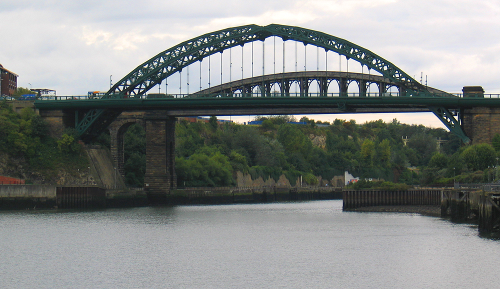
caption = Wearmouth Rail Bridge, behind Wearmouth Bridge, 2005.
official_name =
locale = Sunderland, England
carries = Rail
Tyne and Wear Metro
crosses = River Wear
open = 1879
below = 86ft
design = Box girder, tied arch bridge
mainspan = 300ft

The Wearmouth Rail Bridge is a rail bridge spanning the River Wear in North East England. The bridge links Sunderland station and St Peter's Metro station as part of the Tyne and Wear Metro and is part of the Durham Coast Line, linking Newcastle upon Tyne and Middlesbrough. The iron box girder, tied arch (bowstring) bridge (with two cross-braced ribs which, relieved by large oval stiffening webs) was opened in 1879. The bridge lies adjacent to Wearmouth Bridge.

Crossings navbox
structure = Crossings
place = River Wear
bridge = Wearmouth Rail Bridge
upstream = Queen Alexandra Bridge
downstream = Wearmouth Bridge


Wikimedia Foundation. 2010.

Игры ⚽ Поможем написать курсовую

Look at other dictionaries:

  • Wearmouth Bridge — Infobox Bridge bridge name = Wearmouth Bridge caption = The current Wearmouth Bridge constructed in 1929. The bridge in the background is a railway bridge and is still in use. official name = locale = Sunderland, England carries = Motor vehicles… …   Wikipedia

  • Queen Alexandra Bridge — This article is about the bridge crossing the River Wear; for the bridge crossing the Ottawa River, see Alexandra Bridge. Infobox Bridge bridge name = Queen Alexandra Bridge caption = The Queen Alexandra Bridge in October 2007. official name =… …   Wikipedia

  • List of crossings of the River Wear — This is a list of crossings of the River Wear, heading downstream, including road and rail bridges and fords.Wearhead to Stanhope* Wearhead Bridge (road) * West Blackdene Bridge (road, foot?) * Ireshopeburn Bridge (road?, foot?) * Coronation… …   Wikipedia

  • Durham Coast Line — Overview System National Rail Locale North East England Operation Owner National Rail …   Wikipedia

  • Monkwearmouth Station Museum — Coordinates: 54°54′47″N 1°23′06″W / 54.913°N 1.385°W / 54.913; 1.385 …   Wikipedia

  • Mowbray Park — The bandstand in Mowbray Park Type Municipal Location Sunderland, England …   Wikipedia

  • Sunderland Museum and Winter Gardens — from Mowbray Park Established 1846 Location Burdon Road, Sunderland, England …   Wikipedia

  • Holy Trinity Church, Sunderland — Western (front) elevation Holy Trinity is a former church in Sunderland. It was opened in 1719 as the church for the newly created Parish of Sunderland …   Wikipedia

  • Doxford House — Front of Doxford House, 2008 General information Town or city Sunderland Country Un …   Wikipedia

  • Corder House and Sydenham House — Corder House (left) and Sydenham House (right) …   Wikipedia

Share the article and excerpts

Direct link
Do a right-click on the link above
and select “Copy Link”