- Shire of Tullaroop
Infobox Australian Place | type = lga
name = Shire of Tullaroop
state = vic
region =
area = 637.63
est = 1861
seat = Maryborough
pop = 2780 (1992) [cite book|title=Victorian Year Book|author=Australian Bureau of Statistics, Victoria Office|year=1994|page=52|id=ISSN 0067-1223]
logosize =
caption = Location in Victoria
county = Talbot, Gladstone
near-nw = Bet Bet
near-n = Bet Bet
near-ne = Maldon
near-w = Avoca
near-e = Newstead
near-sw = Avoca
near-s = Talbot & Clunes
near-se = Newstead
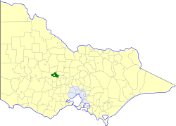
_noautocat = yesThe Shire of Tullaroop was a Local Government Area located about convert|170|km|mi|0 northwest of
Melbourne , the state capital of Victoria,Australia , surrounding the regional centre of Maryborough. The shire covered an area of convert|637.63|km2|sqmi|1, and existed from 1861 until 1995. Maryborough itself was managed by a separate entity, ultimately known as the City of Maryborough. After a large-scale statewide amalgamation program by the Victorian Government in 1994, they were united under theShire of Central Goldfields .History
Tullaroop was first incorporated as a district on 18 January 1861, and became a shire on 24 January 1865.
On 1 October 1915, two boroughs were united with Tullaroop—Carisbrook Borough, established on 7 August 1857 with an area of convert|21.83|km2|sqmi|2, and Majorca Borough, established on 28 December 1864 with an area of convert|20.25|km2|sqmi|2, which had been known as Craigie Borough until 1876.cite book|title=Victorian Municipal Directory|year=1992|publisher=Arnall & Jackson|location=Brunswick|pages=861-862 Accessed at
State Library of Victoria , La Trobe Reading Room.] [Victorian Municipal Directory (1915), pp.298, 316.]On 20 January 1995, the Shire was abolished, and merged with the City of Maryborough, most of the
Shire of Bet Bet and surrounding districts into theShire of Central Goldfields . TheLaanecoorie Reservoir was transferred to theShire of Loddon . [cite book|url=http://www.ausstats.abs.gov.au/ausstats/free.nsf/0/76E601D6DB55E88ACA25722500049195/$File/12570_1994-95.pdf|title=Victorian local government amalgamations 1994-1995: Changes to the Australian Standard Geographical Classification|author=Australian Bureau of Statistics |date=1 August 1995|publisher=Commonwealth of Australia|page=5,8|isbn=0-642-23117-6|accessdate=2008-01-05]Wards
Tullaroop was divided into four ridings , each of which elected three councillors:
* Carisbrook Riding
* Charlotte Plains Riding
* Norwood Riding
* Rodborough RidingTowns and Localities
* Adelaide Lead
* Alma
* Bowenvale
* Carisbrook
* Craigie
* Eddington
* Havelock
* Majorca
* Moores Flat
* Moolort
* Moonlight Flat
* Rodborough
* Simson
* WareekPopulation
* Estimate in the 1958 Victorian Year Book.
References
Wikimedia Foundation. 2010.