Shire of Avoca

Shire of Avoca

Infobox Australian Place | type = lga
name = Shire of Avoca
state = vic
region =
area = 1124
est = 1861
seat = Avoca
pop = 2320 (1992) [cite book|title=Victorian Year Book|author=Australian Bureau of Statistics, Victoria Office|year=1994|page=49-52|id=ISSN 0067-1223]

logosize =


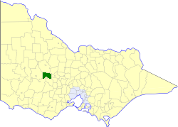
caption = Location in Victoria
county = Gladstone, Kara Kara
near-nw = Kara Kara
near-n = Kara Kara
near-ne = Bet Bet
near-w = Stawell
near-e = Tullaroop
near-sw = Ararat
near-s = Lexton
near-se = Talbot & Clunes
_noautocat = yes

The Shire of Avoca was a Local Government Area located about convert|180|km|mi|0 northwest of Melbourne, the state capital of Victoria, Australia. The shire covered an area of convert|1124|km2|sqmi|1, and existed from 1861 until 1994.

History

Avoca was first incorporated as a district on 6 December 1861, and became a shire on 28 December 1864. In January 1941, it lost part of its area to the Shire of Lexton.cite book|title=Victorian Municipal Directory|year=1992|publisher=Arnall & Jackson|location=Brunswick|pages=571-572 Accessed at State Library of Victoria, La Trobe Reading Room.]

On 23 September 1994, the Shire was abolished, and merged with Shire of Lexton and Shire of Ripon into the Shire of Pyrenees, with the district around Navarre transferring to the Shire of Northern Grampians. [cite book|url=http://www.ausstats.abs.gov.au/ausstats/free.nsf/0/76E601D6DB55E88ACA25722500049195/$File/12570_1994-95.pdf|title=Victorian local government amalgamations 1994-1995: Changes to the Australian Standard Geographical Classification|author=Australian Bureau of Statistics|date=1 August 1995|publisher=Commonwealth of Australia|page=10,11|isbn=0-642-23117-6|accessdate=2008-01-05]

Wards

Avoca was divided into three ridings, each of which elected three councillors:
* Avoca Township Riding
* East Riding
* West Riding

Towns and Localities

* Avoca
* Barkly
* Crowlands
* Frenchmans
* Glenlofty
* Homebush
* Lamplough
* Landsborough
* Moonambel
* Natte Yallock
* Navarre
* Percydale
* Rathscar
* Rathscar West
* Redbank
* Tanwood
* Warrenmang
* Wattle Creek

Population

* Estimate in the 1958 Victorian Year Book.

References


Wikimedia Foundation. 2010.

Игры ⚽ Поможем написать реферат

Look at other dictionaries:

  • Shire of Lexton — Infobox Australian Place | type = lga name = Shire of Lexton state = vic region = area = 821.03 est = 1860 seat = Lexton pop = 1380 (1992) [cite book|title=Victorian Year Book|author=Australian Bureau of Statistics, Victoria Office|year=1994|page …   Wikipedia

  • Shire of Ripon — Infobox Australian Place | type = lga name = Shire of Ripon state = vic region = area = 1533 est = 1861 seat = Beaufort pop = 3530 (1992) [cite book|title=Victorian Year Book|author=Australian Bureau of Statistics, Victoria… …   Wikipedia

  • Avoca, New South Wales — Avoca is a small town in the Southern Highlands of New South Wales, Australia, in Wingecarribee Shire.The population is about 500 including the villages of Fitzroy Falls and Myra Vale …   Wikipedia

  • Avoca, Victoria — Infobox Australian Place | type = town name = Avoca state = vic caption = Location of Avoca in Victoria (red) lga = Pyrenees Shire postcode = 3467 pop = 956 (2001 census) est = elevation= 242 maxtemp = 20.3 mintemp = 7.4 rainfall = 525.8 stategov …   Wikipedia

  • Shire of Pyrenees — Pyrenees Shire Lage des Pyrenees Shire in Victoria Basisdaten Bundesstaat: Victoria Hauptort: Beaufort Fläche …   Deutsch Wikipedia

  • Shire of Talbot and Clunes — Infobox Australian Place | type = lga name = Shire of Talbot and Clunes state = vic region = area = 541.31 est = 1860 seat = Talbot pop = 2,580 (1992) [cite book|title=Victorian Year Book|author=Australian Bureau of Statistics, Victoria… …   Wikipedia

  • Shire of Tullaroop — Infobox Australian Place | type = lga name = Shire of Tullaroop state = vic region = area = 637.63 est = 1861 seat = Maryborough pop = 2780 (1992) [cite book|title=Victorian Year Book|author=Australian Bureau of Statistics, Victoria… …   Wikipedia

  • Shire of Stawell — Infobox Australian Place | type = lga name = Shire of Stawell state = vic region = area = 2606 est = 1861 seat = Stawell pop = 2620 (1992) [cite book|title=Victorian Year Book|author=Australian Bureau of Statistics, Victoria Office|year=1994|page …   Wikipedia

  • Shire of Kara Kara — Infobox Australian Place | type = lga name = Shire of Kara Kara state = vic region = area = 2292.79 est = 1861 seat = St Arnaud pop = 1160 (1992) [cite book|title=Victorian Year Book|author=Australian Bureau of Statistics, Victoria… …   Wikipedia

  • Shire of Buloke — Buloke Shire Lage des Buloke Shire in Victoria Basisdaten Bundesstaat: Victoria Hauptort: Wycheproof Fläche: 8.020 …   Deutsch Wikipedia

Share the article and excerpts

Direct link
Do a right-click on the link above
and select “Copy Link”