- Cottonwood Falls, Kansas
-
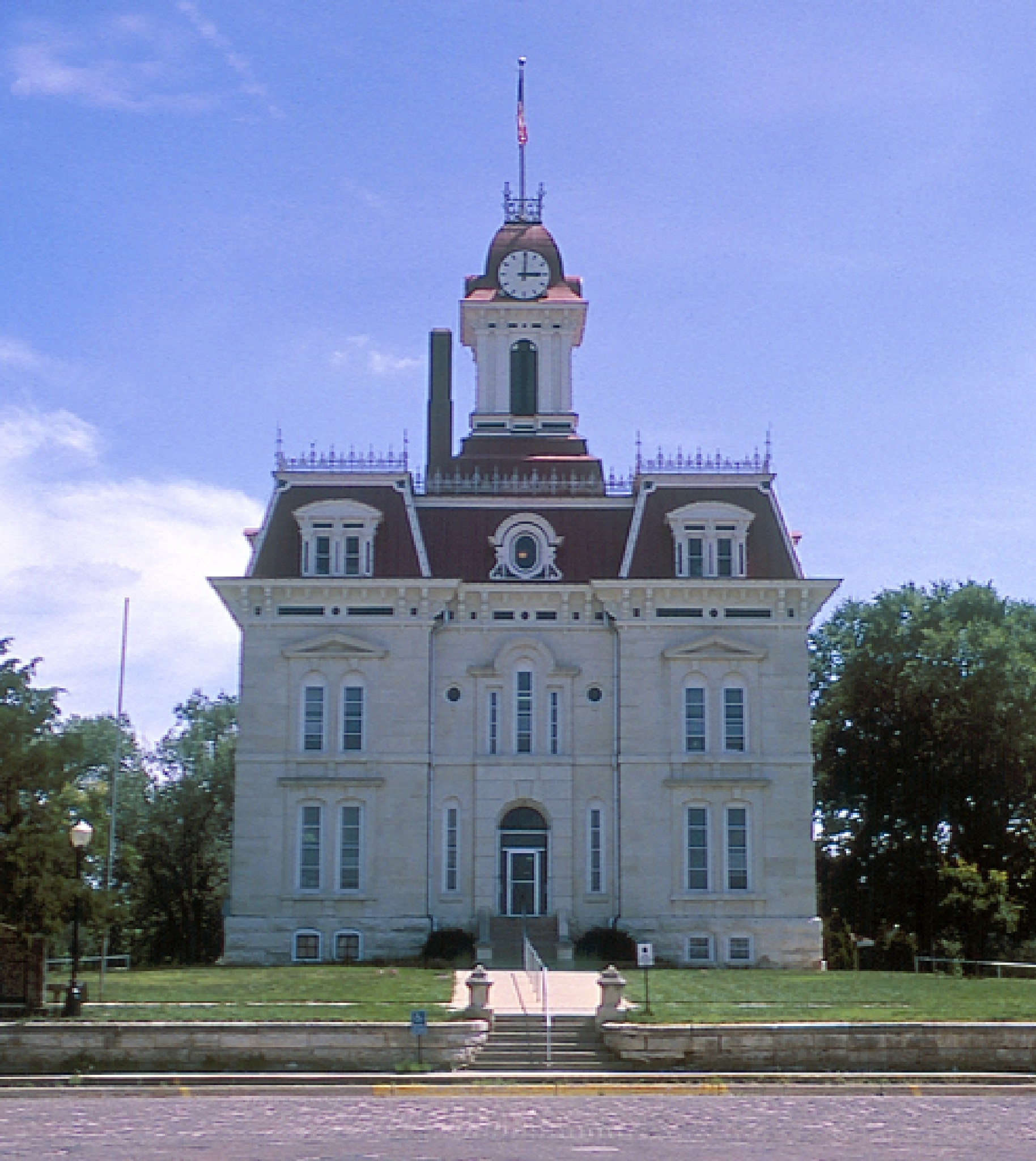
Cottonwood Falls, Kansas — City — Chase County Courthouse designed by Kansas State Capitol architect John G. Haskell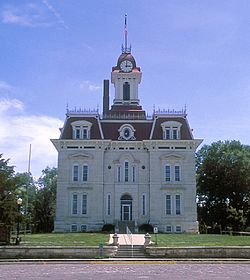 Location of Cottonwood Falls, Kansas
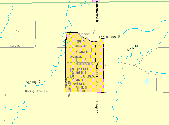
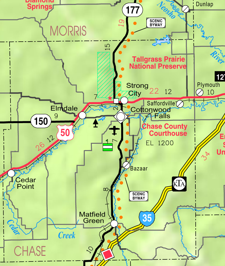
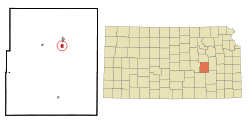 Detailed map of Cottonwood Falls, Kansas
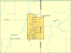
Coordinates: 38°22′5″N 96°32′35″W / 38.36806°N 96.54306°WCoordinates: 38°22′5″N 96°32′35″W / 38.36806°N 96.54306°W Country  United States
State  Kansas
County Chase Platted Incorporated Government - Type Mayor–Council Area - Total 0.6 sq mi (1.5 km2) - Land 0.6 sq mi (1.5 km2) - Water 0.0 sq mi (0.0 km2) Elevation 1,204 ft (367 m) Population (2010)[1] - Total 903 - Density 1,505/sq mi (581.1/km2) Time zone Central (CST) (UTC-6) - Summer (DST) CDT (UTC-5) ZIP code 66845 Area code(s) 620 FIPS code 20-15900[2] GNIS feature ID 0477262[3] Website City website Cottonwood Falls is the largest city and county seat of Chase County, Kansas. As of the 2010 census, the city population was 903.[1]
Contents
History
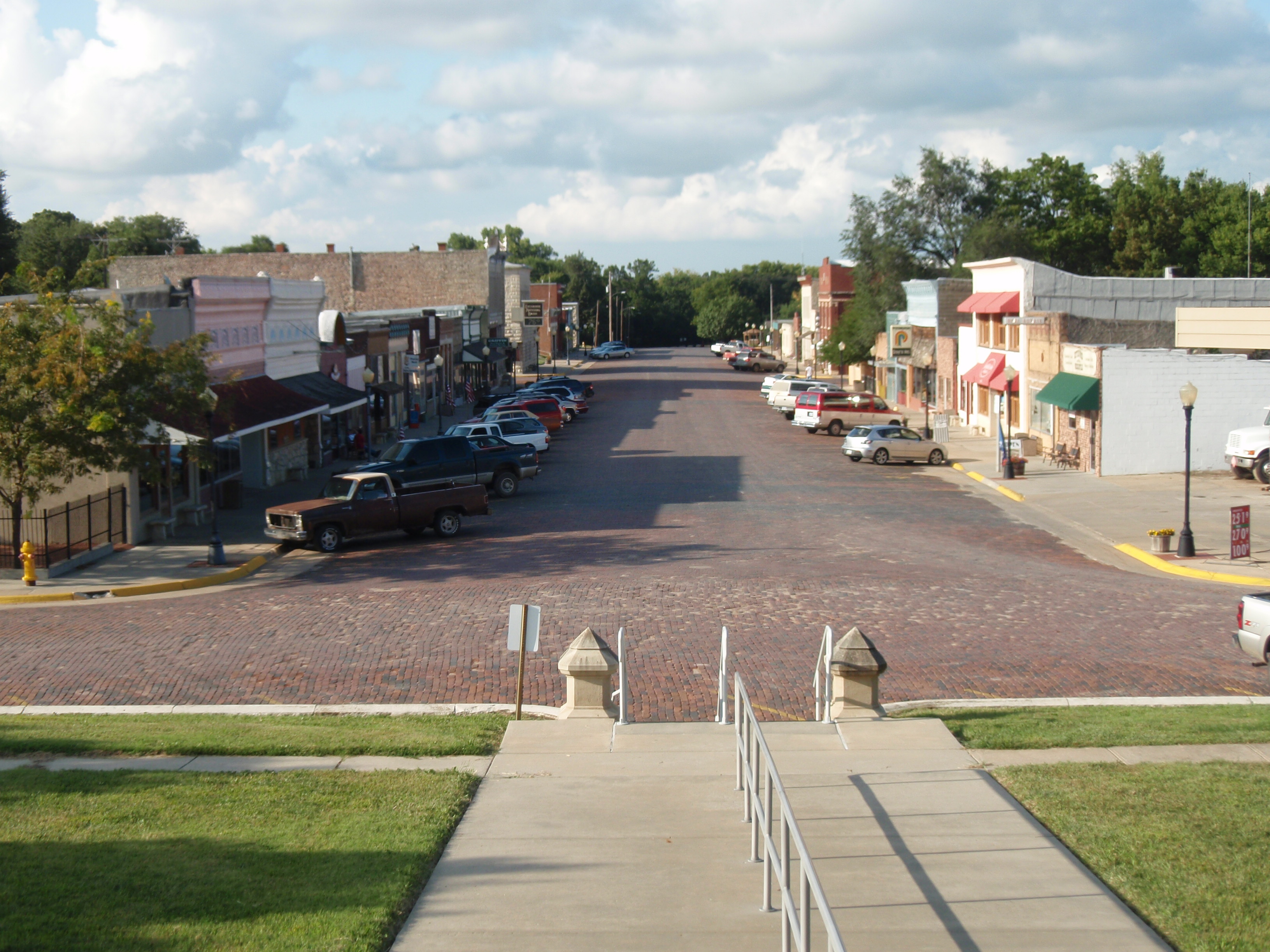
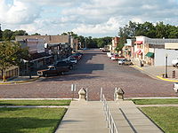 Cottonwood Falls business district, as seen from steps of Courthouse
19th century
The first settlement in the area of Cottonwood Falls was in 1854, when an Indian trader named Seth Hayes founded a cattle ranch on the Cottonwood River close to the mouth of Diamond Spring Creek. The area around the town was organized as Chase County in 1859. In 1873 the city's French Renaissance style Chase County courthouse was built; at roughly the same time, the Atchison, Topeka and Santa Fe Railway reached Cottonwood Falls. Through the late 19th and early 20th centuries the area around the city was mainly divided into farms and cattle ranches.
20th century
In 1931, Transcontinental & Western Air Flight 599 crashed ten miles south of Cottonwood Falls near the community of Bazaar, killing all eight on board, including Notre Dame University football coach Knute Rockne. A monument to the crash is located on private property.
There has been numerous floods during the history of Cottonwood Falls. In June and July 1951, due to heavy rains, rivers and streams flooded numerous cities in Kansas, including Cottonwood Falls. Many reservoirs and levees were built in Kansas as part of a response to the Great Flood of 1951.
Geography
Cottonwood Falls is located at 38°22′5″N 96°32′35″W / 38.36806°N 96.54306°W (38.368159, -96.542918)[4]. According to the United States Census Bureau, the city has a total area of 0.6 square miles (1.6 km2), all of it land, except Spring Creek and Cottonwood River.
Area events
Area attractions
Cottonwood Falls has five listings on the National Register of Historic Places (NRHP).
- Cartter Building[6] (NRHP).
- Chase County Courthouse[7] (NRHP). It is the oldest courthouse in continual use in the state of Kansas and one of the oldest in continual use West of the Mississippi.
- Chase County National Bank[8] (NRHP).
- Cottonwood River Bridge[9] (NRHP).[10]
- Samuel N Wood House[11] (NRHP).
- Kansas Historical Marker - A Landmark Of Distinction, located in courthouse square.[12]
- Chase Lake Falls[13]
Demographics
 U.S. Post Office in Cottonwood Falls
Historical populations Census Pop. %± 1960 971 — 1970 987 1.6% 1980 954 −3.3% 1990 889 −6.8% 2000 966 8.7% 2010 903 −6.5% U.S. Decennial Census Cottonwood Falls's population was estimated to be 955 in the year 2006, a decrease of 11, or -1.1%, over the previous six years.[14]
As of the census[2] of 2000, there were 966 people, 375 households, and 227 families residing in the city. The population density was 1,674.9 people per square mile (643.1/km²). There were 427 housing units at an average density of 740.3 per square mile (284.3/km²). The racial makeup of the city was 94.93% White, 2.38% African American, 1.14% Native American, 0.21% Asian, 0.83% from other races, and 0.52% from two or more races. Hispanic or Latino of any race were 2.38% of the population.
There were 375 households out of which 28.3% had children under the age of 18 living with them, 47.2% were married couples living together, 11.7% had a female householder with no husband present, and 39.2% were non-families. 34.4% of all households were made up of individuals and 20.5% had someone living alone who was 65 years of age or older. The average household size was 2.27 and the average family size was 2.93.
In the city the population was spread out with 23.2% under the age of 18, 6.1% from 18 to 24, 29.6% from 25 to 44, 18.1% from 45 to 64, and 23.0% who were 65 years of age or older. The median age was 39 years. For every 100 females there were 91.7 males. For every 100 females age 18 and over, there were 90.7 males.
The median income for a household in the city was $28,947, and the median income for a family was $37,986. Males had a median income of $27,639 versus $19,167 for females. The per capita income for the city was $15,166. About 8.8% of families and 11.6% of the population were below the poverty line, including 15.0% of those under age 18 and 8.6% of those age 65 or over.
Cottonwood Falls is part of the Emporia Micropolitan Statistical Area.
Government
City
The Cottonwood Falls government consists of a mayor and five council members. The council meets the 1st and 3rd Monday of each month at 7PM. City Council Members are elected in odd-numbered years and serve a four-year term.[15][16]
- City Hall, 220 Broadway St.
County
- Chase County Courthouse, Broadway St.
- Chase County Sheriff Department, 201 Walnut St.
- Chase County Fire Department, 201 Walnut.
U.S.
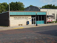
- U.S. Post Office, 206 Broadway St.
- U.S. Consolidated Farm Service Agency, 219 Broadway St.
- National Park Service (U.S. Dept of Interior), 226 Broadway St.
Education
Primary and secondary education
Cottonwood Falls is part of Unified School District 284.[17][18]
- Chase County Junior/Senior High School, 600 Main St.
- Chase County Elementary School, 401 Maple St.
Sports
The Chase County High School mascot is a Bulldog. All high school athletic and non-athletic competition is overseen by the Kansas State High School Activities Association. For 2010/2011 seasons, the football team competes as Class 2A.[19]
Library
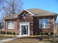
- Burnley Memorial Library, 401 Oak St.
Infrastructure
Transportation
K-177 highway passes north-south through the city. Chase County Airport, FAA:9K0,[20] located south-east of 8th St and Airport Rd.[21]
Utilities
- Internet
- TV
- Satellite TV is provided by DirecTV, Dish Network.
- Free over-the-air ATSC digital TV.
Gallery
-
Burnley Memorial Library, 2006
-
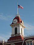
Courhouse Clock Tower, 2009
-
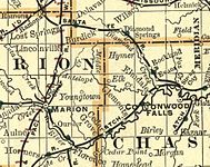
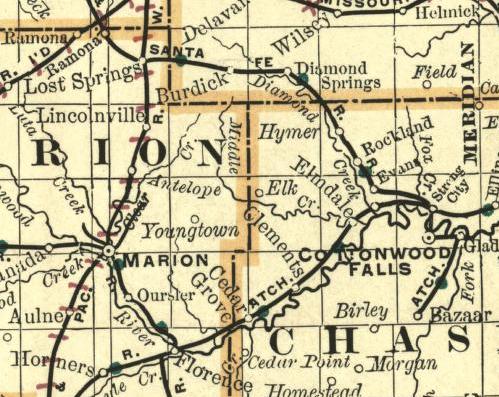
1893 Railroad Map
See also
- National Register of Historic Places listings in Chase County, Kansas
- Chase County Junior/Senior High School
- Cottonwood River
- Great Flood of 1951
References

- ^ a b "2010 City Population and Housing Occupancy Status". U.S. Census Bureau. http://factfinder2.census.gov/faces/tableservices/jsf/pages/productview.xhtml?pid=DEC_10_PL_GCTPL2.ST13&prodType=table. Retrieved March 6, 2011.
- ^ a b "American FactFinder". United States Census Bureau. http://factfinder.census.gov. Retrieved 2008-01-31.
- ^ "US Board on Geographic Names". United States Geological Survey. 2007-10-25. http://geonames.usgs.gov. Retrieved 2008-01-31.
- ^ "US Gazetteer files: 2010, 2000, and 1990". United States Census Bureau. 2011-02-12. http://www.census.gov/geo/www/gazetteer/gazette.html. Retrieved 2011-04-23.
- ^ Prairie Fire Festival - Kansas Travel
- ^ National Register of Historic Places - Cartter Building
- ^ National Register of Historic Places - Chase County Courthouse
- ^ National Register of Historic Places - Chase County National Bank
- ^ National Register of Historic Places - Cottonwood River Bridge
- ^ Cottonwood Falls Dam & Bridge - Kansas Travel
- ^ National Register of Historic Places - Samuel N Wood House
- ^ Kansas Historical Marker - A Landmark Of Distinction
- ^ Chase Lake Falls - Kansas Travel
- ^ "Population Estimates". U.S. Census Bureau, Population Division. http://www.census.gov/popest/estimates.php. Annual estimates of the population to 2006-07-01. Released 2007-06-28. Population change is from 2000-07-01 to 2006-07-01.
- ^ Cottonwood Falls - Directory of Public Officials
- ^ Cottonwood Falls - Government
- ^ USD 284
- ^ Kansas School District Boundary Map
- ^ KSHSAA Football Class Size Assignments
- ^ Chase County Airport map
- ^ Chase County Airport information
Further reading
- History of the State of Kansas; William G. Cutler; A.T. Andreas Publisher; 1883. (Online HTML eBook)
- Kansas : A Cyclopedia of State History, Embracing Events, Institutions, Industries, Counties, Cities, Towns, Prominent Persons, Etc; 3 Volumes; Frank W. Blackmar; Standard Publishing Co; 944 / 955 / 824 pages; 1912. (Volume1 - Download 54MB PDF eBook),(Volume2 - Download 53MB PDF eBook), (Volume3 - Download 33MB PDF eBook)
External links
- City
- City of Cottonwood Falls
- Cottonwood Falls - Directory of Public Officials
- Cottonwood Falls - Information, Skyways
- Schools
- USD 284, school district for all of Chase County.
- Historical
- 1912 Encyclopedia of Kansas article on Chase County
- TWA Flight 599 Memorial, Knute Rockne crash site.
- Historic Images of Cottonwood Falls, Special Photo Collections at Wichita State University Library.
- Lodging
- Maps
- Cottonwood Falls City Map, KDOT
- Chase County Map, KDOT
- Topo Map of Cottonwood Falls / Bazaar area, USGS
Municipalities and communities of Chase County, Kansas County seat: Cottonwood FallsCities Cedar Point | Cottonwood Falls | Elmdale | Matfield Green | Strong City

Townships Bazaar | Cedar | Cottonwood | Diamond Creek | Falls | Homestead | Matfield | Strong | Toledo
Unincorporated
communitiesGhost towns Elk | Ellinor | Neva | Thurman
Categories:- Cities in Kansas
- County seats in Kansas
- Populated places in Chase County, Kansas
- Emporia micropolitan area


Wikimedia Foundation. 2010.