- Rice County, Kansas
Infobox U.S. County
county=Rice County
state=Kansas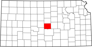
founded=February 26 ,1867
seat=Lyons
area_total_km2=1886|area_total_sq_mi=728
area_land_km2=1882|area_land_sq_mi=727
area_water_km2=4|area_water_sq_mi=2
area percentage=0.24%
census estimate yr=2005
pop=10452
density_km2=5.6|density_sq_mi=14.4
time zone=Central
UTC offset=-6
DST offset=-5|Rice County (standard abbreviation: RC) is a county located in the
U.S. state ofKansas ; it was named in memory ofSamuel Allen Rice , Brigadier-General, United States volunteers, killedApril 30 ,1864 at Jenkins Ferry, Arkansas. [cite web| title =Rice County| publisher =Kansas State Library| url =http://skyways.lib.ks.us/counties/RC/| accessdate = 2007-08-13] As of the 2000 census, the population was 10,761. The largest city andcounty seat is Lyons.History
The
Santa Fe Trail followed the route of present dayU.S. Route 56 . Ruts in the earth from the trail are still visible in several locations. (Ralph's Ruts are visible in aerial photos at coord|38.35959264|-98.42225502|type:landmark_region:US|display=inline.)cite web |url=http://www.santafetrailresearch.com/spacepix/0ur-space-link-page.html |title=Aerial Photos Topo Maps of Santa Fe Trail Ruts and Sites |accessdate=2007-12-28 |format= |work=]Law and government
Although the
Kansas Constitution was amended in 1986 to allow the sale of alcoholic liquor by the individual drink with the approval of voters, Rice County has remained a prohibition, or "dry", county. [Cite web| url=http://www.ksrevenue.org/abcwetdrymap.htm| title=Map of Wet and Dry Counties| publisher=Alcoholic Beverage Control, Kansas Department of Revenue| month=November | year=2004| accessdate=2007-01-21]Geography
According to the
U.S. Census Bureau , the county has a total area of 728square mile s (1,886km² ), of which, 727 square miles (1,882 km²) of it is land and 2 square miles (4 km²) of it (0.24%) is water.Adjacent counties
*Ellsworth County (north)
*McPherson County (east)
*Reno County (south)
*Stafford County (southwest)
*Barton County (northwest)National
protected area *
Quivira National Wildlife Refuge (part)Demographics
As of the
census GR|2 of 2000, there were 10,761 people, 4,050 households, and 2,830 families residing in the county. Thepopulation density was 15 people per square mile (6/km²). There were 4,609 housing units at an average density of 6 per square mile (2/km²). The racial makeup of the county was 94.68% White, 1.15% Black or African American, 0.57% Native American, 0.33% Asian, 0.04% Pacific Islander, 1.84% from other races, and 1.39% from two or more races. 5.61% of the population were Hispanic or Latino of any race.There were 4,050 households out of which 31.20% had children under the age of 18 living with them, 59.10% were married couples living together, 7.20% had a female householder with no husband present, and 30.10% were non-families. 27.80% of all households were made up of individuals and 15.30% had someone living alone who was 65 years of age or older. The average household size was 2.44 and the average family size was 2.97.
In the county the population was spread out with 24.70% under the age of 18, 13.30% from 18 to 24, 22.80% from 25 to 44, 21.30% from 45 to 64, and 18.00% who were 65 years of age or older. The median age was 38 years. For every 100 females there were 92.20 males. For every 100 females age 18 and over, there were 88.20 males.
The median income for a household in the county was $35,671, and the median income for a family was $40,960. Males had a median income of $31,175 versus $18,968 for females. The
per capita income for the county was $16,064. About 8.50% of families and 10.70% of the population were below thepoverty line , including 14.60% of those under age 18 and 8.20% of those age 65 or over.Cities and towns
Incorporated cities
Name and population (2004 estimate):
*Lyons, 3,576 (county seat)
*Sterling, 2,587
*Little River, 530
*Chase, 471
*Bushton, 300
*Geneseo, 271
*Alden, 161
*Raymond, 95
*Frederick, 11Townships
Rice County is divided into twenty townships. The cities of Lyons and Sterling are considered "governmentally independent" and are excluded from the census figures for the townships. In the following table, the population center is the largest city (or cities) included in that township's population total, if it is of a significant size.
Education
Unified school districts
* Lorraine USD 328 (serves Bushton and northwestern areas of the county)
* Sterling USD 376
* Chase USD 401
* Lyons USD 405
* Little River USD 444References
ee also
*
Dry counties External links
;Local History and Genealogy:* [http://www.kancoll.org/books/cutler/rice/rice-co-p1.html Cutler's History of Rice County, Kansas] :* [http://skyways.lib.ks.us/genweb/rice/index.html Rice County GenWeb] ;Official websites:* [http://ricecounty.org/index.htm Rice County Government] ;General county information:* [http://skyways.lib.ks.us/counties/RC/ Blue Skyways] ;County Level Data:* [http://www.ku.edu/pri/ksdata/county.shtml Kansas Statistical Abstract]

Wikimedia Foundation. 2010.