- Stafford County, Kansas
Infobox U.S. County
county=Stafford County
state=Kansas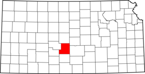
founded=1879
seat=St. John
area_total_km2=2058|area_total_sq_mi=795
area_land_km2=2051|area_land_sq_mi=792
area_water_km2=7|area_water_sq_mi=3
area percentage=0.34%
census estimate yr=2005
pop=4488
density_km2=2.2|density_sq_mi=5.7
time zone=Central
UTC offset=-6
DST offset=-5|Stafford County (standard abbreviation: SF) is a
county located in theU.S. state ofKansas . As of 2000, the population is 4,789. Itscounty seat is St. John.GR|6 The county is named in memory ofLewis Stafford .Law and government
Although the
Kansas Constitution was amended in 1986 to allow the sale of alcoholic liquor by the individual drink with the approval of voters, Stafford County has remained a prohibition, or "dry", county. [Cite web| url=http://www.ksrevenue.org/abcwetdrymap.htm| title=Map of Wet and Dry Counties| publisher=Alcoholic Beverage Control, Kansas Department of Revenue| month=November | year=2004| accessdate=2007-01-21]Geography
According to the
U.S. Census Bureau , the county has a total area of 795square mile s (2,058km² ), of which, 792 square miles (2,051 km²) of it is land and 3 square miles (7 km²) of it (0.34%) is water.Adjacent counties
*Barton County (north)
*Rice County (northeast)
*Reno County (east)
*Pratt County (south)
*Edwards County (west)
*Pawnee County (west)National
protected area *
Quivira National Wildlife Refuge (part)Demographics
As of the
census GR|2 of 2000, there were 4,789 people, 2,010 households, and 1,294 families residing in the county. Thepopulation density was 6 people per square mile (2/km²). There were 2,458 housing units at an average density of 3 per square mile (1/km²). The racial makeup of the county was 94.97% White, 0.15% Black or African American, 0.38% Native American, 0.13% Asian, 2.97% from other races, and 1.42% from two or more races. 5.41% of the population were Hispanic or Latino of any race.There were 2,010 households out of which 29.90% had children under the age of 18 living with them, 55.90% were married couples living together, 5.90% had a female householder with no husband present, and 35.60% were non-families. 33.00% of all households were made up of individuals and 17.20% had someone living alone who was 65 years of age or older. The average household size was 2.34 and the average family size was 2.99.
In the county the population was spread out with 26.30% under the age of 18, 5.40% from 18 to 24, 24.60% from 25 to 44, 22.50% from 45 to 64, and 21.20% who were 65 years of age or older. The median age was 41 years. For every 100 females there were 95.20 males. For every 100 females age 18 and over, there were 91.40 males.
The median income for a household in the county was $31,107, and the median income for a family was $38,235. Males had a median income of $27,328 versus $21,063 for females. The
per capita income for the county was $16,409. About 8.70% of families and 11.80% of the population were below thepoverty line , including 15.20% of those under age 18 and 8.90% of those age 65 or over.Cities and towns
Incorporated cities
Name and population (2004 estimate):
*St. John, 1,224 (county seat)
*Stafford, 1,077
*Macksville, 495
*Hudson, 128
*Seward, 61
*Radium, 38Townships
Stafford County is divided into twenty-one townships. None of the cities within the county are considered "governmentally independent", and all figures for the townships include those of the cities. In the following table, the population center is the largest city (or cities) included in that township's population total, if it is of a significant size.
Education
Unified school districts
* Stafford USD 349
* St. John-Hudson USD 350
* Macksville USD 351References
External links
;General information on Stafford County:* [http://skyways.lib.ks.us/counties/SF/ Blue Skyways]
;Kansas County Data:* [http://www.ku.edu/pri/ksdata/county.shtml Kansas Statistical Abstract]
;Stafford County local history and genealogy:* [http://www.kshs.org/genealogists/places/counties.php?county=SF Kansas State Historical Society] :* [http://www.kancoll.org/books/cutler/stafford/ William G. Cutler's History of the State of Kansas] :* [http://home.earthlink.net/~mjhathaway61 Stafford County Historical & Genealogical Society]

Wikimedia Foundation. 2010.