- Dinuba, California
-
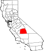
City of Dinuba — City — Motto: Together, A Better Community Location in Tulare County and the state of California
Coordinates: 36°32′42″N 119°23′21″W / 36.545°N 119.38917°WCoordinates: 36°32′42″N 119°23′21″W / 36.545°N 119.38917°W Country  United States
State  California
County Tulare Government – Mayor Mark Wallace – Vice Mayor Area[1] – Total 6.470 sq mi (16.758 km2) – Land 6.470 sq mi (16.758 km2) – Water 0 sq mi (0 km2) 0% Elevation 345 ft (102 m) Population (2010) – Total 21,453 – Density 3,315.8/sq mi (1,280.2/km2) Time zone Pacific (PST) (UTC-8) – Summer (DST) Pacific (PDT) (UTC-7) ZIP code 93618 Area code(s) 559 FIPS code 06-19318 GNIS feature ID 1658422 Website http://www.dinuba.org/ Dinuba is a city in Tulare County, California, United States. The population was 21,453 at the 2010 census. It is part of the Visalia Metropolitan Statistical Area according to the United States Census Bureau. The Alta District Museum is located in Dinuba in a restored railroad station; the museum has a collection of materials to illustrate local history.[2]
Contents
Geography
Dinuba is located at 36°32′42″N 119°23′21″W / 36.545°N 119.38917°W (36.544898, -119.389260).[3]
According to the United States Census Bureau, the city has a total area of 6.5 square miles (17 km2), all of it land. The general topography is quite level ground, at an elevation of approximately 345 feet (105 m) above mean sea datum.[4] The gradient is approximately ten feet per mile, from east-northeast to west-southwest. Groundwater generally also flows with the surface of the terrain, that is, from the northeast to the southwest.[5] There are small hills to the northeast side of Dinuba with some elevations achieving heights of 526 feet (160 m).
Government and infrastructure
In 1997 the police in Dinuba accepted gifts of paramilitary equipment from the U.S. military. The police raided the residence of a 67-year old man and his wife while using the equipment. When the man tried to defend himself, the police killed him. The family filed a federal lawsuit against the City of Dinuba. At the trial, held in Fresno, California, a jury awarded the plaintiffs $12.5 million, exceeding two times the City of Dinuba's budget. The city's insurance policy covered up to $9.5 million.[6]
Demographics
2010
The 2010 United States Census[7] reported that Dinuba had a population of 21,453. The population density was 3,315.7 people per square mile (1,280.2/km²). The racial makeup of Dinuba was 11,166 (52.0%) White, 141 (0.7%) African American, 193 (0.9%) Native American, 454 (2.1%) Asian, 17 (0.1%) Pacific Islander, 8,630 (40.2%) from other races, and 852 (4.0%) from two or more races. Hispanic or Latino of any race were 18,114 persons (84.4%).
The Census reported that 21,291 people (99.2% of the population) lived in households, 77 (0.4%) lived in non-institutionalized group quarters, and 85 (0.4%) were institutionalized.
There were 5,593 households, out of which 3,275 (58.6%) had children under the age of 18 living in them, 3,162 (56.5%) were opposite-sex married couples living together, 1,077 (19.3%) had a female householder with no husband present, 481 (8.6%) had a male householder with no wife present. There were 544 (9.7%) unmarried opposite-sex partnerships, and 37 (0.7%) same-sex married couples or partnerships. 672 households (12.0%) were made up of individuals and 324 (5.8%) had someone living alone who was 65 years of age or older. The average household size was 3.81. There were 4,720 families (84.4% of all households); the average family size was 4.04.
The population was spread out with 7,495 people (34.9%) under the age of 18, 2,476 people (11.5%) aged 18 to 24, 5,881 people (27.4%) aged 25 to 44, 3,920 people (18.3%) aged 45 to 64, and 1,681 people (7.8%) who were 65 years of age or older. The median age was 27.2 years. For every 100 females there were 103.3 males. For every 100 females age 18 and over, there were 101.4 males.
There were 5,868 housing units at an average density of 906.9 per square mile (350.2/km²), of which 3,176 (56.8%) were owner-occupied, and 2,417 (43.2%) were occupied by renters. The homeowner vacancy rate was 2.3%; the rental vacancy rate was 4.2%. 11,975 people (55.8% of the population) lived in owner-occupied housing units and 9,316 people (43.4%) lived in rental housing units.
2000
As of the census[8] of 2000, there were 16,504 people, 4,493 households, and 3,724 families residing in the city. The population density was 4,923.8 people per square mile (1,901.6/km²). There were 4,670 housing units at an average density of 1,365.1 per square mile (527.2/km²). The racial makeup of the city was 49.34% White, 0.34% African American, 1.28% Native American, 2.42% Asian, 0.14% Pacific Islander, 37.98% from other races, and 5.28% from two or more races. Hispanic or Latino of any race were 79.08% of the population.
There were 4,493 households out of which 52.3% had children under the age of 18 living with them, 59.8% were married couples living together, 16.6% had a female householder with no husband present, and 17.1% were non-families. 14.4% of all households were made up of individuals and 8.4% had someone living alone who was 65 years of age or older. The average household size was 3.72 and the average family size was 4.02.
In the city the population was spread out with 35.8% under the age of 18, 12.7% from 18 to 24, 27.5% from 25 to 44, 15.0% from 45 to 64, and 9.1% who were 65 years of age or older. The median age was 26 years. For every 100 females there were 103.2 males. For every 100 females age 18 and over, there were 101.1 males.
The median income for a household in the city was $33,345, and the median income for a family was $33,769. Males had a median income of $23,663 versus $25,364 for females. The per capita income for the city was $11,566. About 31.1% of families and 26.2% of the population were below the poverty line, including 37.1% of those under age 18 and 12.3% of those age 65 or over.
Politics
In the state legislature Dinuba is located in the 16th Senate District, represented by Democrat Dean Florez, and in the 31st Assembly District, represented by Democrat Juan Arambula. Federally, Dinuba is located in California's 21st congressional district, which has a Cook PVI of R +13[9] and is represented by Republican Devin Nunes.
President George W. Bush made a visit to this small community in October 2003 to commemorate Ruiz Foods' 20th anniversary.
Famous Dinubans
- Cruz Bustamante, 45th Lieutenant Governor of California
- Doris Matsui, member of the United States House of Representatives
- Rose Ann Vuich, California's First Woman State Senator and local park's namesake
- Ester Hernandez, an artist of the Chicano Movement
- Oswald Hope Robertson, founder of the world's first blood bank
- Burt Rutan, founder of Scaled Composites, designer of both the Voyager aircraft, and SpaceShipOne the world's first non-governmental spacecraft.
- William Michaelian, Novelist, short story writer, poet.
- Bryce Seligman DeWitt, Theoretical physicist, author of seminal work in quantum gravity.
- Earl Kim, Korean-American composer.
- Russ Letlow, NFL player for the Green Bay Packers.
- Stephen H. Burum, cinematographer
- Claramae Turner, opera singer, film actress
Economy
Dinuba is home to the food company Ruiz Foods and the production facility of popular juice company Odwalla. There is also a Best Buy distribution center which sits on the western edge of the town. Many new businesses have been made around the Wal-Mart shopping center such as Burger King, Panda Express, IHOP, Starbucks, and Baskin Robbins.
Sister cities
References
- ^ U.S. Census
- ^ Alta District Museum
- ^ "US Gazetteer files: 2010, 2000, and 1990". United States Census Bureau. 2011-02-12. http://www.census.gov/geo/www/gazetteer/gazette.html. Retrieved 2011-04-23.
- ^ U.S. Geological Survey, Orange Grove South Quadrangle, 1947, photorevised 1974
- ^ Environmental Site Assessment, Dinuba shopping Center, 9037 Avenue 416 (East El Monte Way), Dinuba, Tulare County, California, Earth Metrics Incorporated, Report 10106, September 29, 1989
- ^ "DINUBA'S PLIGHT - BEWARE OF FEDS BEARING GIFTS" (editorial). The Sacramento Bee. Thursday, April 8, 1999. Metro Final Editorial B6.
- ^ All data are derived from the United States Census Bureau reports from the 2010 United States Census, and are accessible on-line here. The data on unmarried partnerships and same-sex married couples are from the Census report DEC_10_SF1_PCT15. All other housing and population data are from Census report DEC_10_DP_DPDP1. Both reports are viewable online or downloadable in a zip file containing a comma-delimited data file. The area data, from which densities are calculated, are available on-line here. Percentage totals may not add to 100% due to rounding. The Census Bureau defines families as a household containing one or more people related to the householder by birth, opposite-sex marriage, or adoption. People living in group quarters are tabulated by the Census Bureau as neither owners nor renters. For further details, see the text files accompanying the data files containing the Census reports mentioned above.
- ^ "American FactFinder". United States Census Bureau. http://factfinder.census.gov. Retrieved 2008-01-31.
- ^ "Will Gerrymandered Districts Stem the Wave of Voter Unrest?". Campaign Legal Center Blog. http://www.clcblog.org/blog_item-85.html. Retrieved 2008-02-10.
External links
Municipalities and communities of Tulare County, California Cities Dinuba | Exeter | Farmersville | Lindsay | Porterville | Tulare | Visalia | Woodlake
CDPs Allensworth | Alpaugh | California Hot Springs | Camp Nelson | Cedar Slope | Cutler | Delft Colony | Ducor | Earlimart | East Orosi | East Porterville | East Tulare Villa | El Rancho | Goshen | Hartland | Idlewild | Ivanhoe | Kennedy Meadows | Lemon Cove | Lindcove | Linnell Camp | London | Matheny | McClenney Tract | Monson | Orosi | Panorama Heights | Patterson Tract | Pierpoint | Pine Flat | Pixley | Plainview | Ponderosa | Poplar-Cotton Center | Posey | Poso Park | Richgrove | Rodriguez Camp | Sequoia Crest | Seville | Silver City | Springville | Strathmore | Sugarloaf Mountain Park | Sugarloaf Saw Mill | Sugarloaf Village | Sultana | Terra Bella | Teviston | Three Rivers | Tipton | Tonyville | Tooleville | Traver | Waukena | West Goshen | Wilsonia | Woodville | Yettem
Unincorporated
communitiesAdvance | Angiola | Badger | Balance Rock | Cairns Corner | Calgro | Johnsondale | Kaweah | Rocky Hill | White River | Yokohl Valley | Zante
Ghost town Fountain Springs
Indian
reservationTule River Reservation
Categories:- Incorporated cities and towns in California
- Cities in Tulare County, California
- Populated places in California with Hispanic majority populations


Wikimedia Foundation. 2010.