- Springville, California
Infobox Settlement
official_name = Springville, California
other_name =
native_name =
nickname =
settlement_type = CDP
motto =
imagesize =
image_caption =
flag_size =
image_
seal_size =
image_shield =
shield_size =
image_blank_emblem =
blank_emblem_type =
blank_emblem_size =
imagesize =
image_caption =
flag_size =
image_
seal_size =
image_shield =
shield_size =
image_blank_emblem =
blank_emblem_type =
blank_emblem_size =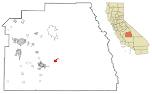
mapsize = 250x200px
map_caption = Location in Tulare County and the state ofCalifornia
mapsize1 =
map_caption1 =
image_dot_
dot_mapsize =
dot_map_caption =
dot_x =
dot_y =
pushpin_
pushpin_label_position =
pushpin_map_caption =
pushpin_mapsize =
subdivision_type = Country
subdivision_name =United States
subdivision_type1 = State
subdivision_name1 =California
subdivision_type2 = County
subdivision_name2 = Tulare
subdivision_type3 =
subdivision_name3 =
subdivision_type4 =
subdivision_name4 =
government_footnotes =
government_type =
leader_title =
leader_name =
leader_title1 =
leader_name1 =
leader_title2 =
leader_name2 =
leader_title3 =
leader_name3 =
leader_title4 =
leader_name4 =
established_title =
established_date =
established_title2 =
established_date2 =
established_title3 =
established_date3 =
area_magnitude =
unit_pref =
area_footnotes =
area_total_km2 = 10.9
area_land_km2 = 10.8
area_water_km2 = 0.1
area_total_sq_mi = 4.2
area_land_sq_mi = 4.2
area_water_sq_mi = 0
area_water_percent =
area_urban_km2 =
area_urban_sq_mi =
area_metro_km2 =
area_metro_sq_mi =
area_blank1_title =
area_blank1_km2 =
area_blank1_sq_mi =
population_as_of = 2000
population_footnotes =
population_note =
population_total = 1109
population_density_km2 = 101.7
population_density_sq_mi = 264
population_metro =
population_density_metro_km2 =
population_density_metro_sq_mi =
population_urban =
population_density_urban_km2 =
population_density_urban_sq_mi =
population_blank1_title =
population_blank1 =
population_density_blank1_km2 =
population_density_blank1_sq_mi =
timezone = Pacific (PST)
utc_offset = -8
timezone_DST = PDT
utc_offset_DST = -7
latd = 36 |latm = 7 |lats = 42 |latNS = N
longd = 118 |longm = 49 |longs = 8 |longEW = W
elevation_footnotes =
elevation_m = 312
elevation_ft = 1024
postal_code_type =ZIP code s
postal_code = 93208, 93265
area_code = 559
blank_name = FIPS code
blank_info = 06-73710
blank1_name = GNIS feature ID
blank1_info = 0249828
website =
footnotes =Springville is a
census-designated place (CDP) in Tulare County,California ,United States . The population was 1,109 at the 2000 census.Geography
Springville is located at coor dms|36|7|42|N|118|49|8|W|city (36.128378, -118.819001).GR|1
According to the
United States Census Bureau , the CDP has a total area of 4.2square mile s (10.9km² ), of which, 4.2 square miles (10.8 km²) of it is land and 0.04 square miles (0.1 km²) of it (0.71%) is water.Demographics
As of the
census GR|2 of 2000, there were 1,109 people, 544 households, and 283 families residing in the CDP. Thepopulation density was 265.8 people per square mile (102.7/km²). There were 613 housing units at an average density of 146.9/sq mi (56.8/km²). The racial makeup of the CDP was 94.14% White, 0.09% African American, 0.54% Native American, 0.27% Asian, 1.80% from other races, and 3.16% from two or more races. Hispanic or Latino of any race were 5.59% of the population.There were 544 households out of which 22.2% had children under the age of 18 living with them, 38.6% were married couples living together, 10.3% had a female householder with no husband present, and 47.8% were non-families. 41.9% of all households were made up of individuals and 22.2% had someone living alone who was 65 years of age or older. The average household size was 2.04 and the average family size was 2.80.
In the CDP the population was spread out with 21.6% under the age of 18, 3.6% from 18 to 24, 22.8% from 25 to 44, 28.6% from 45 to 64, and 23.4% who were 65 years of age or older. The median age was 46 years. For every 100 females there were 90.2 males. For every 100 females age 18 and over, there were 83.3 males.
The median income for a household in the CDP was $24,271, and the median income for a family was $35,000. Males had a median income of $34,375 versus $31,406 for females. The
per capita income for the CDP was $19,695. About 21.6% of families and 25.7% of the population were below thepoverty line , including 42.5% of those under age 18 and 10.7% of those age 65 or over.Politics
In the state legislature Springville is located in the 18th Senate District, represented by Republican
Roy Ashburn , and in the 34th Assembly District, represented by RepublicanBill Maze . Federally, Springville is located inCalifornia's 21st congressional district , which has a Cook PVI of R +13 [cite web | title = Will Gerrymandered Districts Stem the Wave of Voter Unrest? | publisher = Campaign Legal Center Blog | url=http://www.clcblog.org/blog_item-85.html | accessdate = 2008-02-10] and is represented by RepublicanDevin Nunes .Fictional references
In the science fiction novel "
Lucifer's Hammer ", written byLarry Niven andJerry Pournelle , fragments of a comet strike the Earth, causing massive tidal waves to destroy most of the planet's coastal cities. Los Angeles is completely destroyed, and the collapse of dams throughout California causes theSan Joaquin Valley to become an inland sea. The second half of this novel focuses on an enclave of civilization in the fictional "Silver Valley", located slightly east or northeast of Springville, and just north of the Middle Fork of theTule River . ["Lucifer's Hammer" ISBN 0-872-23487-8]Several key scenes in Alfred Hitchcock's "Saboteur" (1942) take place at a ranch in Springville.
References
External links
* [http://springville.ca.us/ Springville Chamber of Commerce]
Wikimedia Foundation. 2010.