- Matheny, California
-
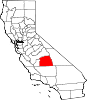
Matheny — census-designated place — Position in California.
 Matheny
Coordinates: 36°10′14″N 119°21′06″W / 36.17056°N 119.35167°WCoordinates: 36°10′14″N 119°21′06″W / 36.17056°N 119.35167°W Country  United States
State  California
County Tulare Area[1] – Total 0.430 sq mi (1.113 km2) – Land 0.430 sq mi (1.113 km2) – Water 0 sq mi (0 km2) 0% Elevation[2] 269 ft (82 m) Population (2010) – Total 1,212 – Density 2,820.4/sq mi (1,088.9/km2) Time zone Pacific (PST) (UTC-8) – Summer (DST) PDT (UTC-7) ZIP Code GNIS feature ID 2585433 U.S. Geological Survey Geographic Names Information System: Matheny, California Matheny is a census-designated place (CDP) in Tulare County, California.[2] Matheny sits at an elevation of 269 feet (82 m).[2] The 2010 United States census reported Matheny's population was 1,212.
Geography
According to the United States Census Bureau, the CDP covers an area of 0.4 square miles (1.1 km²), all of it land.
Demographics
The 2010 United States Census[3] reported that Matheny had a population of 1,212. The population density was 2,820.5 people per square mile (1,089.0/km²). The racial makeup of Matheny was 651 (53.7%) White, 44 (3.6%) African American, 24 (2.0%) Native American, 4 (0.3%) Asian, 0 (0.0%) Pacific Islander, 436 (36.0%) from other races, and 53 (4.4%) from two or more races. Hispanic or Latino of any race were 890 persons (73.4%).
The Census reported that 1,212 people (100% of the population) lived in households, 0 (0%) lived in non-institutionalized group quarters, and 0 (0%) were institutionalized.
There were 320 households, out of which 188 (58.8%) had children under the age of 18 living in them, 164 (51.3%) were opposite-sex married couples living together, 61 (19.1%) had a female householder with no husband present, 41 (12.8%) had a male householder with no wife present. There were 22 (6.9%) unmarried opposite-sex partnerships, and 1 (0.3%) same-sex married couples or partnerships. 38 households (11.9%) were made up of individuals and 17 (5.3%) had someone living alone who was 65 years of age or older. The average household size was 3.79. There were 266 families (83.1% of all households); the average family size was 4.05.
The population was spread out with 459 people (37.9%) under the age of 18, 120 people (9.9%) aged 18 to 24, 330 people (27.2%) aged 25 to 44, 204 people (16.8%) aged 45 to 64, and 99 people (8.2%) who were 65 years of age or older. The median age was 26.9 years. For every 100 females there were 106.8 males. For every 100 females age 18 and over, there were 108.6 males.
There were 344 housing units at an average density of 800.5 per square mile (309.1/km²), of which 155 (48.4%) were owner-occupied, and 165 (51.6%) were occupied by renters. The homeowner vacancy rate was 0.6%; the rental vacancy rate was 4.5%. 525 people (43.3% of the population) lived in owner-occupied housing units and 687 people (56.7%) lived in rental housing units.
References
- ^ U.S. Census
- ^ a b c U.S. Geological Survey Geographic Names Information System: Matheny, California
- ^ All data are derived from the United States Census Bureau reports from the 2010 United States Census, and are accessible on-line here. The data on unmarried partnerships and same-sex married couples are from the Census report DEC_10_SF1_PCT15. All other housing and population data are from Census report DEC_10_DP_DPDP1. Both reports are viewable online or downloadable in a zip file containing a comma-delimited data file. The area data, from which densities are calculated, are available on-line here. Percentage totals may not add to 100% due to rounding. The Census Bureau defines families as a household containing one or more people related to the householder by birth, opposite-sex marriage, or adoption. People living in group quarters are tabulated by the Census Bureau as neither owners nor renters. For further details, see the text files accompanying the data files containing the Census reports mentioned above.
Municipalities and communities of Tulare County, California Cities Dinuba | Exeter | Farmersville | Lindsay | Porterville | Tulare | Visalia | Woodlake
CDPs Allensworth | Alpaugh | California Hot Springs | Camp Nelson | Cedar Slope | Cutler | Delft Colony | Ducor | Earlimart | East Orosi | East Porterville | East Tulare Villa | El Rancho | Goshen | Hartland | Idlewild | Ivanhoe | Kennedy Meadows | Lemon Cove | Lindcove | Linnell Camp | London | Matheny | McClenney Tract | Monson | Orosi | Panorama Heights | Patterson Tract | Pierpoint | Pine Flat | Pixley | Plainview | Ponderosa | Poplar-Cotton Center | Posey | Poso Park | Richgrove | Rodriguez Camp | Sequoia Crest | Seville | Silver City | Springville | Strathmore | Sugarloaf Mountain Park | Sugarloaf Saw Mill | Sugarloaf Village | Sultana | Terra Bella | Teviston | Three Rivers | Tipton | Tonyville | Tooleville | Traver | Waukena | West Goshen | Wilsonia | Woodville | Yettem
Unincorporated
communitiesAdvance | Angiola | Badger | Balance Rock | Cairns Corner | Calgro | Johnsondale | Kaweah | Rocky Hill | White River | Yokohl Valley | Zante
Ghost town Fountain Springs
Indian
reservationTule River Reservation
Categories:- Census-designated places in Tulare County, California
- Populated places in California with Hispanic majority populations


Wikimedia Foundation. 2010.