- Porterville, California
Infobox Settlement
official_name = Porterville, California
other_name =
native_name =
nickname =
settlement_type =City
motto = "The Good Life"
imagesize =
image_caption =
flag_size =
image_
seal_size =
image_shield =
shield_size =
image_blank_emblem =
blank_emblem_type =
blank_emblem_size =
imagesize =
image_caption =
flag_size =
image_
seal_size =
image_shield =
shield_size =
image_blank_emblem =
blank_emblem_type =
blank_emblem_size =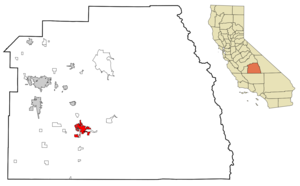
mapsize = 250px
map_caption = Location in Tulare County and the state ofCalifornia
mapsize1 =
map_caption1 =
image_dot_
dot_mapsize =
dot_map_caption =
dot_x =
dot_y =
pushpin_
pushpin_label_position =
pushpin_map_caption =
pushpin_mapsize =
subdivision_type = Country
subdivision_name =United States
subdivision_type1 = State
subdivision_name1 =California
subdivision_type2 = County
subdivision_name2 = Tulare
subdivision_type3 =
subdivision_name3 =
subdivision_type4 =
subdivision_name4 =
government_footnotes =
government_type = Council-Manager
leader_title =
leader_name =
leader_title1 = City Manager
leader_name1 = John Longley
leader_title2 = Mayor
leader_name2 = Cameron J. Hamilton
leader_title3 = Mayor Pro Tempore
leader_name3 = Felipe A. Martinez
leader_title4 =
leader_name4 =
established_title = Settled
established_date = approx. 1826
established_title2 = Incorperated
established_date2 = May 7, 1902
established_title3 =
established_date3 =
area_magnitude =
unit_pref =
area_footnotes =
area_total_km2 = 36.5
area_land_km2 = 36.3
area_water_km2 = 0.2
area_total_sq_mi = 14.1
area_land_sq_mi = 14
area_water_sq_mi = 0.1
area_water_percent =
area_urban_km2 =
area_urban_sq_mi =
area_metro_km2 =
area_metro_sq_mi =
area_blank1_title =
area_blank1_km2 =
area_blank1_sq_mi =
population_as_of = 2000
population_footnotes =
population_note =
population_total = 39,615
population_density_km2 = 1085.3
population_density_sq_mi = 2809.6
population_metro =
population_density_metro_km2 =
population_density_metro_sq_mi =
population_urban =
population_density_urban_km2 =
population_density_urban_sq_mi =
population_blank1_title =
population_blank1 =
population_density_blank1_km2 =
population_density_blank1_sq_mi =
timezone = Pacific (PST)
utc_offset = -8
timezone_DST = PDT
utc_offset_DST = -7
latd = 36 |latm = 4 |lats = 7 |latNS = N
longd = 119 |longm = 1 |longs = 39 |longEW = W
elevation_footnotes =
elevation_m = 139
elevation_ft = 456
postal_code_type =ZIP code s
postal_code = 93257-93258
area_code = 559
blank_name = FIPS code
blank_info = 06-58240
blank1_name = GNIS feature ID
blank1_info = 1652779
website =
footnotes =Porterville is a city in Tulare County,
California ,United States . The population was 39,615 at the 2000 census. City limit signs currently have the population at 51,467. The city's population grew dramatically as the city annexed many properties and unincorporated areas in and around Porterville. Porterville is considered part of theCensus Bureau 's designation of the Visalia-Porterville metropolitan statistical area.Geography
Porterville is located at coor dms|36|4|7|N|119|1|39|W|city (36.068550, -119.027536)GR|1.
According to the
United States Census Bureau , the city has a total area of 14.1square mile s (36.4km² ), of which, 14.0 square miles (36.3 km²) of it is land and 0.1 square miles (0.2 km²) of it (0.50%) is water.Porterville is located in the foothills of the
Sierra Nevada mountains , and many of the town's inhabitants are intimately familiar with the upper regions of the hills. There is also a large man-made body of water, Lake Success, which finds much use for recreation and revelry when in season.Demographics
As of the
census GR|2 of 2000, there were 39,615 people, 11,884 households, and 9,174 families residing in the city. Thepopulation density was 2,828.4 people per square mile (1,091.8/km²). There were 12,691 housing units at an average density of 906.1/sq mi (349.8/km²). The racial makeup of the city was 49.75% White, 1.28% African American, 1.73% Native American, 4.63% Asian, 0.15% Pacific Islander, 32.71% from other races, and 4.75% from two or more races. Hispanic or Latino of any race were 54.45% of the population.There were 11,884 households out of which 47.5% had children under the age of 18 living with them, 53.1% were married couples living together, 17.7% had a female householder with no husband present, and 22.8% were non-families. 19.1% of all households were made up of individuals and 8.3% had someone living alone who was 65 years of age or older. The average household size was 3.20 and the average family size was 3.62.
In the city the population was spread out with 34.3% under the age of 18, 10.8% from 18 to 24, 28.0% from 25 to 44, 17.5% from 45 to 64, and 9.4% who were 65 years of age or older. The median age was 29 years. For every 100 females there were 96.4 males. For every 100 females age 18 and over, there were 93.0 males.
The median
income for a household in the city was $32,046, and the median income for a family was $35,136. Males had a median income of $31,171 versus $23,737 for females. Theper capita income for the city was $12,745. About 20.3% of families and 25.7% of the population were below thepoverty line , including 33.7% of those under age 18 and 6.4% of those age 65 or over.Politics
In the state legislature Porterville is located in the 18th Senate District, represented by Republican
Roy Ashburn , and in the 34th Assembly District, represented by RepublicanBill Maze . Federally, Porterville is located inCalifornia's 21st congressional district , which has a Cook PVI of R +13 [cite web | title = Will Gerrymandered Districts Stem the Wave of Voter Unrest? | publisher = Campaign Legal Center Blog | url=http://www.clcblog.org/blog_item-85.html | accessdate = 2008-02-10] and is represented by RepublicanDevin Nunes .Local Trivia
*The city gained some notoriety from the similarly-titled song by
Creedence Clearwater Revival , included on the band's eponymous debut album in 1968 and was released as their first single and gained airplay at the #1 station in Central California Boss Radio, KYNO-Fresno.
*Porterville received theAll-America City Award in 1994 [ http://www.ncl.org/aac/past_winners/past_winners.html All-America City: Past Winners] ] .
*Porterville is home to the oldest high school band in California: the Porterville Panther Band, started by Mr. Frank "Buck" Shaffer.
*Porteville is home to the Monache Marauder Band, who is 23-time Selma Marching Band Festival Grand Sweepstakes Champion and the 2006 Chic-Fil-A Bowl Jazz, Parade, and Marching Band sweepstakes winner.
*Porterville's Granite Hills High School has won the CountyAcademic Decathlon for 5 years straight, starting in 2003.
*Porterville's Granite Hills High School Online Newspaper, The Grizzly Gazette, has won the NSPA Online Pacemaker Award for its 2nd consecutive year, and has been a finalist for its 3rd consecutive year.
*Porterville'sMonache High School was labeled as a bronze high school in a nation wide school ranking.
*Porterville has 2,500Southeast Asian s, one of America's largest SE Asian communities. Mainly areLaotian s,Cambodian s andThais , many arrived since the 1970's. There's also a fast-growingVietnamese community and a large Filipino population.
*In the science fiction novel "Lucifer's Hammer ", Porterville is destroyed by the collapse of the dam at Lake Success.Notable Locals
*
Marv Acton -NASCAR driver
*Barbara Baxley - film, stage and television actress
*Dick Brooks -NASCAR driver
*Brant Brown -Fresno State andMajor League Baseball Outfielder (Chicago Cubs ,Pittsburgh Pirates , andFlorida Marlins )
*Tex Clevenger -Fresno State andMajor League Baseball pitcher (Boston Red Sox ,Washington Senators ,Los Angeles Angels , andNew York Yankees )
*Steve Cox -Major League Baseball Firstbaseman (Tampa Bay Devil Rays )
*Sim Iness -Oklahoma -born Olympic Gold Medalist (Discus )
*Monte Moore - LongtimeMajor League Baseball andOakland Athletics broadcaster
*Rance Mulliniks -Major League Baseball Infielder (California Angels ,Kansas City Royals , andToronto Blue Jays )
*Rick Owens - fashion designer
*David Treadwell - Porterville Rescue Mission
*James Sanders (American football) -Fresno State andNFL Safety for theNew England Patriots
*Bill Sharman - NBA Hall of Fame player and coach
*Tim Vanni - two-time Olympic Wrestler
*Tyson Crandall - owner of Swisher Sweets CigarsMedia
The "Porterville Recorder" is the daily
newspaper serving Porterville. Radio stationsKIOO (99.7 FM),KMQA (100.5 FM) andKTIP (1450 AM) and TV stationKTFF-TV are all licensed to Porterville.Education
Most of Porterville is served by the Porterville Unified School District, while portions of the western section of the city are zoned to the Burton School District
chools in the Porterville Unified School District
*
Monache High School
*Porterville High School
*Granite Hills High School
*Strathmore High School
*Pioneer Middle School
*Sequoia Middle School
*Bartlett Middle School
*Los Robles Elementary School
*Vandalia Elementary School
*Roche Avenue Elementary School
*Belleview Elementary School
*John J. Doyle Elementary School
*Monte Vista Elementary School
*Olive Street Elementary School
*Westfield Elementary School
*West Putnam Elementary Schoolchools in the Burton School District
*Burton Middle School
*Burton Elementary School
*Oak Grove Elementary School
*Buckley Elementary
*Jim Maples Academy
*Summit Charter Academy
*Summit Charter Academy Redwood CampusHigher Education
*There is one junior college in Porterville, [http://www.pc.cc.ca.us/ Porterville College] (PC), located on South Main Street.
Sister cities
Porterville has two sister cities,
*flagicon|Mexico
La Barca ,Mexico
*flagicon|JapanMikkabi ,Japan References
External links
* [http://www.ci.porterville.ca.us/ Porterville official website]
Wikimedia Foundation. 2010.