Middle Fork Vermilion River
- Middle Fork Vermilion River
-

Baby softshell surveys a bar on the Middle Fork
The Middle Fork of the Vermilion River is a tributary of the Vermilion River (Wabash River tributary) in Illinois. The Middle Fork rises in Ford County and flows southeast to join the Vermilion near Danville.
In its natural state, the Middle Fork drained a large upland marsh in what is now Ford County. The Middle Fork has been extended into the marsh by drainage ditches. Including the ditches, the Middle Fork is about 77 miles (124 km) long.[1]
Parks and access points
The Middle Fork is Illinois' only designated National Wild and Scenic River. Parks and access points include:
Cities, towns and counties
The following cities, towns and villages are among those in the watershed of the Middle Fork:
Parts of the following counties are drained by the Middle Fork:
See also
References
- ^ U.S. Geological Survey. National Hydrography Dataset high-resolution flowline data. The National Map, accessed May 19, 2011
External links
Categories:
- Rivers of Illinois
- Wabash River Watershed
- Wild and Scenic Rivers of the United States
Wikimedia Foundation.
2010.
Look at other dictionaries:
Salt Fork Vermilion River — The Salt Fork is a tributary of the Vermilion River (Wabash River tributary) located in Illinois.The Salt Fork owes its name to saline springs that provided natural salt licks for animals, and which were used for production of salt by Native… … Wikipedia
Vermilion River (Wabash River tributary) — The Vermilion River is a tributary of the Wabash River located in the state of Illinois, United States. There are two Vermilion Rivers in Illinois. The Wabash tributary flows south. The other Vermilion River flows north. See Vermilion River… … Wikipedia
Middle Fork River — For the Middle Fork in east central IL, USA, see Middle Fork Vermilion River. Coordinates: 39°03′41″N 80°02′51″W / 39.06139°N 80.0475°W … Wikipedia
Vermilion River (Illinois River tributary) — The Vermilion River is a tributary of the Illinois River in the State of Illinois, United States. This Vermilion River flows north. There is another Vermilion River in Illinois. That river, which flows south, is the Vermilion River (Wabash River… … Wikipedia
Middle Fork State Fish and Wildlife Area — IUCN Category IV (Habitat/Species Management Area) … Wikipedia
Vermilion County, Illinois — Seal … Wikipedia
Vermilion — (spr. Wermillion), 1) Kirchspiel (Parish) im Staate Louisiana (Nordamerika), 86 QM., an den Mexicanischen Meerbusen grenzend, von den Vermilion u. Mermenteau Rivers durchflossen; große Prairien, theilweis sumpfig; Producte: Mais u. Zucker;… … Pierer's Universal-Lexikon
Vermilion County (Illinois) — Verwaltung US Bundesstaat: Illinois Verwaltungssitz: Danville Adresse des Verwaltungssitzes: Vermilion Courthouse Annex 6 North Vermilion Street Danville, Illinois 61832 Gründung: 18. Januar … Deutsch Wikipedia
List of tributaries of the Columbia River — Tributaries and sub tributaries are hierarchically listed in order from the mouth of the Columbia River upstream. Major dams and reservoir lakes are also noted.Minor tributaries* Skipanon River (Oregon) * Lewis and Clark River (Oregon) * Youngs… … Wikipedia
List of rivers of Illinois — List of rivers in Illinois (U.S. state), sorted by name.Apple to Fox*Apple River *Big Muddy River *Beaucoup Creek *Boneyard Creek *Bonpas Creek *Cache River *Calumet River *Casey Creek, also known as Casey Fork Creek *Chicago River *Des Plaines… … Wikipedia
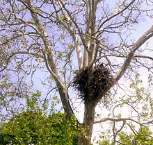
 Bald Eagle on nest, spring 2011

