- National Register of Historic Places listings in Clark County, Ohio
-
 Location of Clark County in Ohio
This is a list of the National Register of Historic Places listings in Clark County, Ohio.
This is intended to be a complete list of the properties and districts on the National Register of Historic Places in Clark County, Ohio, United States. The locations of National Register properties and districts for which the latitude and longitude coordinates are included below, may be seen in a Google map.[1]
There are 35 properties and districts listed on the National Register in the county.
-
- This National Park Service list is complete through NPS recent listings posted November 10, 2011.[2]
Current listings
[3] Landmark name [4] Image Date listed Location City or town Summary 1 Arcade Hotel 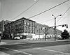
October 16, 1974 Fountain Ave. and High St.
39°55′21″N 83°48′36″W / 39.9225°N 83.81°WSpringfield 2 Francis Bookwalter House 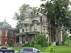
January 3, 1980 611 S. Fountain Ave.
39°55′02″N 83°48′40″W / 39.917222°N 83.811111°WSpringfield 3 Brewer Log House 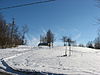
August 13, 1974 2665 Old Springfield Rd., south of Springfield
39°51′03″N 83°45′53″W / 39.850833°N 83.764722°WGreen Township 4 David Crabill House 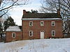
October 10, 1975 5 mi (8.0 km) east of Springfield off State Route 4
39°57′39″N 83°44′52″W / 39.960833°N 83.747778°WMoorefield Township 5 East High Street District 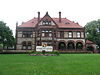
October 9, 1974 Roughly bounded by E. High, S. Sycamore, and Walnut Sts.
39°55′18″N 83°47′48″W / 39.921667°N 83.796667°WSpringfield 6 Enon Mound 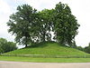
February 23, 1972 Mound Circle in central Enon
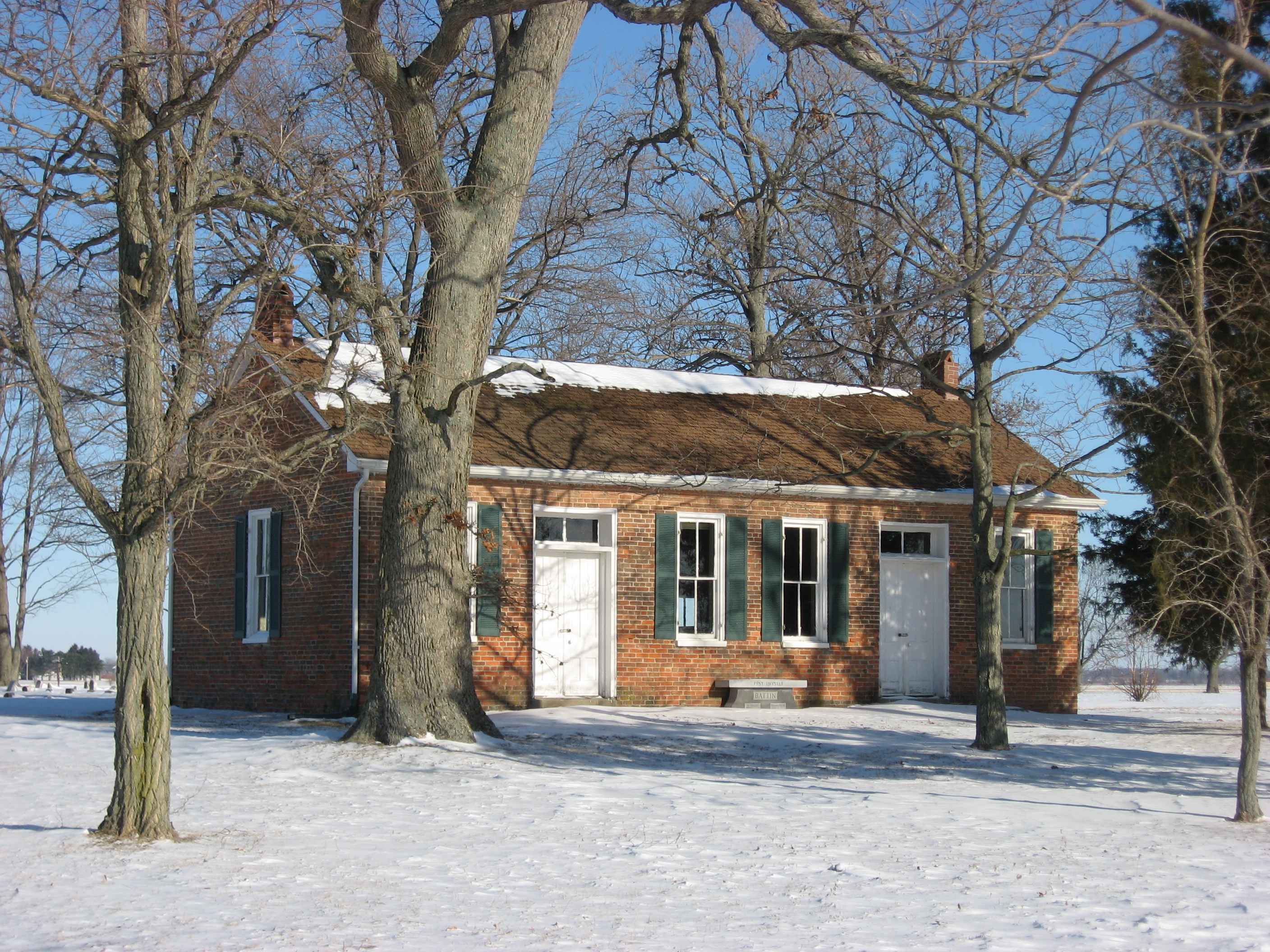
39°52′46.524″N 83°55′53.976″W / 39.87959°N 83.93166°W[5]Enon Probably built by the Adena culture.[6] 7 Green Plain Monthly Meetinghouse 
April 1, 1982 Clifton Rd., southwest of South Charleston
39°48′35″N 83°41′28″W / 39.809722°N 83.691111°WMadison Township 8 Daniel Hertzler House 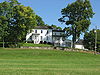
February 7, 1978 West of Springfield off State Route 4
39°54′33″N 83°54′40″W / 39.909167°N 83.911111°WBethel Township 9 Kenton-Hunt Farm 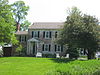
February 8, 1980 North of Springfield at 4690 Urbana Rd.
39°59′33″N 83°48′13″W / 39.992383°N 83.803717°WMoorefield Township 10 Lagonda Club Building 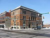
May 28, 1975 Northwestern corner of High and Spring Sts.
39°55′24″N 83°48′25″W / 39.923333°N 83.807°WSpringfield 11 Main Street Buildings 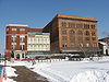
March 2, 1979 6-14 E. Main St.
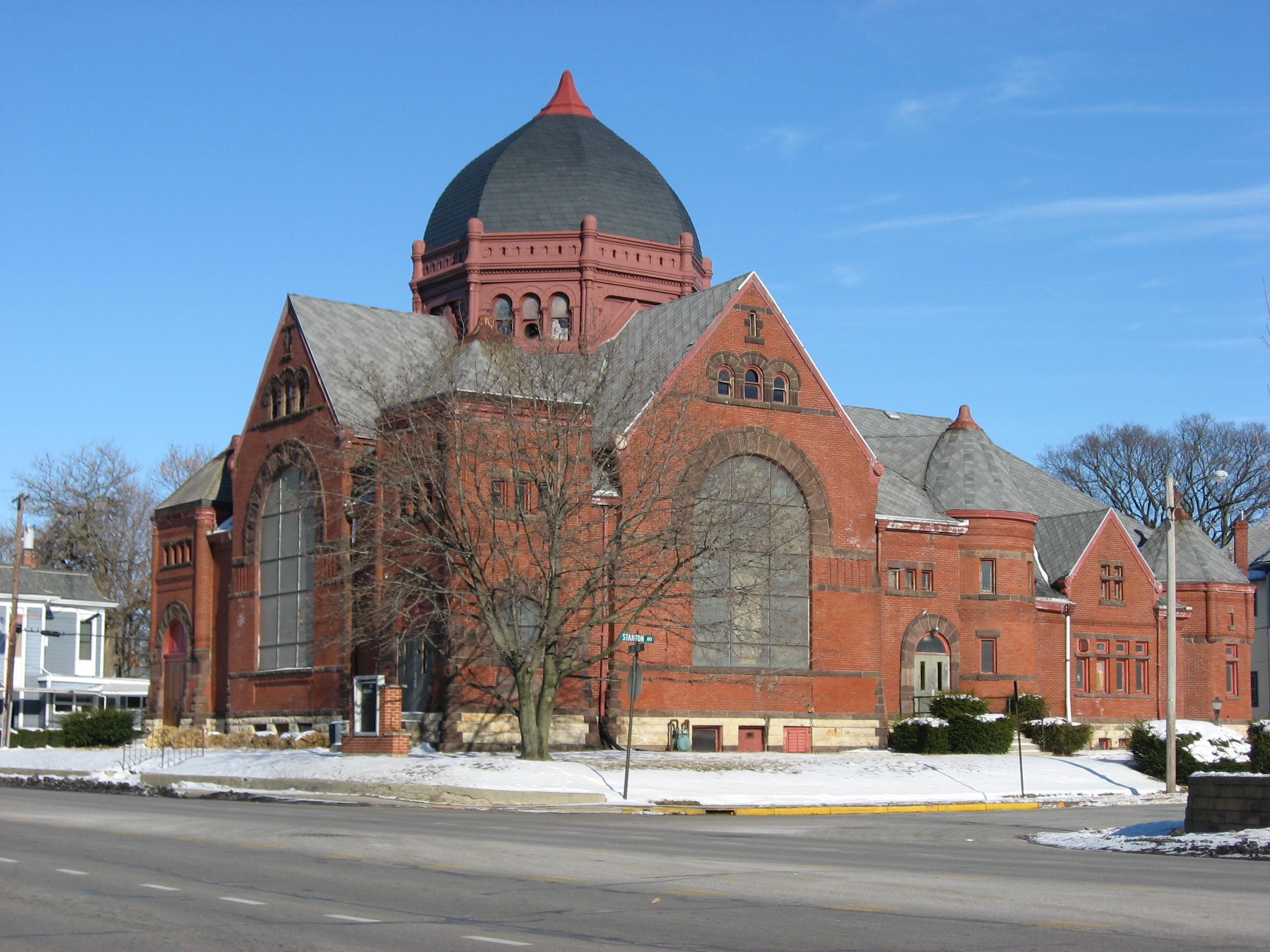
39°55′28″N 83°48′35″W / 39.924444°N 83.809722°WSpringfield 12 Marquart-Mercer Farm 
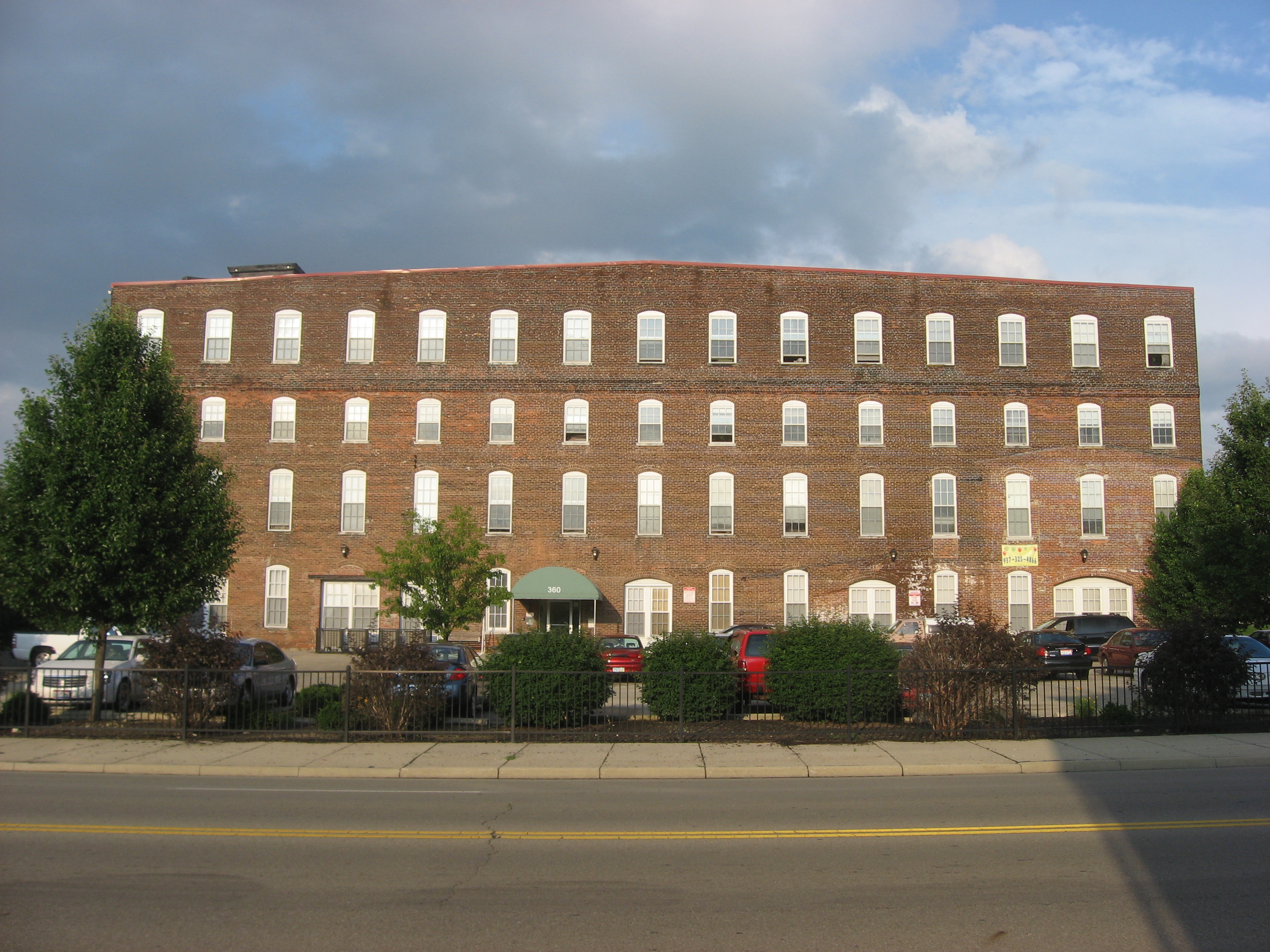
July 26, 1979 Southwest of Springfield
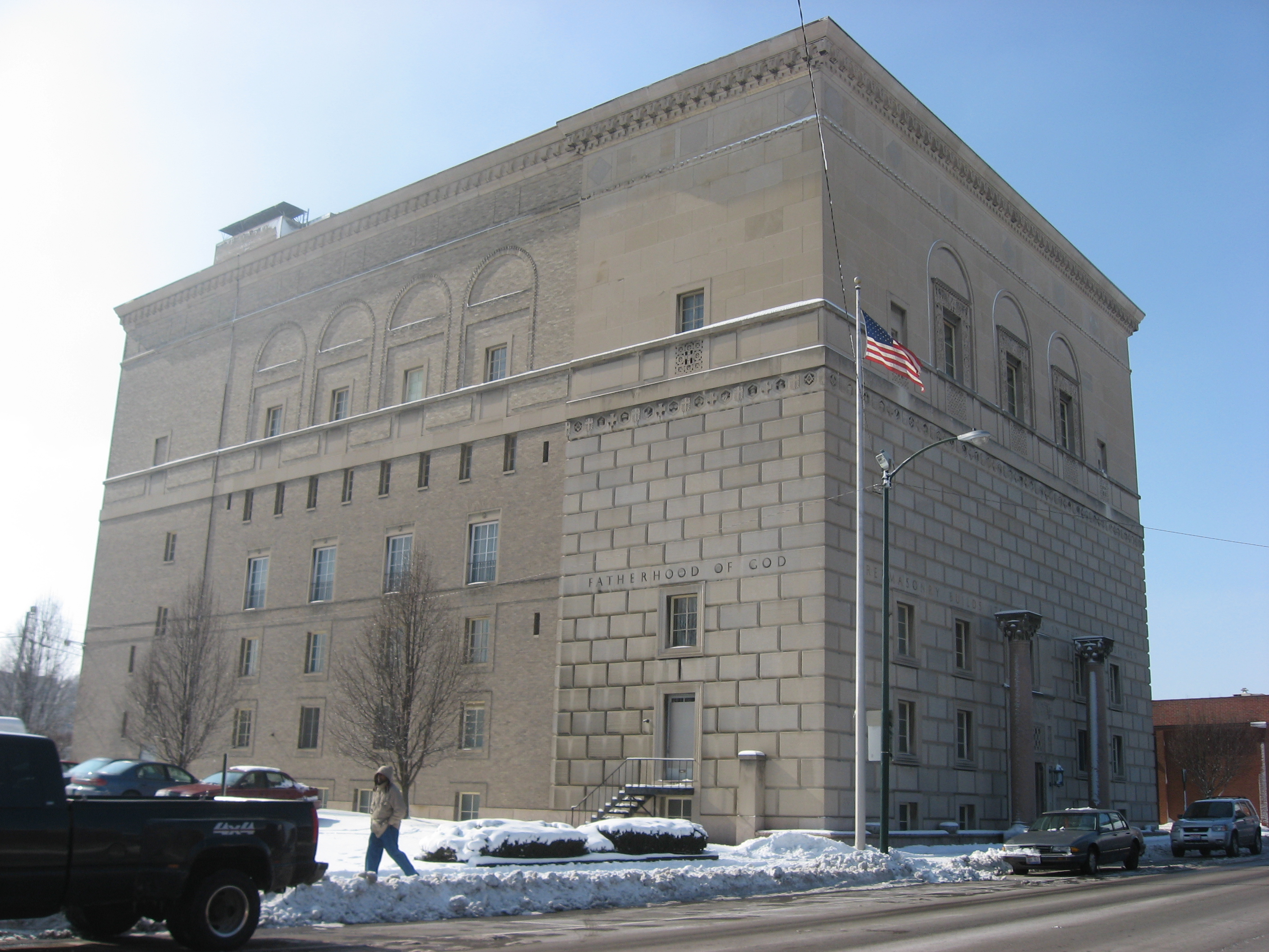
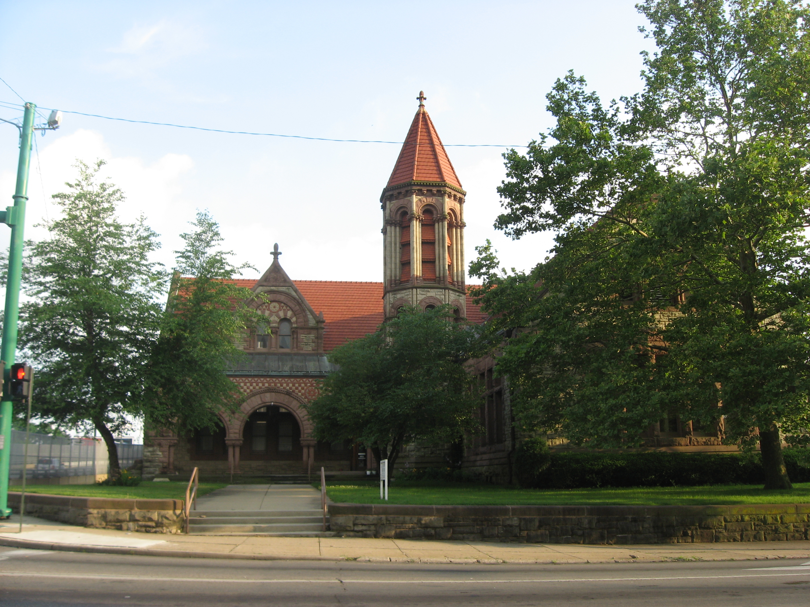
39°51′21″N 83°49′47″W / 39.855833°N 83.829722°WMad River Township 13 Masonic Temple 
December 17, 2008 125 W. High St.
39°55′24″N 83°48′48″W / 39.923333°N 83.813333°WSpringfield 14 Municipal Building 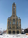
May 25, 1973 S. Fountain Ave. between High and Washington Sts.
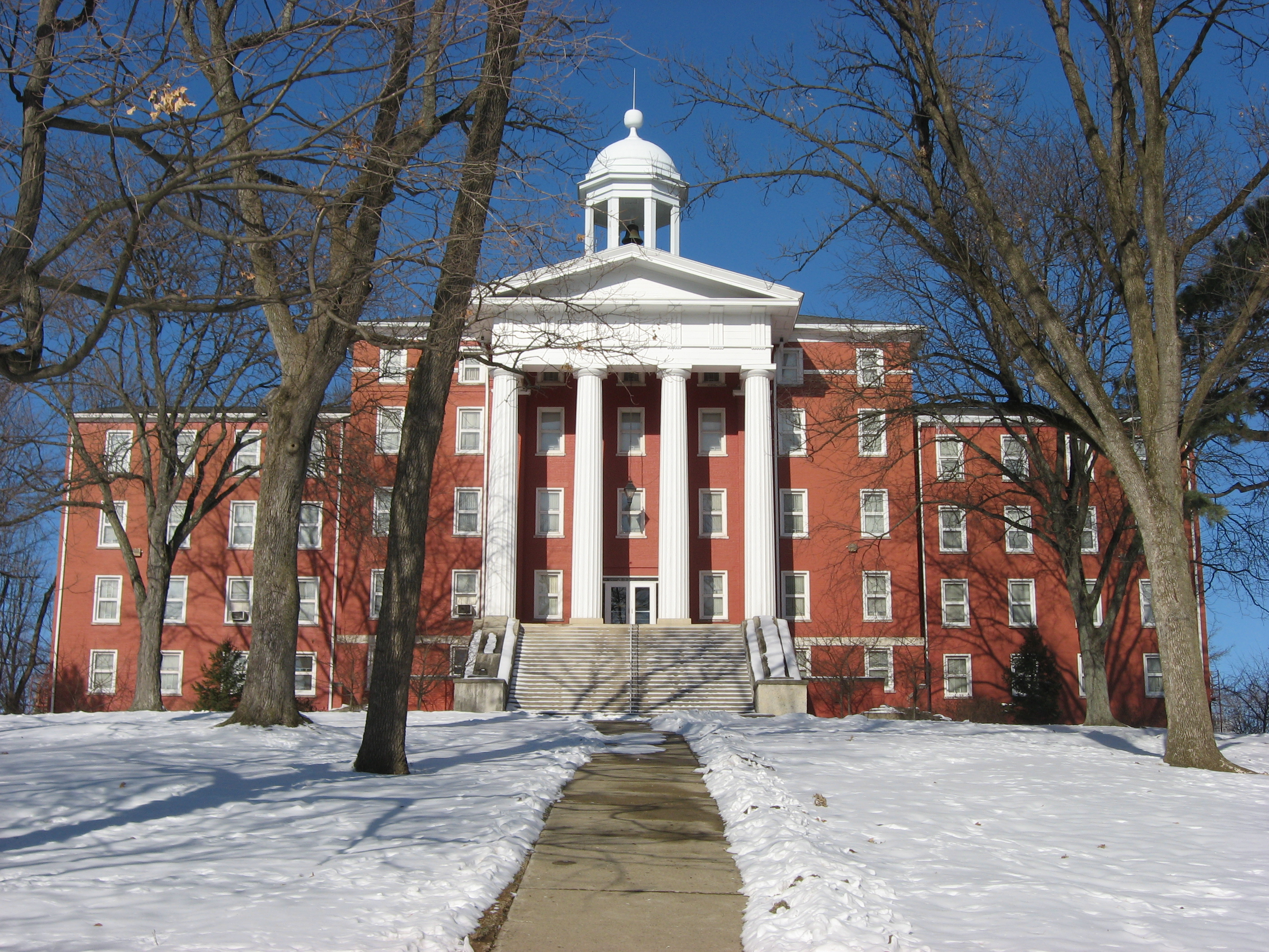
39°55′23″N 83°48′40″W / 39.923056°N 83.811111°WSpringfield 15 Myers Hall 
June 30, 1975 Wittenberg Ave. and Ward St.
39°56′05″N 83°48′50″W / 39.934722°N 83.813889°WSpringfield 16 Newlove Works 
June 4, 1973 Along Newlove Road in Section 29 of Harmony Township
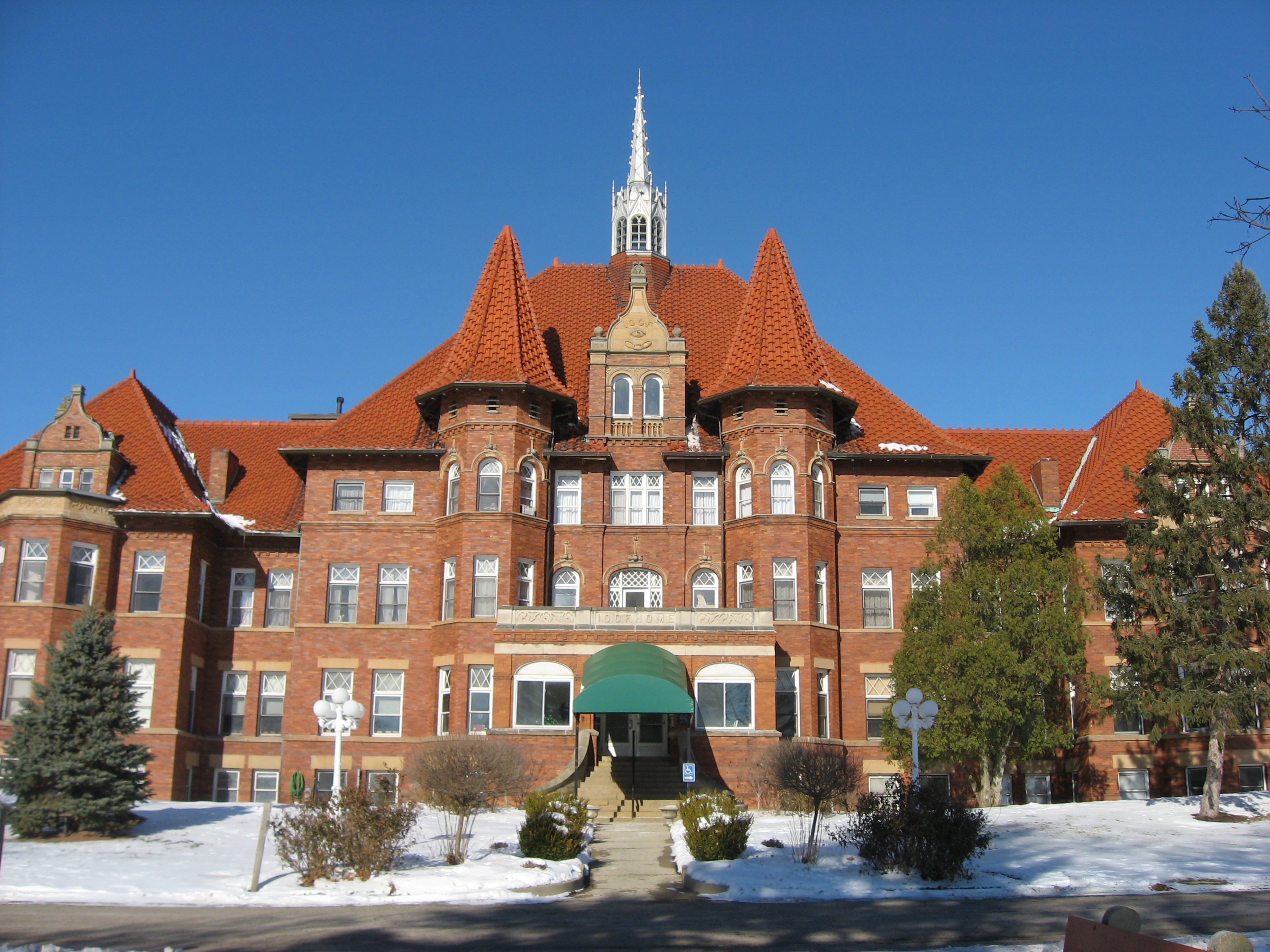
39°55′0.1″N 83°40′36″W / 39.916694°N 83.67667°W[7]Harmony Township 17 Odd Fellows' Home for Orphans, Indigent and Aged 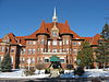
April 16, 1980 404 E. McCreight Ave.
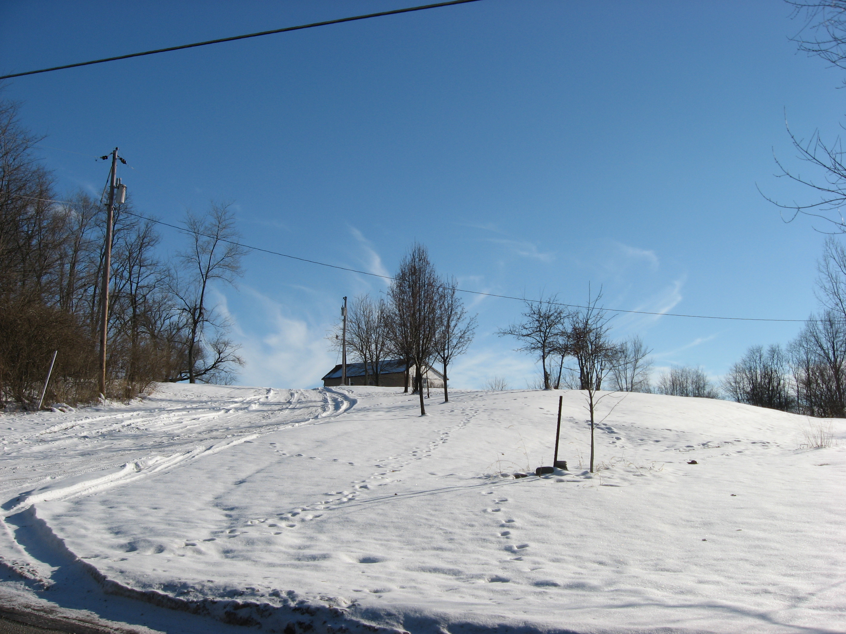
39°56′18″N 83°48′06″W / 39.938447°N 83.801667°WSpringfield 18 Old Enon Road Stone Arch Culvert 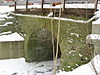
April 16, 2009 Rocky Point Rd., approximately 185 feet west of Old Mill Rd.
39°52′10″N 83°52′46″W / 39.869544°N 83.879428°WMad River Township 19 Olive Branch High School 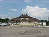
July 23, 2009 9710 W. National Rd., southeast of New Carlisle
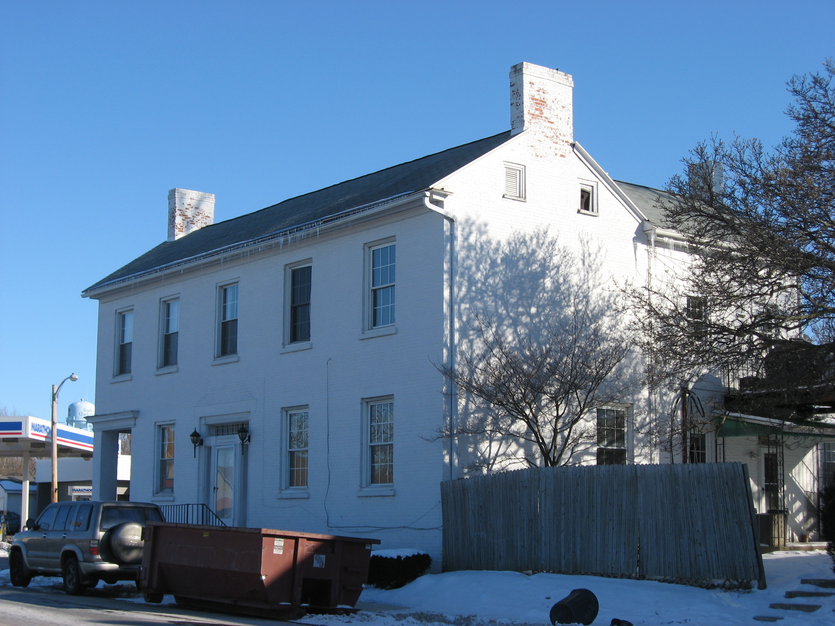
39°54′48″N 83°59′36″W / 39.913333°N 83.993333°WBethel Township 20 Ollie's Tavern 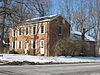
January 25, 1997 10516 Marquart Rd., north of New Carlisle
39°58′59″N 84°00′08″W / 39.983056°N 84.002222°WPike Township 21 Pennsylvania House 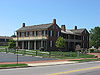
April 11, 1973 1311 W. Main St.
39°55′32″N 83°49′58″W / 39.925556°N 83.832778°WSpringfield 22 Pickaway Settlements Battlesite 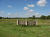
May 8, 1980 North of Enon
39°54′27″N 83°55′15″W / 39.9075°N 83.920833°WBethel Township 23 Pringle-Patric House 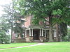
December 15, 1997 1314-1316 E. High St.
39°55′16″N 83°47′24″W / 39.921111°N 83.79°WSpringfield 24 C.A. Reeser House 
June 20, 1980 1425 Innisfallen Ave.
39°54′51″N 83°50′07″W / 39.914167°N 83.835278°WSpringfield Destroyed 25 St. John's Evangelical Lutheran Church 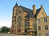
June 7, 2006 27 N. Wittenberg Ave.
39°55′33″N 83°48′51″W / 39.9258°N 83.814147°WSpringfield 26 St. Joseph Roman Catholic Church 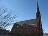
March 15, 1982 802 Kenton St.
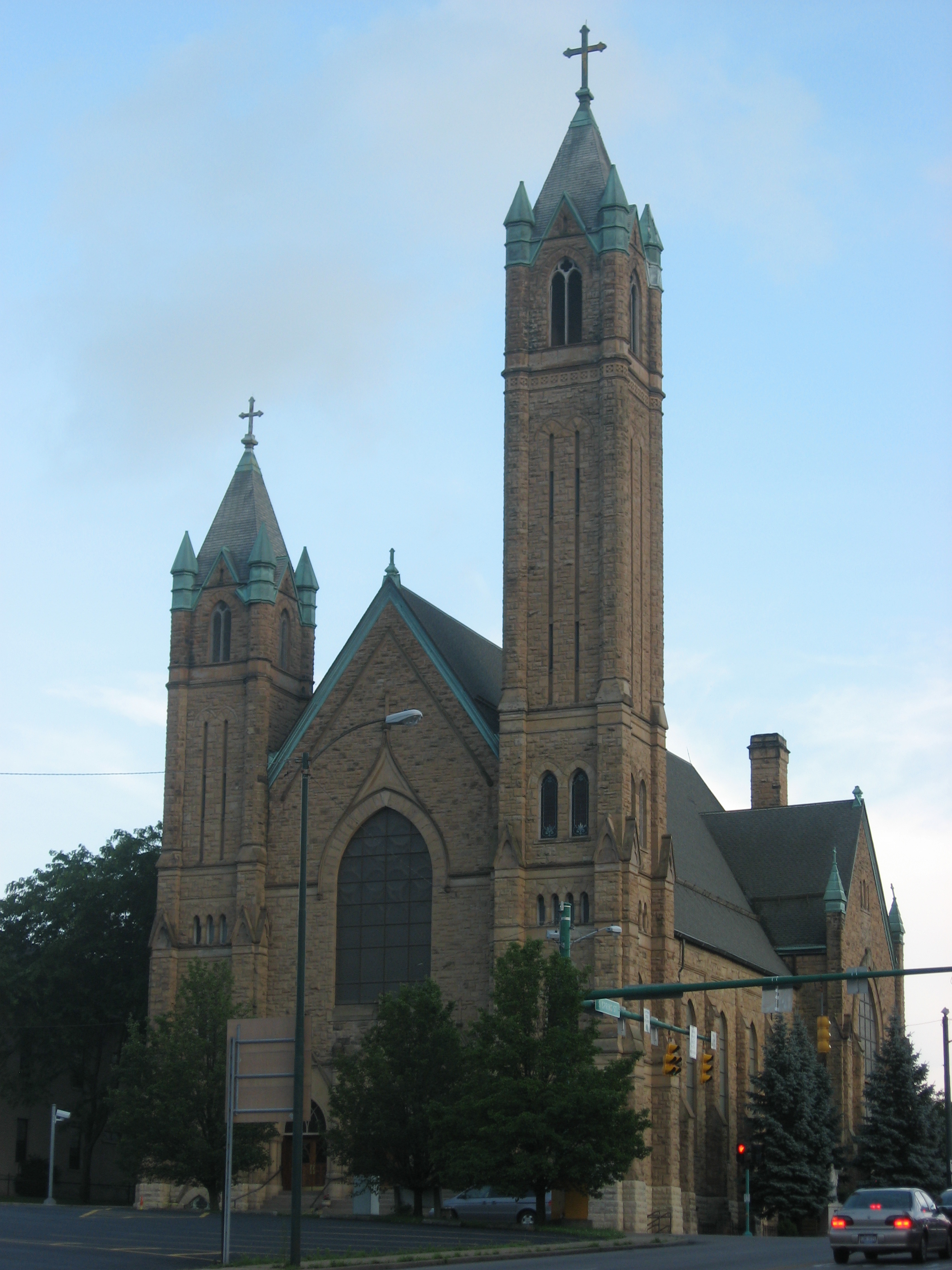
39°54′57″N 83°47′52″W / 39.915833°N 83.797778°WSpringfield 27 St. Raphael Church 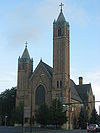
June 22, 1976 225 E. High St.
39°55′22″N 83°48′23″W / 39.922778°N 83.806389°WSpringfield 28 Shawnee Hotel 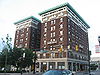
December 5, 1985 Main and Limestone Sts.
39°55′28″N 83°48′26″W / 39.924444°N 83.807222°WSpringfield 29 South Charleston Historic District 
July 17, 1978 Centered on Jamestown and Chillicothe Sts.
39°49′30″N 83°38′4″W / 39.825°N 83.63444°W[8]South Charleston 30 South Fountain Avenue Historic District 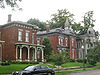
December 29, 1983 Roughly Fountain Ave. and Limestone St. from Perrin to Monroe Sts.
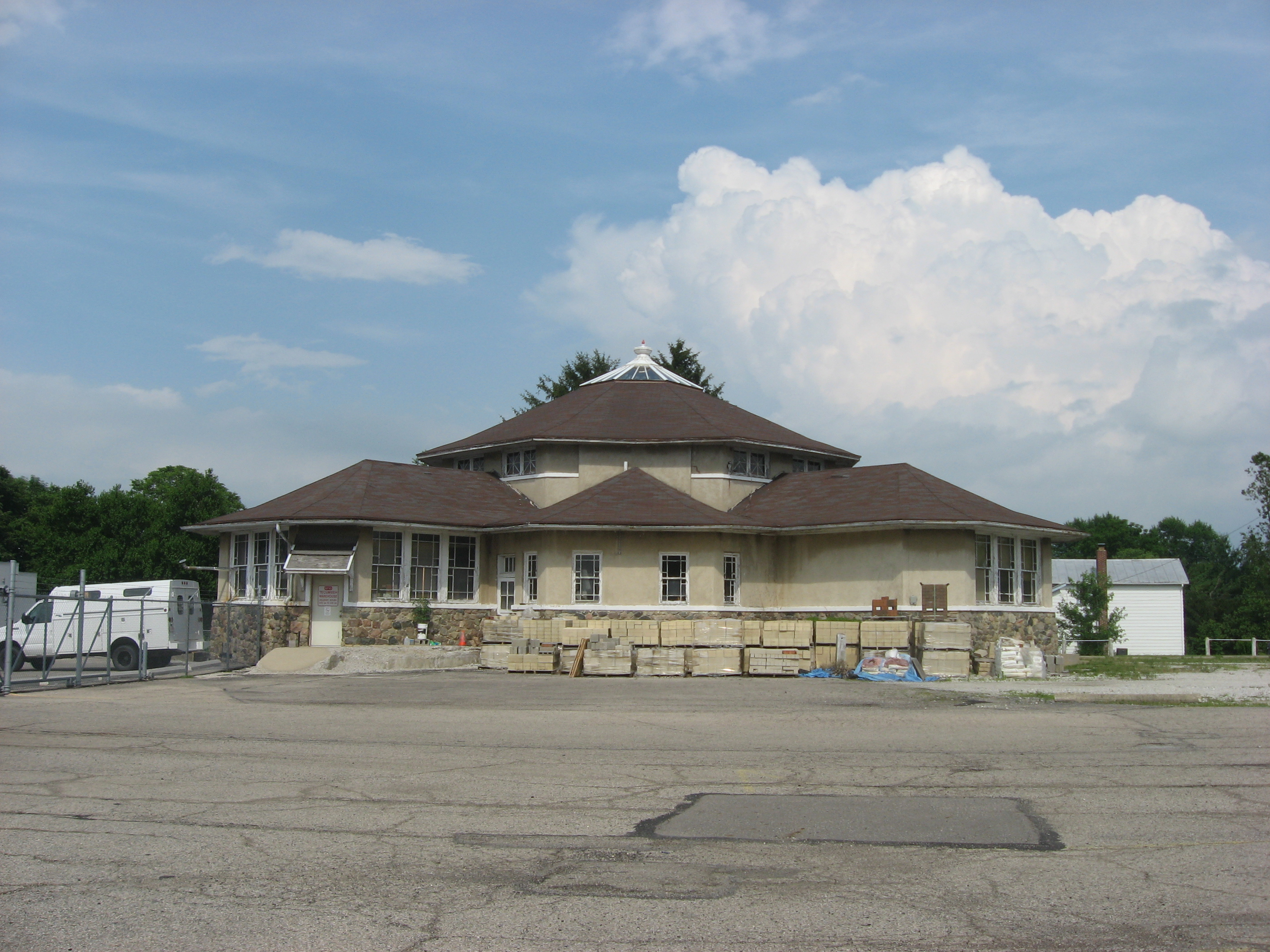
39°54′53″N 83°48′40″W / 39.914769°N 83.811086°WSpringfield 31 Tecumseh Building 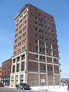
December 28, 2000 34 W. High St.
39°55′25″N 83°48′42″W / 39.923556°N 83.811667°WSpringfield 32 Third Presbyterian Church 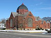
January 3, 1980 714 N. Limestone St.
39°55′58″N 83°48′20″W / 39.932778°N 83.805556°WSpringfield 33 Thomas Manufacturing Company Warehouse 
February 2, 2001 360 S. Limestone St.
39°55′12″N 83°48′30″W / 39.92°N 83.808333°WSpringfield 34 Warder Public Library 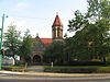
February 17, 1978 E. High and Spring Sts.
39°55′21″N 83°48′26″W / 39.9225°N 83.807222°WSpringfield A gift of local businessman Benjamin Warder, it now houses the Warder Literacy Center after the main branch of Clark County Public Library was moved to a modern facility in 1989.[9] 35 Westcott House 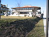
July 24, 1974 1340 E. High St.
39°55′17″N 83°47′21″W / 39.921389°N 83.789222°WSpringfield The only Frank Lloyd Wright-designed Prairie School house in Ohio See also
References
- ^ The latitude and longitude information provided in this table was derived originally from the National Register Information System, which has been found to be fairly accurate for about 99% of listings. For about 1% of NRIS original coordinates, experience has shown that one or both coordinates are typos or otherwise extremely far off; some corrections may have been made. A more subtle problem causes many locations to be off by up to 150 yards, depending on location in the country: most NRIS coordinates were derived from tracing out latitude and longitudes off of USGS topographical quadrant maps created under the North American Datum of 1927, which differs from the current, highly accurate WGS84 GPS system used by Google maps. Chicago is about right, but NRIS longitudes in Washington are higher by about 4.5 seconds, and are lower by about 2.0 seconds in Maine. Latitudes differ by about 1.0 second in Florida. Some locations in this table may have been corrected to current GPS standards.
- ^ "National Register of Historic Places: Weekly List Actions". National Park Service, United States Department of the Interior. Retrieved on November 10, 2011.
- ^ Numbers represent an ordering by significant words. Various colorings, defined here, differentiate National Historic Landmark sites and National Register of Historic Places Districts from other NRHP buildings, structures, sites or objects.
- ^ "National Register Information System". National Register of Historic Places. National Park Service. . http://nrhp.focus.nps.gov/natreg/docs/All_Data.html.
- ^ Location derived from this Ohio Historical Society webpage; the NRIS lists the site as "Address Restricted"
- ^ Enon Mound, Ohio Historical Society, 2010. Accessed 9 February 2010.
- ^ Location derived from Mills, William C. Archeological Atlas of Ohio. Columbus: Ohio State Archeological and Historical Society, 1914, page 7 and plate 7. The NRIS lists the site as "Address Restricted".
- ^ Location derived from South Charleston Historic District, Ohio Historical Society, 2007, accessed 2010-12-28. The NRIS lists it at the nonexistent "State Route 70".
- ^ Library History, Clark County Public Library, 2005. Accessed 9 February 2010.
National Register of Historic Places in Ohio Lists by county Adams • Allen • Ashland • Ashtabula • Athens • Auglaize • Belmont • Brown • Butler • Carroll • Champaign • Clark • Clermont • Clinton • Columbiana • Coshocton • Crawford • Cuyahoga • Darke • Defiance • Delaware • Erie • Fairfield • Fayette • Franklin • Fulton • Gallia • Geauga • Greene • Guernsey • Hamilton • Hancock • Hardin • Harrison • Henry • Highland • Hocking • Holmes • Huron • Jackson • Jefferson • Knox • Lake • Lawrence • Licking • Logan • Lorain • Lucas • Madison • Mahoning • Marion • Medina • Meigs • Mercer • Miami • Monroe • Montgomery • Morgan • Morrow • Muskingum • Noble • Ottawa • Paulding • Perry • Pickaway • Pike • Portage • Preble • Putnam • Richland • Ross • Sandusky • Scioto • Seneca • Shelby • Stark • Summit • Trumbull • Tuscarawas • Union • Van Wert • Vinton • Warren • Washington • Wayne • Williams • Wood • Wyandot

Lists by city Other lists Municipalities and communities of Clark County, Ohio Cities 
Villages Catawba | Clifton‡ | Donnelsville | Enon | North Hampton | South Charleston | South Vienna | Tremont City
Townships Bethel | German | Green | Harmony | Mad River | Madison | Moorefield | Pike | Pleasant | Springfield
CDPs Unincorporated
communitiesFootnotes ‡This populated place also has portions in an adjacent county or counties
Categories:- National Register of Historic Places in Ohio by county
- Clark County, Ohio
-


Wikimedia Foundation. 2010.