Buccleuch County

Buccleuch County
Buccleuch
New South Wales
Buccleuch NSW.PNG
Location in New South Wales
Lands administrative divisions around Buccleuch
Clarendon Harden Harden
Wynyard Buccleuch Cowley
Selwyn Wallace Wallace

Buccleuch County is one of the 141 Cadastral divisions of New South Wales. It contains the locality of Adjungbilly. The Murrumbidgee River is at the northern boundary, with the Goodradigbee River on the eastern boundary, and the Tumut River on the western boundary. It includes the northern part of the Kosciuszko National Park.

Buccleuch County was named in honour of the Duke of Buccleuch (1806-1884).[1]

Parishes within this county

A full list of parishes found within this county; their current LGA and mapping coordinates to the approximate centre of each location is as follows:

Parish LGA Coordinates
Adjungbilly Gundagai Shire Council 35°05′54″S 148°24′04″E / 35.09833°S 148.40111°E / -35.09833; 148.40111 (Adjungbilly)
Baloo Tumut Shire Council 35°25′54″S 148°23′04″E / 35.43167°S 148.38444°E / -35.43167; 148.38444 (Baloo)
Blowering Tumut Shire Council 35°22′54″S 148°17′04″E / 35.38167°S 148.28444°E / -35.38167; 148.28444 (Blowering)
Bogong Tumut Shire Council 35°26′54″S 148°18′04″E / 35.44833°S 148.30111°E / -35.44833; 148.30111 (Bogong)
Boraig Tumut Shire Council 35°38′54″S 148°22′04″E / 35.64833°S 148.36778°E / -35.64833; 148.36778 (Boraig)
Bramina Tumut Shire Council 35°27′54″S 148°40′04″E / 35.465°S 148.66778°E / -35.465; 148.66778 (Bramina)
Brungle Tumut Shire Council 35°09′54″S 148°15′04″E / 35.165°S 148.25111°E / -35.165; 148.25111 (Brungle)
Bundarbo Gundagai Shire Council 34°54′49″S 148°21′08″E / 34.91361°S 148.35222°E / -34.91361; 148.35222 (Bundarbo)
Bungongo Gundagai Shire Council 34°59′49″S 148°26′04″E / 34.99694°S 148.43444°E / -34.99694; 148.43444 (Bungongo)
Childowla Gundagai Shire Council 34°59′54″S 148°30′04″E / 34.99833°S 148.50111°E / -34.99833; 148.50111 (Childowla)
Clive Yass Valley Council 35°14′54″S 148°40′04″E / 35.24833°S 148.66778°E / -35.24833; 148.66778 (Clive)
Cooleman Tumut Shire Council 35°17′54″S 148°26′04″E / 35.29833°S 148.43444°E / -35.29833; 148.43444 (Cooleman)
Cowrajago Tumut Shire Council 35°08′54″S 148°30′04″E / 35.14833°S 148.50111°E / -35.14833; 148.50111 (Cowrajago)
Cromwell Tumut Shire Council 35°19′54″S 148°41′04″E / 35.33167°S 148.68444°E / -35.33167; 148.68444 (Cromwell)
Darbalara Gundagai Shire Council 35°01′54″S 148°15′04″E / 35.03167°S 148.25111°E / -35.03167; 148.25111 (Darbalara)
Garnet Tumut Shire Council 35°23′54″S 148°34′04″E / 35.39833°S 148.56778°E / -35.39833; 148.56778 (Garnet)
Goobarragandra Tumut Shire Council 35°29′54″S 148°33′04″E / 35.49833°S 148.55111°E / -35.49833; 148.55111 (Goobarragandra)
Goobarralong Gundagai Shire Council 34°58′54″S 148°21′04″E / 34.98167°S 148.35111°E / -34.98167; 148.35111 (Goobarralong)
Jibeen Tumut Shire Council 35°29′54″S 148°30′04″E / 35.49833°S 148.50111°E / -35.49833; 148.50111 (Jibeen)
Jounama Tumut Shire Council 35°37′54″S 148°25′04″E / 35.63167°S 148.41778°E / -35.63167; 148.41778 (Jounama)
Killimicat Tumut Shire Council 35°14′54″S 148°15′04″E / 35.24833°S 148.25111°E / -35.24833; 148.25111 (Killimicat)
Mundongo Tumut Shire Council 35°16′54″S 147°19′04″E / 35.28167°S 147.31778°E / -35.28167; 147.31778 (Mundongo)
Nanangroe Gundagai Shire Council 34°55′54″S 148°28′04″E / 34.93167°S 148.46778°E / -34.93167; 148.46778 (Nanangroe)
Napier Yass Valley Council 35°16′54″S 148°34′04″E / 35.28167°S 148.56778°E / -35.28167; 148.56778 (Napier)
Nimbo Tumut Shire Council 35°19′54″S 148°30′04″E / 35.33167°S 148.50111°E / -35.33167; 148.50111 (Nimbo)
Peppercorn Tumut Shire Council 35°33′54″S 148°36′04″E / 35.565°S 148.60111°E / -35.565; 148.60111 (Peppercorn)
Pinbeyan Tumut Shire Council 35°44′54″S 148°24′04″E / 35.74833°S 148.40111°E / -35.74833; 148.40111 (Pinbeyan)
Talbingo Tumut Shire Council 35°33′54″S 148°20′04″E / 35.565°S 148.33444°E / -35.565; 148.33444 (Talbingo)
The Peaks Tumut Shire Council 35°36′54″S 148°30′04″E / 35.615°S 148.50111°E / -35.615; 148.50111 (The Peaks)
Tumorrama Tumut Shire Council 35°14′54″S 148°30′04″E / 35.24833°S 148.50111°E / -35.24833; 148.50111 (Tumorrama)
Wagara Gundagai Shire Council 35°04′54″S 148°15′04″E / 35.08167°S 148.25111°E / -35.08167; 148.25111 (Wagara)
Wee Jasper Yass Valley Council 35°10′54″S 148°38′04″E / 35.18167°S 148.63444°E / -35.18167; 148.63444 (Wee Jasper)
West Goodradigbee Yass Valley Council 35°02′54″S 148°37′04″E / 35.04833°S 148.61778°E / -35.04833; 148.61778 (West Goodradigbee)
Wyangle Tumut Shire Council 35°12′54″S 148°23′04″E / 35.215°S 148.38444°E / -35.215; 148.38444 (Wyangle)
Yarrangobilly Tumut Shire Council 35°44′54″S 148°30′04″E / 35.74833°S 148.50111°E / -35.74833; 148.50111 (Yarrangobilly)

References


Wikimedia Foundation. 2010.

Игры ⚽ Поможем написать курсовую

Look at other dictionaries:

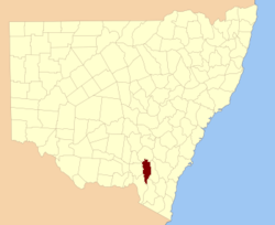
  • Buccleuch County, New South Wales — Infobox Australian cadastral name = Buccleuch state = New South Wales caption = Location in New South Wales near nw = Clarendon near n = Harden near ne = Harden near e = Cowley near se = Wallace near s = Wallace near sw = Selwyn near w =… …   Wikipedia

  • Buccleuch Mansion — Infobox nrhp name = Buccleuch Mansion caption = location = New Brunswick, New Jersey lat degrees = lat minutes = lat seconds = lat direction = long degrees = long minutes = long seconds = long direction = area = architect = architecture = built …   Wikipedia

  • Duke of Buccleuch — Coat of Arms of the 10th Duke of Buccleuch.[1] …   Wikipedia

  • John Scott, 9th Duke of Buccleuch — Walter Francis John Montagu Douglas Scott, 9th Duke of Buccleuch and 11th Duke of Queensberry, KT, VRD, JP, DL (28 September 1923 ndash; 4 September 2007) was a Scottish Peer, politician and landowner. He served in the Royal Naval Volunteer… …   Wikipedia

  • John Scott, 9. Herzog von Buccleuch — Walter Francis John Montagu Douglas Scott, 9. Herzog von Buccleuch und 11. Herzog von Queensberry, KT (* 28. September 1923 in Westminster; † 4. September 2007 in Selkirk, Scottish Borders) war ein schottischer Adliger, Politiker und Landbesitzer …   Deutsch Wikipedia

  • John Scott, 9. Duke of Buccleuch — John Scott, 9. Duke of Buccleuch, 11. Duke of Queensberry Walter Francis John Montagu Douglas Scott, 9. Duke of Buccleuch, 11. Duke of Queensberry, KT (* 28. September 1923 in Westminster; † 4. September 2007 in Selkirk, Scottish Borders) war ein …   Deutsch Wikipedia

  • National Register of Historic Places listings in Middlesex County, New Jersey — List of the National Register of Historic Places listings in Middlesex County, New Jersey Contents: Counties in New Jersey   Atlantic Bergen Burlington Camden Cape May Cumberland Essex Gloucester Hudson Hunterdon Mercer Middlesex Monmouth… …   Wikipedia

  • Cowley County, New South Wales — Map of all coordinates from Google Map of all coordinates from Bing Export all coordinates as KML …   Wikipedia

  • Wynyard County — Map of all coordinates from Google Map of all coordinates from Bing Export all coordinates as KML …   Wikipedia

  • Wynyard County, New South Wales — Infobox Australian cadastral name = Wynyard state = New South Wales caption = Location in New South Wales near nw = Bourke near n = Clarendon near ne = Harden near e = Buccleuch near se = Selwyn near s = Selwyn near sw = Goulburn near w =… …   Wikipedia

Share the article and excerpts

Direct link
Do a right-click on the link above
and select “Copy Link”