- Franklin Range
Geobox | Range
name=Franklin Range
other_name=
image_size=
image_caption=
country=Canada
region=British Columbia
parent=Vancouver Island Ranges
geology=
geology1=
geology2=
orogeny=
highest=
highest_elevation=
highest_lat_d=|highest_lat_m=|highest_lat_s=|highest_lat_NS=N
highest_long_d=|highest_long_m=|highest_long_s=|highest_long_EW=W

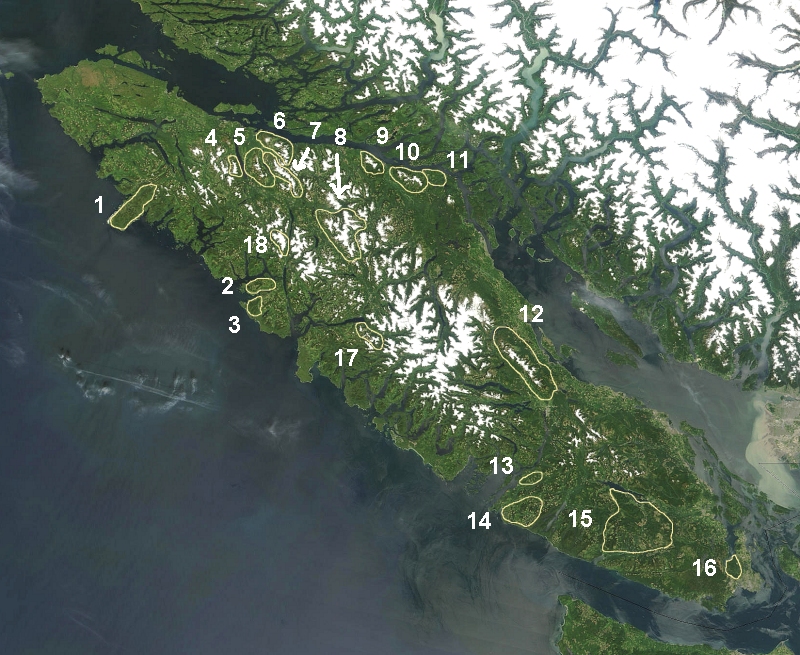
map_caption=The Franklin Range is marked 6 on map.
map_size=275The Franklin Range is a small
mountain range onVancouver Island ,British Columbia ,Canada , located just southwest ofRobson Bight andJohnstone Strait . It has an area of 200 km2 and is a subrange of theVancouver Island Ranges which in turn form part of theInsular Mountains . [http://www.bivouac.com/ArxPg.asp?ArxId=1494 Franklin Range] in the Canadian Mountain Encyclopedia] The range was named in 1861 by Captain Richards for noted Arctic explorer Rear Admiral Sir John Franklin who died exploring the Arctic and his wife, Lady Franklin. [Citation | last =Walbran | first = Captain John T. | title =British Columbia Place Names, Their Origin and History |url= http://www.nosracines.ca/e/toc.aspx?id=3545| place=Vancouver/Toronto | publisher =Douglas & McIntyre | year =1971 | edition =Facsimile reprint of 1909 edition | isbn = 0-88894-143-9] rp|187ee also
*
List of mountain ranges References
External links
Wikimedia Foundation. 2010.

