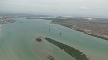
- Makupa Causeway
-
Makupa Causeway Route information Length: 1.5 mi (2.4 km) Major junctions North end: Tudor Roundabout, Mombasa South end: Magongo Circus, Changamwe Location Counties: Mombasa District Highway system Roads in Kenya
The Makupa Causeway (Swahili pron. [maˈkupa]) is a causeway linking Mombasa island to the Kenyan mainland. The road runs for approximately one and a half miles between the Magongo Circus and Makupa Circus. The causeway dissects Tudor Creek to the east and Port Reitz Creek to the west[1].
The causeway is one of three road links between the island and the Kenyan mainland - the other two being the New Nyali Bridge and the Changamwe Bridge.
Function
The causeway is a dual-purpose transport corridor that carries a trunk road (serving the main Mombasa-Nairobi road route) and the Uganda Railway[2]. The road is split into a two-level route (the south-bound carriageway is elevated on an embankment) and traffic is restricted to fifty miles per hour. The road serves few businesses except a large waste disposal site in the Kipevu district. In 2008, the area was the site of a considerable toxic waste leak[3].
Checkpoint
The south end of the causeway is the site of an armed police checkpoint. This is primarily for immigration purposes, but also functions as a traffic policing location.
References
- ^ A. W. Muohia, J. M. Onyarib: "Heavy metals in sediments from Makupa and Port–Reitz Creek systems: Kenyan Coast" (2002)
- ^ East African Railways
- ^ BBC NEWS | World | Africa | Kenyans ill in 'toxic waste' leak
Coordinates: 4°1′59.24″S 39°39′01.67″E / 4.0331222°S 39.6504639°E
Categories:- Causeways
- Transport in Kenya
- Mombasa
- Roads in Kenya
Wikimedia Foundation. 2010.

