- Moniaive
-
Coordinates: 55°11′49″N 3°55′16″W / 55.197°N 3.921°W
Moniaive is a village in the south of Scotland in Dumfries and Galloway, near Thornhill, on the A702 road and B729 road. Population 520 (2004). The name is from Gaelic monadh-abh and means "Hill of Streams". It is situated at the northern end of the very scenic and tranquil Cairn Valley. It is within the parish of Glencairn and a bi-monthly newspaper, called the Glencairn Gazette and free for local residents, is produced by volunteers .
Contents
History
Covenanters
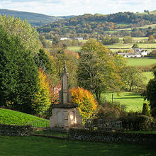
In the 17th century, Moniaive became the refuge for the Covenanters, a group of Presbyterian nonconformists who rebelled at having the Episcopalian religion forced on them by the last three Stuart kings, Charles I, Charles II and James II of England (James VII of Scotland). There is a monument off the Ayr Road to James Renwick, a Covenanter leader born in Moniaive and later executed in Edinburgh.
The community
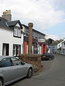
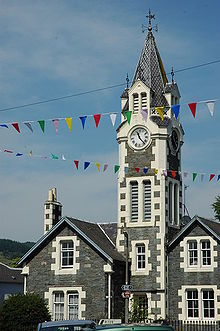
The village was planned and built by a local landowner in the 17th century and consists of two parts separated by the Dalwhat Burn, Dunreggan and Moniaive village itself. With a large general store including a post office counter, the village also has a garage, an organic cafe, a chocolatier, several artist' studios, a primary school, a guest house and two hotels with bars and restaurants, one with accommodation, and two village halls. It is a thriving community with a strong community spirit. Every year a number of festivals are held within the parish; Moniaive Horse Show, Gala Day, Arts Association exhibition, Beer and Food festival, Comedy nights, Moniaive Folk Festival,the annual Duck Race, and the Horticultural show, to name but a few. In 2004 The Times described the village as one of the 'coolest' in Britain.
James Paterson
The Scottish artist James Paterson,associated with 'The Glasgow Boys' of the Glasgow School, lived here and painted many local scenes including The Last Turning, one of Scotland's most famous pictures now in the Kelvingrove Art Gallery and Museum, which is a view of a woman on the last bend in the road before approaching the village on the other side of Dalwhat Water. Until 2005 there was a Paterson museum within the village but this has now closed and Paterson's photographs and memorabilia are now in the possession of his grand-daughter Anne Paterson-Wallace.
Transport
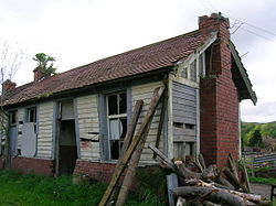
The Cairn Valley Light Railway was opened from Dumfries in 1905 but closed to passengers during World War II and never reopened. The village is connected to Dumfries and Thornhill by local bus services. There is also a community bus run by volunteers for trips, with a scheduled service to Castle Douglas.
Local economy
The local economy is dominated by sheep and some cattle farming as well as forestry. It also has a very large self-employed community including writers, artists, graphic designers, historical interpretation services, clothing designers, aromatherapists, stained glass workers, a wine importing business,a chocolatier,computer repairs, garden and landscaping services, plant nursery, child care, etc.
Micro-history
The village has its own website and is currently home to both Batman writer Alan Grant and a member of the Scottish band Franz Ferdinand. Joanna Lumley also has a home near here. The writer Rumer Godden lived in Moniaive.
Moniaive has won prizes in both Nithsdale in Bloom and Scotland in Bloom competitions.
Four valleys
Four valleys meet at Moniaive.
- The Dalwhat Water runs from the centre of the Carsphairn and Scaur hills south eastward to the village. A road runs up the Dalwhat Glen to Cairnhead where you can find Andy Goldsworthy structures on the surrounding hillsides.
- Craigdarroch Water approaches the village from the west and the B729 travels in through this glen from the A713 (Castle Douglas to Dalmellington road) and Carsphairn which is on the A713 some 10 miles from Moniaive and the nearest centre of population in that direction.
- Castlefairn Water comes in from the south west and this glen carries the A702 over moorland road from St John's Town of Dalry. Castlefairn water and Craigdarroch water meet just south of the village before they join the Cairn Water.
- Cairn Water originates just to the east of the village and travels eastward down the Cairn Valley before ultimately joining the River Nith just north of Dumfries.
External links
- Village website
- Moniaive village history
- Moniaive on Undiscovered Scotland
- The Last Turning on Glasgow Museums' website
See also
- List of places in Dumfries and Galloway
- Ley tunnel Covenanter's escape tunnel
- William West Neve - Architect
Categories:- Villages in Dumfries and Galloway
Wikimedia Foundation. 2010.


