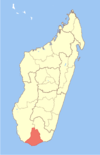
- Morafeno Bekily
-
Morafeno Bekily Location in Madagascar Coordinates: 24°11′S 45°23′E / 24.183°S 45.383°E Country  Madagascar
Region Androy District Bekily Elevation[1] 434 m (1,424 ft) Population (2001)[2] - Total 10,000 Time zone EAT (UTC3) Morafeno Bekily is a town and commune in Madagascar. It belongs to the district of Bekily, which is a part of Androy Region. The population of the commune was estimated to be approximately 10,000 in 2001 commune census.[2]
In addition to primary schooling the town offers secondary education at both junior and senior levels. The town provides access to hospital services to its citizens. The majority 75% of the population of the commune are farmers, while an additional 15% receives their livelihood from raising livestock. The most important crop is rice, while other important products are peanuts and cassava. Services provide employment for 2% of the population. Additionally fishing employs 8% of the population.[2]
References and notes
- ^ Estimated based on DEM data from Shuttle Radar Topography Mission
- ^ a b c "ILO census data". Cornell University. 2002. http://www.ilo.cornell.edu/ilo/data.html. Retrieved 2008-05-02.
Ambovombe Ambanisarike · Ambazoa · Ambohimalaza · Ambonaivo · Ambondro · Ambovombe · Ampamata · Andalatanosy · Anjeky Ankilikira · Antanimora Sud · Imanombo · Erada · Jafaro · Maroalomainty · Maroalopoty · Marovato Befeno · Sihanamaro
Bekily Ambahita · Ambatosola · Anivorano Mitsinjo · Anja Nord · Ankaranabo Nord · Antsakoamaro · Bekitro · Belindo Mahasoa · Beraketa · Beteza · Bevitiky · Manakompy · Maroviro · Morafeno Bekily · Tanambao Tsirandrana · Tanandava · Tsikolaky · VohimangaBeloha Tsiombe 
This Androy location article is a stub. You can help Wikipedia by expanding it. Categories:- Madagascar geography stubs
- Populated places in Androy
Wikimedia Foundation. 2010.
Look at other dictionaries:
Morafeno Bekily — 24° 11′ 00″ S 45° 23′ 00″ E / 24.183333, 45.383333 … Wikipédia en Français
District de Bekily — Bekily Région Androy Chef lieu Bekily Nombre de kaominina 18 Superficie 5 097 km2 … Wikipédia en Français
Tanandava (Bekily) — 24° 19′ 00″ S 45° 33′ 00″ E / 24.316667, 45.55 … Wikipédia en Français
Manakompy — Manakompy … Wikipedia
Maroviro — Country Madagascar Region Androy District Bekily Populatio … Wikipedia
Bevitiky — 24° 36′ 00″ S 45° 23′ 00″ E / 24.6, 45.383333 … Wikipédia en Français
Androy — Localisation de la région d Androy à Madagascar. Androy est l une des vingt deux régions de Madagascar. Elle est située dans la province de Tuléar, dans le sud de l île. Sommaire … Wikipédia en Français
Ambahita — 24° 00′ 00″ S 45° 16′ 00″ E / 24, 45.26666 … Wikipédia en Français
Ambatosola — 24° 03′ S 45° 27′ E / 24.05, 45.45 … Wikipédia en Français
Anivorano Mitsinjo — 24° 24′ S 45° 39′ E / 24.4, 45.65 … Wikipédia en Français

