- Colcabamba District, Tayacaja
-
Colcabamba — District — 
Coat of armsLocation of Colcabamba in the Tayacaja province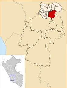
Coordinates: 12°24.5′S 74°40.6′W / 12.4083°S 74.6767°WCoordinates: 12°24.5′S 74°40.6′W / 12.4083°S 74.6767°W Country  Peru
PeruRegion Huancavelica Province Tayacaja Founded Capital Colcabamba Government – Mayor Augusto Maravi Romani Area – Total 598.12 km2 (230.9 sq mi) Elevation 2,979 m (9,774 ft) Population (2005 census) – Total 21,593 – Density 36.1/km2 (93.5/sq mi) Time zone PET (UTC-5) UBIGEO 090705 Colcabamba District is one of sixteen districts of the province Tayacaja in Peru.[1]
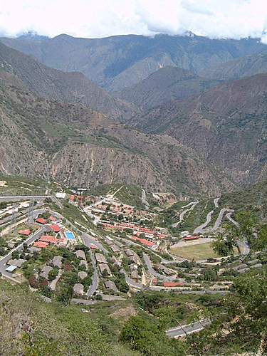
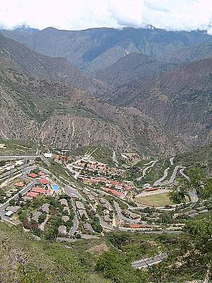 Campo Armiño, in the Colcabamba District
References
- ^ (Spanish) Instituto Nacional de Estadística e Informática. Banco de Información Distrital. Retrieved April 11, 2008.
Acobamba Angaraes Castrovirreyna Arma · Aurahua · Capillas · Castrovirreyna · Chupamarca · Cocas · Huachos · Huamatambo · Mollepampa · San Juan · Santa Ana · Tantara · TicrapoChurcampa Huancavelica Acobambilla · Acoria · Ascensión · Conayca · Cuenca · Huachocolpa · Huancavelica · Huando · Huayllahuara · Izcuchaca · Laria · Manta · Mariscal Cáceres · Moya · Nuevo Occoro · Palca · Pilchaca · Vilca · YauliHuaytará Tayacaja Acostambo · Acraquia · Ahuaycha · Colcabamba · Daniel Hernández · Huachocolpa · Huaribamba · Ñahuimpuquio · Pampas · Pazos · Quishuar · Salcabamba · Salcahuasi · San Marcos de Rocchac · Surcubamba · Tintay PuncuCategories:- Districts of the Huancavelica Region
- Districts of the Tayacaja Province
- Huancavelica Region geography stubs

Wikimedia Foundation. 2010.