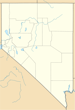
Delamar Mountains

Delamar Mountains
Delamar Mountains
Mountain Range
Country United States
State Nevada
District Lincoln County
Coordinates 37°17′52.873″N 114°45′58.004″W / 37.29802028°N 114.76611222°W / 37.29802028; -114.76611222
Highest point
 - elevation 2,174 m (7,133 ft)
Timezone Pacific (UTC-8)
 - summer (DST) PDT (UTC-7)
Topo map USGS Gregerson Basin
Delamar Mountains
in Nevada [1]

The Delamar Mountains is a mountain range in Lincoln County, Nevada, named after Captain Joseph Raphael De Lamar.[1] The range's crest forms part of the Great Basin Divide between the Meadow Watershed and the Dry Lake Watershed, which includes Delamar Dry Lake and Delamar, Nevada.

References


Wikimedia Foundation. 2010.

Игры ⚽ Поможем написать реферат

Look at other dictionaries:

  • Delamar Dry Lake — Delamar Lake Landing Strip IATA: none – ICAO: none Summary Coordinates …   Wikipedia

  • Delamar, Nevada — Delamar Mine Area (Tailings Visible on Left Side) Delamar, Nevada, nicknamed The Widowmaker, is a ghost town in central eastern Nevada, USA along the east side of the Delamar Valley.[1] During its heyday, primarily between 1895 and 1900, it… …   Wikipedia

  • North Jackson Mountains Wilderness — Coordinates: 41°21′40.641″N 118°28′11.576″W / 41.36128917°N 118.46988222°W / 41.36128917; 118.46988222 …   Wikipedia

  • List of mountain ranges of Nevada — There are 313 named mountain ranges in Nevada, some of them quite small but still constituting distinct biomes.*Adobe Range *Anchorite Hills *Antelope Range (Pershing County) *Antelope Range (White Pine County) *Antelope Range (Nye County)… …   Wikipedia

  • Death Valley National Park — IUCN Category II (National Park) …   Wikipedia

  • National Landscape Conservation System — The National Landscape Conservation System (NLCS) is a 27 million acres (110,000 km2) collection of the lands considered to be the crown jewels of the American west. NLCS is also known as National Conservation Lands. These lands represent 10% of… …   Wikipedia

  • North Black Rock Range Wilderness — Coordinates: 41°26′15.634″N 119°2′20.665″W / 41.43767611°N 119.03907361°W / 41.43767611; 119.03907361 …   Wikipedia

  • Mount Charleston Wilderness — IUCN Category Ib (Wilderness Area) Bristlecone pines blanket the high ridge between Charlesto …   Wikipedia

  • Environment of Nevada — Berlin Ichthyosaur State Park The environment of Nevada comprises diverse biotas, climates, and geologies. Environmental regulations and the environmental movement have aimed to respond to environmental threats. Contents …   Wikipedia

  • List of Nevada state parks — …   Wikipedia

Share the article and excerpts

Direct link
Do a right-click on the link above
and select “Copy Link”