- Gresham, Wisconsin
Infobox Settlement
official_name = Gresham, Wisconsin
settlement_type = Village
nickname =
motto =
imagesize =
image_caption =
image_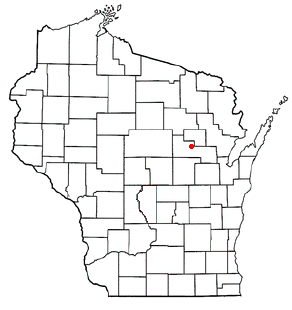
mapsize = 250px
map_caption = Location of Gresham, Wisconsin
mapsize1 =
map_caption1 =subdivision_type = Country
subdivision_name =United States
subdivision_type1 = State
subdivision_name1 =Wisconsin
subdivision_type2 = County
subdivision_name2 = Shawanogovernment_footnotes =
government_type =
leader_title =
leader_name =
leader_title1 =
leader_name1 =
established_title =
established_date =unit_pref = Imperial
area_footnotes =area_magnitude =
area_total_km2 = 3.2
area_land_km2 = 3.0
area_water_km2 = 0.3
area_total_sq_mi = 1.2
area_land_sq_mi = 1.1
area_water_sq_mi = 0.1population_as_of = 2000
population_footnotes =
population_total = 575
population_density_km2 = 194.3
population_density_sq_mi = 503.3timezone = Central (CST)
utc_offset = -6
timezone_DST = CDT
utc_offset_DST = -5
elevation_footnotes = GR|3
elevation_m = 283
elevation_ft = 928
latd = 44 |latm = 51 |lats = 0 |latNS = N
longd = 88 |longm = 47 |longs = 0 |longEW = Wpostal_code_type =
postal_code =
area_code =
blank_name = FIPS code
blank_info = 55-31675GR|2
blank1_name = GNIS feature ID
blank1_info = 1581552GR|3
website =
footnotes =Gresham is a village in Shawano County,
Wisconsin ,United States . The population was 575 at the 2000 census.Geography
Gresham is located at coor dms|44|50|60|N|88|46|60|W|city (44.849920, -88.783312)GR|1.
According to the
United States Census Bureau , the village has a total area of 1.2square mile s (3.2km² ), of which, 1.1 square miles (3.0 km²) of it is land and 0.1 square miles (0.3 km²) of it (8.06%) is water.Demographics
As of the
census GR|2 of 2000, there were 575 people, 233 households, and 143 families residing in the village. Thepopulation density was 503.3 people per square mile (194.7/km²). There were 257 housing units at an average density of 225.0/sq mi (87.0/km²). The racial makeup of the village was 68.70% White, 0.17% African American, 23.48% Native American, 0.52% from other races, and 7.13% from two or more races. Hispanic or Latino of any race were 2.09% of the population.There were 233 households out of which 32.2% had children under the age of 18 living with them, 41.2% were married couples living together, 15.0% had a female householder with no husband present, and 38.6% were non-families. 34.3% of all households were made up of individuals and 17.6% had someone living alone who was 65
References
External links
Wikimedia Foundation. 2010.