- Maungakaramea
-
Maungakaramea 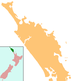
 Maungakaramea
Coordinates: 35°50′38″S 174°12′15″E / 35.84389°S 174.20417°ECoordinates: 35°50′38″S 174°12′15″E / 35.84389°S 174.20417°E Country New Zealand Region Northland Region District Whangarei District Maungakaramea is a locality in Northland, New Zealand. Whangarei is to the northeast.[1][2] Maungakaramea forms part of the Bream Bay Ward of the Whangarei District Council.
Contents
History
The name Maungakaramea was given to the area by the Māori. There are two interpretations of the meaning of the name, one is that "Karamea" means Native Tree, hence the "Karamea tree mountain", the other is that Karamea is a coloured clay of a reddish type used for war paint on the face and body. A safe interpretation is "Red Ochre Mountain".
The area from Whangarei to Waipu, Waihonga and Tangihua, was taken from Ngaitahuhu by a Ngapuhi chief, Te Ponaharakeke, who joined with Te Ngarokiteuru to drive all the Ngaitahuhu out in the mid-18th century.
The first record of a white man (pakeha) in the Maungakaramea area was in 1820 when the Reverend Samuel Marsden encountered a Māori tribe whilst travelling overland via the Kaipara Harbour.
The Maungakaramea blocks were purchased by the government in 1855.
The Eastern part of the Maungakaramea Block (now part of Mangapai) was opened for sale in April 1857, but the area now considered Maungakaramea was not open to selection until May 1859.
Amongst the early settlers were two brothers, Henry Spear Wilson and Daniel Cook Wilson.[3]
Other early settlers were Mr & Mrs Charles Hayward, who left England for New Zealand in the John Scott in 1858. They arrived at Auckland on March 6, 1859, and soon afterwards came to Maungakaramea to Farm.
Notable people
- Jenny McDonald, hockey player.[4]
Education
Maungakaramea School is a coeducational full primary (years 1-8) school with a decile rating of 9 and a roll of 103.[5] The school celebrated its 125th reunion in 2000.[6]
Notes
- ^ Peter Dowling (editor) (2004). Reed New Zealand Atlas. Reed Books. pp. map 7. ISBN 0-7900-0952-8.
- ^ Roger Smith, GeographX (2005). The Geographic Atlas of New Zealand. Robbie Burton. pp. map 27. ISBN 1-877333-20-4.
- ^ Pickmere, Nancy Preece (1986). Whangarei: The Founding Years. pp. p 66.
- ^ "Northland - Leisure and sports". Te Ara Encyclopedia of New Zealand. http://www.teara.govt.nz/Places/Northland/Northland/14/en.
- ^ "Te Kete Ipurangi - Maungakaramea School". Ministry of Education. http://www.tki.org.nz/e/schools/display_school_info.php?school_id=1047.
- ^ "Maungakaramea School" ([dead link]). Education Gazette New Zealand 79 (5). 20 March 2000. http://www.edgazette.govt.nz/notices.php/?id=56336.
Categories:- Populated places in New Zealand
- Whangarei District

Wikimedia Foundation. 2010.