Marble Hill–225th Street (IRT Broadway–Seventh Avenue Line)
- Marble Hill–225th Street (IRT Broadway–Seventh Avenue Line)
Infobox NYCS
name = Marble Hill–225th Street
bg_color = #E20F00
line = IRT Broadway–Seventh Avenue Line
service = Broadway-Seventh north local
platforms = 2 side platforms
tracks = 3
borough = Manhattan
connection = Metro-North Railroad at Marble Hill
open_date = January 7, 1907
north_station = 231st Street
north_line = IRT Broadway–Seventh Avenue Line
north_service = Broadway-Seventh north local
south_station = 215th Street
south_line = IRT Broadway–Seventh Avenue Line
south_service = Broadway-Seventh north local
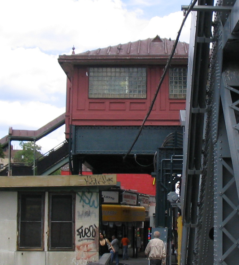
Marble Hill–225th Street is a station on the IRT Broadway–Seventh Avenue Line of the New York City Subway. Located at the intersection of Broadway and 225th Street, it is served by the NYCS|1 train at all times. It is a short distance away from the Marble Hill station of the Metro-North Railroad. Just south of the station, trains cross the Broadway Bridge onto the island of Manhattan.
The Marble Hill neighborhood and the station today reside on the northern shore of the Harlem River Ship Canal, also known as Spuyten Duyvil Creek, and are thus geographically on the mainland. However, the neighborhood was formerly part of the island of Manhattan. The canal was constructed in 1895, separating the neighborhood from the rest of the island. After the original creekbed was filled in, Marble Hill became part of the mainland, although it is still considered part of Manhattan for administrative and political purposes.
:"Note": See Manhattan for an explanation of the distinction between "island" of Manhattan and the "borough" of Manhattan, a political entity consisting of the "island" of Manhattan, several other islands, and the Marble Hill neighborhood on the mainland.
The 1991 artwork here is called "Elevated Nature I-IV" by Wopo Holup. It is also located at four other stations on this line.
Bus connections
*Bx7
*Bx9
*Bx20
External links
*NYCS ref|http://www.nycsubway.org/perl/stations?6:3144 nycsubway.org|IRT West Side|225th Street
*Station Reporter — [http://www.stationreporter.net/1train.htm 1 Train]
* [http://www.subwaynut.com/irt/225n1.htm Subway Nut station information]
Wikimedia Foundation.
2010.
Look at other dictionaries:
215th Street (IRT Broadway–Seventh Avenue Line) — Infobox NYCS name = 215th Street bg color = #E20F00 line = IRT Broadway–Seventh Avenue Line service = Broadway Seventh north local platforms = 2 side platforms tracks = 3 borough = Manhattan open date = March 12, 1906 north station = Marble… … Wikipedia
231st Street (IRT Broadway–Seventh Avenue Line) — Infobox NYCS name = 231st Street accessible = yes bg color = #E20F00 line = IRT Broadway–Seventh Avenue Line service = Broadway Seventh north local platforms = 2 side platforms tracks = 3 borough = Bronx open date = January 27, 1907 north station … Wikipedia
IRT Broadway–Seventh Avenue Line — Infobox rail line name = IRT Broadway–Seventh Avenue Line image width = 150 px caption = type = Rapid transit system = New York City Subway status = locale = start = Van Cortlandt Park–242nd Street end = South Ferry Borough Hall stations = 44… … Wikipedia
IRT Broadway–Seventh Avenue Line — Broadway–Seventh Avenue Line Метрополитен Нью Йорка Станция South Ferry ныне закрытая станция, расположенная на разворотном круге … Википедия
Marble Hill — is the name of several places: Marble Hill, County Donegal, a village in County Donegal, Republic of Ireland Marble Hill, Missouri, a place in Missouri in the United States of America Marble Hill, Manhattan, a section of the borough of Manhattan… … Wikipedia
Marble Hill (Metro-North station) — Marble Hill A train arrives at the temporary station, since rebuilt on the other side of the mezzanine. The Henry Hudson Bridge can be seen in … Wikipedia
Marble Hill — ist der nördlichste Stadtteil des Stadtbezirks (borough) Manhattan der Stadt New York City. Karte von Marble Hill mit früherem Flussverlauf Vom Großteil Manhattans, der sich auf der gleichnamigen Insel befindet, wird Marble Hill durch den Harlem… … Deutsch Wikipedia
Marble Hill, Manhattan — Coordinates: 40°52′34″N 73°54′40″W / 40.87611°N 73.91111°W / 40.87611; 73.91111 … Wikipedia
Broadway Bridge (Manhattan) — Infobox Bridge bridge name= Broadway Bridge caption= From the west official name= also known as= carries= Broadway (US 9) (lower) 2 tracks of IRT Broadway–Seventh Avenue Line (upper). crosses= Harlem River locale= Manhattan and the Bronx, in New… … Wikipedia
Hudson Line (Metro-North) — Infobox rail line name = Hudson Line (Metro North) image width = 250px caption = Metro North #208 pushes Train #872 from Croton Harmon, bound for Grand Central. type = Commuter rail line system = Metro North status = locale = New York City,… … Wikipedia