Mascoma River

Mascoma River
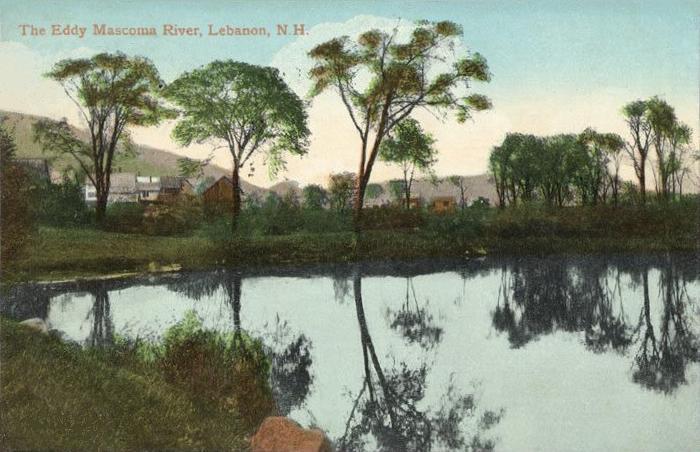
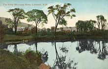
Mascoma River in 1909

The Mascoma River is a 31.6 mile long (51.0 km)[1] river located in western New Hampshire in the United States. It is a tributary of the Connecticut River, which flows to Long Island Sound. The Mascoma comprises two sections which are split by Mascoma Lake in the communities of Enfield and Lebanon. Counting the lake would add 2.7 miles (4.4 km) to the river's length.

The Mascoma River begins at Cummins Pond in a heavily-forested part of the town of Dorchester, New Hampshire and flows south into the town of Canaan, collecting water flowing from Reservoir Pond, Clark Pond, and Canaan Street Lake before reaching the Indian River. Here it turns west, collecting tributaries arriving from Goose Pond and Crystal Lake, before it passes through the mill town of Enfield and arrives at Mascoma Lake.

At the western end of Mascoma Lake, the Mascoma River, now in Lebanon, drops quickly over rapids and occasional falls, passing numerous small hydroelectric dams in the center of Lebanon and on its way to West Lebanon, where it reaches the Connecticut River. The section of the river immediately downstream of the Mascoma Lake dam is reserved for fly fishing only, while other portions of the river are open for all types of fisherman. The river is stocked by the New Hampshire Fish and Game Department.

For most of its path from the Indian River to the Connecticut, the Mascoma River and its valley have influenced the location of numerous transportation routes, including U.S. Route 4 and an inactive, state-owned rail line known as the Northern Railroad, which has now been converted in some areas to a "rail trail" bike path.

References

Coordinates: 43°38′08″N 72°19′32″W / 43.6356°N 72.3256°W / 43.6356; -72.3256


Wikimedia Foundation. 2010.

Игры ⚽ Поможем решить контрольную работу

Look at other dictionaries:

  • Mascoma Lake — Mascoma Lake, February 2005 Location Grafton County, New Hampshire Coordinates …   Wikipedia

  • Mascoma — may refer to: Locations in the United States The Mascoma River in New Hampshire Mascoma Lake in New Hampshire Derived from the river or lake Mascoma Corporation, a biofuel company Mascoma Valley Regional High School, Canaan, New Hampshire, United …   Wikipedia

  • Mascoma Valley Regional High School — Address 27 Royal Road Canaan, NH, 03741 USA Information Type Public Motto …   Wikipedia

  • Bahnstrecke Concord–White River Junction — Concord NH–White River Junction NH, Stand 1999[1][2] Gesellschaft: CLCO, NEGS Streckenlänge: 112,01 km Spurweite: 1435 mm (Normalspur) Gleise: 1 …   Deutsch Wikipedia

  • Indian River (New Hampshire) — The Indian River is a 12.8 mile long (20.7 km) [ [http://www.granit.sr.unh.edu New Hampshire GRANIT state geographic information system] ] river located in western New Hampshire in the United States. The river is a tributary of the Mascoma River …   Wikipedia

  • Knox River — The Knox River is a 2.5 mile long (4.1 km) [ [http://www.granit.sr.unh.edu New Hampshire GRANIT state geographic information system] ] river located in western New Hampshire in the United States. The river is an inlet of Mascoma Lake, which… …   Wikipedia

  • Connecticut River — Coordinates: 41°16′20″N 72°20′03″W / 41.27222°N 72.33417°W / 41.27222; 72.33417 …   Wikipedia

  • Connecticut River — Einzugsgebiet des Flusses Daten …   Deutsch Wikipedia

  • Enfield, New Hampshire — Infobox Settlement official name = Enfield, New Hampshire nickname = motto = image imagesize = image caption = mapsize = 250px map caption = Location in Grafton County, New Hampshire settlement type = Town mapsize1 = map caption1 = subdivision… …   Wikipedia

  • Lebanon, New Hampshire — Infobox Settlement official name = Lebanon, New Hampshire settlement type = City nickname = motto = image imagesize = image caption = mapsize = 250px map caption = Location in Grafton County, New Hampshire mapsize1 = map caption1 = subdivision… …   Wikipedia

Share the article and excerpts

Direct link
Do a right-click on the link above
and select “Copy Link”